အိုရှန်းနီးယားရှိ အချုပ်အခြာအာဏာပိုင်နိုင်ငံများနှင့် အမှီအခိုနယ်မြေများ စာရင်း


ဤသည်မှာ ပထဝီဝင်ဒေသအပိုင်းအခြားအရ သမုဒ္ဒပိုင်းဇုံတွင် ကျရောက်နေသော အချုပ်အခြာအာဏာပိုင်နိုင်ငံများနှင့် အမှီအခိုနယ်မြေများဖြစ်သည်။ သမုဒ္ဒရာရေပြင်အများစုရှိပြီးနှင့် တိုက်ကြီးများ၏ ကျောက်လွှာများစွာတွင် လွှမ်းခြုံတည်ရှိနေသော်လည်း အိုရှန်းနီးယားနိုင်ငံများသည် တိုက်ကြီးများ၏ စာရင်းတွင် ရံဖန်ရံခါသာ ဖော်ပြကြသည်။
ထိုစာရင်းတွင် ပထဝီနိုင်ငံရေးအရ ပစိတ်ဖိတ်သမုဒ္ဒရာဝန်းရံထားသော ဩစတြေးလေးရှား၊ မီလန်နီးရှား၊ မိုက်ခရိုနီးရှားနှင့် ပိုလီနီးရှားတို့ ပါဝင်ကြသည်။ အိုရှန်းနီးယားဒေသ၏ ကုန်မြေထုအကြီးဆုံးပိုင်ဆိုင်သည်မှာ ဩစတေးလျနိုင်ငံဖြစ်သည်။[၁]
အာရှနှင့် အိုးရှန်းနီးယားအကြား နယ်နိမိတ်သည် ရှင်းလင်းစွာ သတ်မှတ်ထားခြင်းမရှိပေ။ နိုင်ငံရေးဆိုင်ရာ အကြောင်းပြချက်များအတွက် ကုလသမဂ္ဂမှ အင်ဒိုနီးယားနှင့် ပါပူအာနယူးဂီနီ၏ ဒေသနှစ်ခုအကြားကို နယ်ကြားမျဉ်းအဖြစ် မှတ်ယူသည်။[၂] ပါပူအာနယူးဂီနီအား အင်ဒိုနီးရှားနိုင်ငံ၏ အိမ်နီးချင်းအဖြစ် အာရှနိုင်ငံအဖြစ် တခါတရံ ထည်သွင်းကြသော်လည်း ဤသည်မှာ ရှားပါးလှပါပြီး ယေဘုယျအားဖြင့် အိုရှန်းနီးယား၏ အစိတ်အပိုင်းတစ်ခုအဖြစ် လက်ခံထားကြသည်။ ပထဝီဝင်အရ ပါပူအာနှင့် အနောက်ပါပူအာပြည်နယ်တို့သည်လည်း အိုရှန်းနီးယား၏ အစိတ်အပိုင်းများ ဖြစ်ကြသည်။
အချုပ်အခြာအာဏာပိုင်နိုင်ငံများ
[ပြင်ဆင်ရန်]ကုလသမဂ္ဂအဖွဲ့ဝင်နိုင်ငံများ
[ပြင်ဆင်ရန်]ဤအပိုင်းတွင် ပါဝင်သော အချုပ်အခြာအာဏာပိုင်နိုင်ငံများသည် အိုရှန်းနီးယားတွင် တည်ရှိသော နိုင်ငံများဖြစ်ပြီး ကုလသမဂ္ဂ၏ အဖွဲ့ဝင်များလည်း ဖြစ်ကြသည်။[၃] ဤနိုင်ငံများအားလုံးသည် ပစိဖိတ်သမုဒ္ဒရာကျွန်းများဖိုရမ်အား အဖွဲ့ဝင်များလည်း ဖြစ်ကြသည်။[၄]
| အလံ | လက်ရုံးတံဆိပ်များ / နိုင်ငံတော်အမှတ်တံဆိပ် | မြေပုံ | မြန်မာဘာသာဖြင့် စီထားသော အမည်နှင့် တရားဝင်အမည်များ [၅][၆][၇] |
ဒေသတွင်း အတိုကောတ်အမည်နှင့် တရားဝင်အမည်[၅][၆] | မြို့တော် [၇][၈][၉] |
လူဦးရေ [၁၀] |
ဧရိယာ [၁၁] |
|---|---|---|---|---|---|---|---|
 |

|

|
ကီရီဘတ်စ်နိုင်ငံ ကီရီဘတ်စ် သမ္မတနိုင်ငံ |
အင်္ဂလိပ်: Kiribati — Republic of Kiribati တမ်းပလိတ်:Lang-gil |
South Tarawa
Bairiki |
၁၀၁,၉၉၈ | ၈၁၁ km2 (၃၁၃ sq mi) |
 |

|

|
ဆမိုးအားနိုင်ငံ လွတ်လပ်သော ဆမိုးအားနိုင်ငံ |
အင်္ဂလိပ်: Samoa — Independent State of Samoa တမ်းပလိတ်:Lang-sm |
Apia | ၁၉၄,၃၂၀ | ၂,၈၃၁ km2 (၁,၀၉၃ sq mi) |
 |

|

|
ဆော်လမွန်အိုင်းလန်းနိုင်ငံ | အင်္ဂလိပ်: Solomon Islands | Honiara | ၅၈၄,၅၇၈ | ၂၈,၈၉၆ km2 (၁၁,၁၅၇ sq mi) |
 |

|

|
တုံဂါနိုင်ငံ တုံဂါ ဘုရင့်နိုင်ငံ |
အင်္ဂလိပ်: Tonga — Kingdom of Tonga တမ်းပလိတ်:Lang-to |
Nukuʻalofa | ၁၀၆,၁၄၆ | ၇၄၇ km2 (၂၈၈ sq mi) |
 |

|

|
တူဗားလူနိုင်ငံ | အင်္ဂလိပ်: Tuvalu တမ်းပလိတ်:Lang-tvl |
Funafuti | ၁၀,၆၁၉ | ၂၆ km2 (၁၀ sq mi) |
 |

|

|
နယူးဇီလန်နိုင်ငံ[note ၁] | အင်္ဂလိပ်: New Zealand တမ်းပလိတ်:Lang-mi |
ဝယ်လင်တန်မြို့ | ၄,၅၇၀,၀၃၈ | ၂၆၇,၇၁၀ km2 (၁၀၃,၃၆၃ sq mi) |
 |
|

|
နအူရူးနိုင်ငံ နအူရူး သမ္မတနိုင်ငံ |
အင်္ဂလိပ်: Nauru — Republic of Nauru တမ်းပလိတ်:Lang-na |
တရားဝင်မြို့တော်မရှိ
အစိုးရအဖွဲ့ရုံးများသည် ယာရန်ခရိုင်တွင် တည်ရှိသည်။ |
9,378 | ၂၁ km2 (၈ sq mi) |
 |

|
ပလောင်းနိုင်ငံ ပလောင်း သမ္မတနိုင်ငံ |
အင်္ဂလိပ်: Palau — Republic of Palau တမ်းပလိတ်:Lang-pau |
Ngerulmud | ၂၁,၀၃၂ | ၄၅၉ km2 (၁၇၇ sq mi) | |
 |

|
|
ပါပူအာနယူးဂီနီနိုင်ငံ လွတ်လပ်သော ပါပူအာနယူးဂီနီနိုင်ငံ |
အင်္ဂလိပ်: Papua New Guinea — Independent State of Papua New Guinea တမ်းပလိတ်:Lang-tpi |
Port Moresby | ၆,၃၁၀,၁၂၉ | ၄၆၂,၈၄၀ km2 (၁၇၈,၇၀၄ sq mi) |
 |

|

|
ဖီဂျီနိုင်ငံ ဖီဂျီသမ္မတနိုင်ငံ |
အင်္ဂလိပ်: Fiji — Republic of Fiji တမ်းပလိတ်:Lang-fj Fiji Hindi फीजी/Fiji - रिपब्लिक ऑफ फीजी/ Ripablik ăph Phījī |
Suva | ၈၉၀,၀၅၇ | ၁၈,၂၇၄ km2 (၇,၀၅၆ sq mi) |
 |
|

|
ဗနွားတူနိုင်ငံ ဗနွားတူ သမ္မတနိုင်ငံ |
တမ်းပလိတ်:Lang-bi အင်္ဂလိပ်: Vanuatu — Republic of Vanuatu ပြင်သစ်: Vanuatu — République de Vanuatu |
Port Vila | ၂၅၆,၁၅၅ | ၁၂,၁၈၉ km2 (၄,၇၀၆ sq mi) |
 |

|

|
မာရှယ်အိုင်းလန်းနိုင်ငံ မာရှယ်အိုင်းလန်း သမ္မတနိုင်ငံ |
အင်္ဂလိပ်: Marshall Islands — Republic of the Marshall Islands တမ်းပလိတ်:Lang-mh |
Majuro | ၆၈,၄၈၀ | ၁၈၁ km2 (၇၀ sq mi) |
 |

|

|
မိုက်ခရိုနီးရှားနိုင်ငံ မိုက်ခရိုနီးရှား ဖက်ဒရယ် ပြည်ထောင်စု |
အင်္ဂလိပ်: Federated States of Micronesia | Palikir | ၁၀၆,၄၈၇ | ၇၀၂ km2 (၂၇၁ sq mi) |
 |

|

|
ဩစတြေးလျနိုင်ငံ[note ၂] ဩစတြေးလျ ဓနသဟာယနိုင်ငံ |
အင်္ဂလိပ်: Australia — Commonwealth of Australia | Canberra | ၂၃,၂၆၈,၃၁၉ | ၇,၇၄၁,၂၂၀ km2 (၂,၉၈၈,၉၀၂ sq mi)
|
ကုလသမဂ္ဂအဖွဲ့ဝင်မဟုတ်သော နိုင်ငံများ
[ပြင်ဆင်ရန်]ကွတ်ကျွန်းစုနှင့် နျူးအေးနိုင်ငံတို့သည် နယူးဇီလန်နိုင်ငံနှင့် လွတ်လပ်စွာဆက်နွယ်သော(Free Association) နိုင်ငံနှစ်ခုဖြစ်သည်။ နယူးဇီလန်နိုင်ငံနှင့် နိုင်ငံရေးအရဖြစ်စေ၊ ဖွဲ့စည်းပုံအရဖြစ်စေ နီးကပ်သော ဆက်ဆံရေးကို ထိန်းသိမ်းထားပြီး ထိုနိုင်ငံနှစ်ခုလုံးသည် ကုလသမဂ္ဂ၏ အထူးအဖွဲ့အစည်းများတွင် အရ အဖွဲ့ဝင်များဖြစ်ကြပြီး ၎င်းတို့၏ အမည်နာမအောက်တွင် အချုပ်အခြာအာဏာပိုင်နိုင်ငံများနှင့် လွတ်လပ်စွာ သံတမန်ဆက်ဆံမှုများ ပြုလုပ်ထားသည်။ နိုင်ငံနှစ်ခုလုံးသည် ပစိတ်ဖိတ်သမုဒ္ဒရာကျွန်းများဖိုရမ်၏ တင်းပြည့်အဖွဲ့ဝင်များဖြစ်ကြသည်။ ထိုကဲ့သို့သော သွင်ပြင်လက္ခဏာများကြောင့် ထိုနိုင်ငံတို့ကို De facto အခြေအနေရှိသော အချုပ်အခြာအာဏာပိုင် နိုင်ငံများအဖြစ် မှတ်ယူကြသည်။[၁၂]
| အလံ | လက်ရုံးတံဆိပ် / နိုင်ငံတော်တံဆိပ် | မြေပုံ | မြန်မာဘာသာဖြင့် အမည်တိုနှင့် တရားဝင်အမည်များ[၅] | အခြေအနေ | ဒေသတွင်း အမည်တိုနှင့် တရားဝင်အမည်များ | မြို့တော် | လူဦးရေ | ဧရိယာ[၁၁] |
|---|---|---|---|---|---|---|---|---|
 |

|

|
ကွတ်ကျွန်းစု[၇] | Self-governing in free association with New Zealand. It shares a head of state with New Zealand as well as having shared citizenship|New Zealand nationality law|shared citizenship, but is independent in its internal affairs. | အင်္ဂလိပ်: Cook Islands တမ်းပလိတ်:Lang-rar |
Avarua[၇][၈] | ၁၁,၁၂၄[၁၀] | ၂၃၆ km2 (၉၁ sq mi) |
 |

|

|
နျူးအေးနိုင်ငံ[၇] | Self-governing in free association with New Zealand. It shares a head of state with New Zealand as well as having shared citizenship|New Zealand nationality law|shared citizenship, but is independent in its internal affairs. | တမ်းပလိတ်:Lang-niu အင်္ဂလိပ်: Niue |
Alofi[၇][၈] | ၁,၃၁၁[၁၀] | ၂၆၀ km2 (၁၀၀ sq mi) |
အချုပ်အခြာအာဏာပိုင်မဟုတ်သော နယ်မြေများ
[ပြင်ဆင်ရန်]အောက်ပါစာရင်းအတွင်းရှိ နိုင်ငံများသည် ဖော်ပြပါအကြောင်းအရင်းများမှ အကြောင်းအချက်တစ်ခုကြောင့်သာ အိုရှန်းနီးယားအတွင်း ပါဝင်သော နိုင်ငံများဟု သတ်မှတ်ပါသည်။
- အချုပ်အခြာအာဏာပိုင်နိုင်ငံ၏ ဖက်ဒရယ်ဒေသသည် ထိုနိုင်ငံ၏ အဓိကတည်ရှိရာ ပင်မနေရာ၏ အပြင်ဘက်(ဝေးကွာစွာ)တည်ရှိခြင်း၊
- အချုပ်အခြာအာဏာပိုင်နိုင်ငံ၏ ဖွဲ့စည်းပုံအရ ခွဲထုတ်၍မရသော ဖက်ဒရယ်ဆက်နွယ်ချက်ထက်ပိုသော ပုံစံရှိသည် နယ်မြေများဖြစ်ပြီး ဤနေရာတွင် အချုပ်အခြာအာဏာပိုင်နိုင်ငံ၏ ကုန်းမြေထု၏ သိသာထင်ရှားသော အစိတ်အပိုင်းသည် အိုရှန်းနီးယား၏ အပြင်ဘက်တွင် တည်ရှိသည် သို့မဟုတ် အချုပ်အခြာအာဏာပိုင်နိုင်ငံ၏ ပင်မနယ်မြေ၏ အပြင်ဘက်၌ တည်ရှိနေသော နယ်မြေဖြစ်သည်။ ထိုနယ်မြေအများစုကို တခါတရံ၌ အမှီအခိုနယ်မြေများ သို့မဟုတ် ကိုယ်ပိုင်အုပ်ချုပ်ခွင့်ရဒေသများအဖြစ် ဖော်ပြကြသည်။
- အချုပ်အခြာအာဏာပိုင်နိုင်ငံ၏ အမှီအခိုနယ်မြေများ။
ဤစာရင်းတွင်ပါရှိသော နယ်မြေ ၂ ခု(ပြင်သစ် ပိုလီနီးရှားနှင့် နယူးကာလီဒိုနီးရှား)မှာ ပစိဖိတ်ကျွန်းများဖိုရမ်၏ အဖွဲ့ဝင်များဖြစ်ကြပြီး အခြားသော ၅ နိုင်ငံ(အမေရိကန်ဆမိုအာ၊ ဂူအမ်း၊ မြောက် မာရီယာနာကျွန်းစု၊ တိုကဲလူကျွန်းနှင့် ဝဲလစ်နှင့်ဖကျူနာကျွန်း)မှာ လေ့လာသူအဖြစ်ဖြင့် ထိုအဖွဲ့နှင့်ဆက်နွယ်၍ နေပါသည်။
| Flag | Coat of Arms / National Emblem | Map | English short and formal names[၅] | Status | Domestic short and formal names | Capital | Population | Area[၁၁] |
|---|---|---|---|---|---|---|---|---|
 |

|

|
American Samoa Territory of American Samoa[၇] |
Insular area of the United States | အင်္ဂလိပ်: American Samoa — Territory of American Samoa တမ်းပလိတ်:Lang-sm |
Pago Pago[၇][၈] | 67,242[၁၀] | ၁၉၉ km2 (၇၇ sq mi) |
 |

|
Ashmore and Cartier Islands Territory of Ashmore and Cartier Islands |
Territory of Australia | အင်္ဂလိပ်: Ashmore and Cartier Islands | Uninhabited | Uninhabited | ၅ km2 (၂ sq mi) | |
 |

|
Baker Island | United States Minor Outlying Island | အင်္ဂလိပ်: Baker Island | Uninhabited | Uninhabited | ၁၂၉.၁ km2 (၄၉.၈ sq mi) | |

|
Clipperton Island | Overseas minor territory of France | ပြင်သစ်: Île de la Passion | Uninhabited | Uninhabited | ၆.၁ km6[convert: မသိသော ယူနစ်] | ||
 |

|
Coral Sea Islands Coral Sea Islands Territory |
Territory of Australia | အင်္ဂလိပ်: Coral Sea Islands — Coral Sea Islands Territory | Uninhabited | Uninhabited | ၃ km2 (၁ sq mi) | |
 |

|
|
Easter Island | Special territory of Chile | စပိန်: Isla de Pascua တမ်းပလိတ်:Lang-rap |
Hanga Roa | 6,148[၁၃] | ၁၆၃.၆ km2 (၆၃ sq mi) |
 |
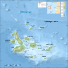 |
Galápagos Islands | Special territory of Ecuador | စပိန်: Islas Galápagos | Puerto Baquerizo Moreno | 35,000 | ၇,၈၈၀ km2 (၃,၀၄၂ sq mi) | |
 |
|

|
French Polynesia Overseas Lands of French Polynesia[၇] |
Overseas country of France | ပြင်သစ်: Polynésie française — Pays d'outre-mer de la Polynesie Francaise[၅] | Papeete[၇][၈] | 294,935[၁၀] | ၄,၁၆၇ km2 (၁,၆၀၉ sq mi) |
 |

|

|
Guam Territory of Guam |
Unincorporated organized territory, and Insular area of the United States | အင်္ဂလိပ်: Guam — Territory of Guam တမ်းပလိတ်:Lang-ch[၅] |
Hagåtña / Agaña[၇][၈] | 183,286[၁၄] | ၅၄၄ km2 (၂၁၀ sq mi) |
 |

|

|
Hawaii State of Hawaii |
State of the United States | အင်္ဂလိပ်: Hawaii — State of Hawaii တမ်းပလိတ်:Lang-haw |
Honolulu | 1,404,054[၁၀] | ၂၈,၃၁၁ km2 (၁၀,၉၃၁ sq mi) |
 |

|
Howland Island | United States Minor Outlying Island | အင်္ဂလိပ်: Howland Island | Uninhabited | Uninhabited | ၁၃၈.၆ km2 (၅၃.၅ sq mi) | |
 |

|
Jarvis Island | United States Minor Outlying Island | အင်္ဂလိပ်: Jarvis Island | Uninhabited | Uninhabited | ၁၅၂ km2 (၅၉ sq mi) | |
 |

|
Johnston Atoll | United States Minor Outlying Island | အင်္ဂလိပ်: Johnston Atoll | Uninhabited | Uninhabited | ၂၇၆.၆ km2 (၁၀၆.၈ sq mi) | |
 |

|
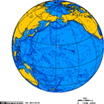
Kingman Reef | United States Minor Outlying Island | အင်္ဂလိပ်: Kingman Reef | Uninhabited | Uninhabited | ၁,၉၅၈.၀၁ km2 (၇၅၅.၉၉ sq mi) | |
 |
|
Midway Atoll | United States Minor Outlying Island | အင်္ဂလိပ်: Midway Islands | Uninhabited | Uninhabited | ၂,၃၅၅.၂ km2 (၉၀၉.၃ sq mi) | |

|

|
New Caledonia Territory of New Caledonia and Dependencies |
Sui generis collectivity of France[၇] | ပြင်သစ်: Nouvelle-Calédonie — Territoire des Nouvelle-Caledonie et Dependances[၅] | Nouméa[၇][၈] | 256,275[၁၀] | ၁၈,၅၇၅ km2 (၇,၁၇၂ sq mi) | |
 |

|

|
Norfolk Island Territory of Norfolk Island[၇] |
Self-governing integral Territory of Australia | အင်္ဂလိပ်: Norfolk Island — Territory of Norfolk Island Norfuk: Teratri of Norf'k Ailen |
Kingston[၇][၈] | 2,169[၁၀] | ၃၆ km2 (၁၄ sq mi) |
 |

|

|
Northern Mariana Islands Commonwealth of the Northern Mariana Islands[၇] |
Commonwealth, and Insular area of the United States | အင်္ဂလိပ်: Northern Mariana Islands — Commonwealth of the Northern Mariana Islands တမ်းပလိတ်:Lang-ch |
Saipan[၇][၈] | 46,050[၁၀] | ၄၆၄ km2 (၁၇၉ sq mi) |
 |
 |

|
Ogasawara Village | Part of Ogasawara Village in Tokyo, Japan | Bonin Islands: ဂျပန်: 小笠原群島 (Ogasawara Islands) Marcus Island: ဂျပန်: 南鳥島 (Minamitorishima) Nishino-shima Island: ဂျပန်: 西之島 (Western Island) Okinotori Islands: ဂျပန်: 沖ノ鳥島 (Okinotorishima) Volcano Islands: ဂျပန်: 火山列島 (Kazan Rettō) |
Ōmura (大村) | 2,871[၁၅] | ၁၀၄.၃၅ km2 (၄၀ sq mi)[၁၅] |
 |
|
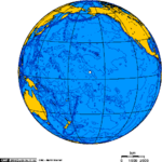
Palmyra Atoll[၅] | United States Minor Outlying Island | အင်္ဂလိပ်: Palmyra Atoll | Uninhabited | Uninhabited | ၁၂ km2 (၅ sq mi) | |
 |
 |

|
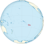
Papua Papua Province |
Province of Indonesia | အင်ဒိုနီးရှား: Papua | Jayapura | 3,486,432[၁၀] | ၃၁၉,၀၃၆.၀၅ km2 (၁၂၃,၁၈၁ sq mi) |
 |

|
|
Pitcairn Islands Pitcairn Group of Islands |
British overseas territory | အင်္ဂလိပ်: Pitcairn Islands — Pitcairn, Henderson, Ducie and Oeno Islands Pitkern: Pitkern Ailen |
Adamstown[၇][၈] | 48[၁၀] | ၄၇ km2 (၁၈ sq mi) |
 |

|

|
Tokelau[၇] | Dependent territory of New Zealand | တမ်းပလိတ်:Lang-tkl အင်္ဂလိပ်: Tokelau |
Each Atoll has its own administrative centre[၇][၈] | 1,384[၁၀] | ၁၂ km2 (၅ sq mi) |
 |
|

|
Wake Island | United States Minor Outlying Island | အင်္ဂလိပ်: Wake Island | Uninhabited | Uninhabited | ၆.၅ km2 (၂.၅ sq mi) |
 |

|

|
Wallis and Futuna Territory of the Wallis and Futuna Islands |
Overseas collectivity of France | ပြင်သစ်: Wallis et Futuna — Territoire des Iles Wallis et Futuna[၅] | Mata-Utu[၇][၈] | 15,398[၁၀] | ၁၄၂ km2 (၅၅ sq mi) |
 |
 |

|
West Papua West Papua Province |
Province of Indonesia | အင်ဒိုနီးရှား: Papua Barat | Manokwari | 760,855[၁၀] | ၁၄၀,၃၇၅.၆၂ km2 (၅၄,၁၉၉ sq mi) |
ဆက်လက်ကြည့်ရှုရန်
[ပြင်ဆင်ရန်]မှတ်စုများ
[ပြင်ဆင်ရန်]- ↑ နယူးဇီလန်နိုင်ငံသည် အန္တာတိကတိုက်တွင် ရိုစ့်အမှီအခိုနယ်မြေဟုခေါ်သည့် နယ်မြေအားပိုင်ဆိုင်သည်ဟု ကြေညာထားသည်။
- ↑ Australia contains 4 external territories not associated with Oceania, the Cocos (Keeling) Islands and Christmas Island in Asia, and the Heard and McDonald Islands and the claimed Australian Antarctic Territory in the Antarctic.
ကိုးကား
[ပြင်ဆင်ရန်]- ↑ Archived copy။ 2003-08-20 တွင် မူရင်းအား မော်ကွန်းတင်ပြီး။ ၄ နိုဝင်ဘာ ၂၀၂၀ တွင် ပြန်စစ်ပြီး။
- ↑ Archived copy။ 2010-07-24 တွင် မူရင်းအား မော်ကွန်းတင်ပြီး။ ၄ နိုဝင်ဘာ ၂၀၂၀ တွင် ပြန်စစ်ပြီး။
- ↑ United Nations Member States။ United Nations။ ၄ နိုဝင်ဘာ ၂၀၂၀ တွင် ပြန်စစ်ပြီး။
- ↑ Member Countries။ Pacific Islands Forum Secretariat။ 11 May 2012 တွင် မူရင်းအား မော်ကွန်းတင်ပြီး။ ၄ နိုဝင်ဘာ ၂၀၂၀ တွင် ပြန်စစ်ပြီး။
- ↑ ၅.၀ ၅.၁ ၅.၂ ၅.၃ ၅.၄ ၅.၅ ၅.၆ ၅.၇ ၅.၈ Field Listing :: Names။ CIA။ 25 December 2018 တွင် မူရင်းအား မော်ကွန်းတင်ပြီး။ ၅ နိုဝင်ဘာ ၂၀၂၀ တွင် ပြန်စစ်ပြီး။
- ↑ ၆.၀ ၆.၁ UNGEGN List of Country Names။ United Nations Group of Experts on Geographical Names (2007)။ ၅ နိုဝင်ဘာ ၂၀၂၀ တွင် ပြန်စစ်ပြီး။
- ↑ ၇.၀၀ ၇.၀၁ ၇.၀၂ ၇.၀၃ ၇.၀၄ ၇.၀၅ ၇.၀၆ ၇.၀၇ ၇.၀၈ ၇.၀၉ ၇.၁၀ ၇.၁၁ ၇.၁၂ ၇.၁၃ ၇.၁၄ ၇.၁၅ ၇.၁၆ ၇.၁၇ ၇.၁၈ ၇.၁၉ ၇.၂၀ List of countries, territories and currencies။ Europa (9 August 2011)။ ၅ နိုဝင်ဘာ ၂၀၂၀ တွင် ပြန်စစ်ပြီး။
- ↑ ၈.၀၀ ၈.၀၁ ၈.၀၂ ၈.၀၃ ၈.၀၄ ၈.၀၅ ၈.၀၆ ၈.၀၇ ၈.၀၈ ၈.၀၉ ၈.၁၀ ၈.၁၁ Field Listing :: Capital။ CIA။ 25 December 2018 တွင် မူရင်းအား မော်ကွန်းတင်ပြီး။ ၅ နိုဝင်ဘာ ၂၀၂၀ တွင် ပြန်စစ်ပြီး။
- ↑ UNGEGN World Geographical Names။ United Nations Group of Experts on Geographical Names (29 July 2011)။ ၅ နိုဝင်ဘာ ၂၀၂၀ တွင် ပြန်စစ်ပြီး။
- ↑ ၁၀.၀၀ ၁၀.၀၁ ၁၀.၀၂ ၁၀.၀၃ ၁၀.၀၄ ၁၀.၀၅ ၁၀.၀၆ ၁၀.၀၇ ၁၀.၀၈ ၁၀.၀၉ ၁၀.၁၀ ၁၀.၁၁ ၁၀.၁၂ ၁၀.၁၃ Country Comparison :: Population။ CIA (July 2012)။ 27 September 2011 တွင် မူရင်းအား မော်ကွန်းတင်ပြီး။ ၅ နိုဝင်ဘာ ၂၀၂၀ တွင် ပြန်စစ်ပြီး။
- ↑ ၁၁.၀ ၁၁.၁ ၁၁.၂ Field Listing :: Area။ CIA။ 31 January 2014 တွင် မူရင်းအား မော်ကွန်းတင်ပြီး။ ၅ နိုဝင်ဘာ ၂၀၂၀ တွင် ပြန်စစ်ပြီး။
- ↑ http://researchcommons.waikato.ac.nz/bitstream/handle/10289/7589/thesis.pdf?sequence=3
- ↑ COMUNAS: ACTUALIZACIÓN POBLACIÓN 2002-2012 Y PROYECCIONES 2013-2020 (in Spanish)။ National Statistics Institute။ 20 April 2015 တွင် ပြန်စစ်ပြီး။
- ↑ Guam။ CIA။ 3 December 2013 တွင် မူရင်းအား မော်ကွန်းတင်ပြီး။ 23 August 2011 တွင် ပြန်စစ်ပြီး။
- ↑ ၁၅.၀ ၁၅.၁ 管内概要|小笠原支庁 Archived 2017-07-24 at the Wayback Machine. (in Japanese).

