
တောင်အမေရိကတိုက်ရှိ အချုပ်အခြာအာဏာပိုင်နိုင်ငံများနှင့် အမှီအခိုနယ်မြေများ စာရင်း
ဤသည်မှာ တောင်အမေရိကတိုက်ရှိ အချုပ်အခြာအာဏာပိုင်နိုင်ငံများနှင့် အမှီအခိုနယ်မြေများ စာရင်းဖြစ်သည်။ ဤစာရင်း၌ တောင်အမေရိကနှင့် တောင်အမေရိကတိုက်မှနဟုတ်သော နိုင်ငံများ၏ အပြည့်အဝအသိအမှတ်ပြုနိုင်ငံများနှင့် အမှီအခိုနယ်မြေနှစ်များလုံး ပါဝင်သည်။ ဤစာရင်းတွင် အချုပ်အခြာအာဏာပိုင်နိုင်ငံ ၁၂ ခုနှင့် အချုပ်အခြာအာဏာပိုင်မဟုတ်သော နယ်မြေ ၄ ခုတို့ပါဝင်သည်။
တောင်အမေရိကတိုက်သည် အနောက်ဘက်တွင် ပစိဖိတ်သမုဒ္ဒရာနှင့် မြောက်ဘက်နှင့်အရှေဘက်တွင် အတ္တလန္တိတ်သမုဒ္ဒရာတို့မှ ဝန်းရံထားသည်။ မြောက်အမေရိကတိုက်နှင့် ကာရစ်ဘီယံ ပင်လယ်သည် အနောက်မြောက်အရပ်တွင် တည်ရှိသည်။ တောင်အမေရိကတိုက်၏ ဧရိယာသည် ခန့်မှန်း ၁၇,၈၄၀,၀၀၀ စတုရန်းကီလိုမီတာ (၆,၈၉၀,၀၀၀ စတုရန်းမိုင်)ရှိသည် သို့မဟုတ် ကမ္ဘာမြေမျက်နှာပြင်၏ ၃.၅% နီးပါးရှိသည်။ ၂၀၀၈ ခုနှစ် The World Factbook ၏ လူဦးရေခန့်မှန်းချက်အရ တောင်အမေရိကတိုက်၏ လူဦးရေသည် သန်း ၃၈၀ ကျော်ရှိသည်။ တောင်အမေရိကတိုက်သည် အာရှ၊ အာဖရိကနှင့် မြောက်အမေရိကတိုက်တို့ပြီးလျှင် စတုတ္ထမြောက်အကြီးဆုံး တိုက်ဖြစ်ပြီး အာရှ၊ အာဖရိက၊ ဥရောပနှင့် မြောက်အမေရိကတိုက်တို့ပြီးလျှင် ပဉ္စမမြောက်လူဦးရေအများဆုံး တိုက်ကြီးဖြစ်သည်။[၁]
မြောက်အမေရိကတိုက်နှင့် တောင်အမေရိကတိုက်ကြားတွင် နယ်မြေခွဲခြားမှုသည် ရှင်းလင်းမှုမရှိပဲ Isthmus of Panama တွင် တည်ရှိနေနိုင်သည်။
အချုပ်အခြာအာဏာပိုင်နိုင်ငံများ
[ပြင်ဆင်ရန်]အချုပ်အခြာအာဏာပိုင်နိုင်ငံများသည် လူထုအတွက် အမျိုးသားအကျိုးစီးပွားနှင့်ပတ်သက်သော ဆုံးဖြတ်ချက်များပြုလုပ်ရေးတွင် ထိရောက်သော အချုပ်အခြာအာဏာရှိသည့် နိုင်ငံရေးအဖွဲ့အစည်းများဖြစ်သည်။[၂] မွန်တီဗီဒီယိုသဘောတူညီချက် (Montevideo convention)အရ အချုပ်အခြာအာဏာပိုင်နိုင်ငံတော်သည် အမြဲတမ်းနေထိုင်သော လူထု၊ တိကျသော နယ်မြေ၊ အစိုးရနှင့် အခြားနိုင်ငံများ ဆက်ဆံရေးဝင်ဆံမှု ရှိရမည်ဖြစ်သည်။[၃] ဖော်ပြပါနိုင်ငံများသည် ကုလသမဂ္ဂ၏ အဖွဲ့ဝင်နိုင်ငံများ[၄]ဖြစ်ပြီး တောင်အာဖရိကသမဂ္ဂ၏ အဖွဲ့ဝင်နိုင်ငံများလည်း ဖြစ်ကြသည်။[၅]
| Flag | Map | English Short Name, Formal name, and ISO Code[၆][၇][၈] |
Local Short Name and Formal Name(s) [၆][၇] |
Capital [၈][၉][၁၀] |
Population [၁၁] |
Area [၁၂] |
|---|---|---|---|---|---|---|
 |
 |
ကိုလံဘီယာနိုင်ငံ ကိုလံဘီယာ သမ္မတနိုင်ငံ COL |
စပိန်: Colombia — República de Colombia | ဘိုဂိုတာမြို့ / Santa Fe de Bogotá စပိန်: Bogotá |
ဖော်ပြချက် အမှား - နားမလည်သော ပုဒ်ဖြတ် စာလုံး "["။ | ၁,၁၃၈,၉၁၀ km2 (၄၃၉,၇၃၆ sq mi) |
 |
 |
ချီလီနိုင်ငံ [n ၁] ချီလီ သမ္မတနိုင်ငံ CHL |
စပိန်: Chile — República de Chile | ဆန်တီယာဂိုမြို့[n ၂] စပိန်: Santiago |
ဖော်ပြချက် အမှား - နားမလည်သော ပုဒ်ဖြတ် စာလုံး "["။ | ၇၅၆,၁၀၂ km2 (၂၉၁,၉၃၃ sq mi) |
 |
 |
ဂိုင်ယာနာနိုင်ငံ Co-operative Republic of Guyana GUY |
အင်္ဂလိပ်: Guyana — Co-operative Republic of Guyana | Georgetown အင်္ဂလိပ်: Georgetown |
ဖော်ပြချက် အမှား - နားမလည်သော ပုဒ်ဖြတ် စာလုံး "["။ | ၂၁၄,၉၆၉ km2 (၈၃,၀၀၀ sq mi) |
 |
 |
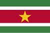
ဆူရာနမ်နိုင်ငံ ဆူရာနမ် သမ္မတနိုင်ငံ SUR |
ဒတ်ချ်: Suriname — Republiek Suriname | Paramaribo ဒတ်ချ်: Paramaribo |
ဖော်ပြချက် အမှား - နားမလည်သော ပုဒ်ဖြတ် စာလုံး "["။ | ၁၆၃,၈၂၀ km2 (၆၃,၂၅၁ sq mi) |
 |
 |
ပါရာဂွေးနိုင်ငံ ပါရာဂွေး သမ္မတနိုင်ငံ PRY |
စပိန်: Paraguay — República del Paraguay တမ်းပလိတ်:Lang-gn |
အာဆွန်စီယွန်မြို့ စပိန်: Asunción |
ဖော်ပြချက် အမှား - နားမလည်သော ပုဒ်ဖြတ် စာလုံး "["။ | ၄၀၆,၇၅၂ km2 (၁၅၇,၀၄၈ sq mi) |
 |
 |
ပီရူးနိုင်ငံ ပီရူး သမ္မတနိုင်ငံ PER |
စပိန်: Perú — República del Perú တမ်းပလိတ်:Lang-qu တမ်းပလိတ်:Lang-ay |
Lima စပိန်: Lima |
ဖော်ပြချက် အမှား - နားမလည်သော ပုဒ်ဖြတ် စာလုံး "["။ | ၁,၂၈၅,၂၁၆ km2 (၄၉၆,၂၂၅ sq mi) |
 |
 |
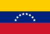
ဗင်နီဇွဲလားနိုင်ငံ ဗင်နီဇွဲလား ဘိုလီဗေးရီးယန်း သမ္မတ နိုင်ငံ VEN |
စပိန်: Venezuela — República Bolivariana de Venezuela | ကရာကက်စ်မြို့ စပိန်: Caracas |
ဖော်ပြချက် အမှား - နားမလည်သော ပုဒ်ဖြတ် စာလုံး "["။ | ၉၁၂,၀၅၀ km2 (၃၅၂,၁၄၄ sq mi) |
 |
 |
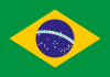
ဘရာဇီးနိုင်ငံ ဘရာဇီး ဖက်ဒရယ် သမ္မတနိုင်ငံ BRA |
ပေါ်တူဂီ: Brasil — República Federativa do Brasil | ဘရာစေးလေးယားမြို့ ပေါ်တူဂီ: Brasília |
ဖော်ပြချက် အမှား - နားမလည်သော ပုဒ်ဖြတ် စာလုံး "["။ | ၈,၅၁၄,၈၇၇ km2 (၃,၂၈၇,၆၁၂ sq mi) |
 |
 |
ဘိုလီးဗီးယားနိုင်ငံ Plurinational State of Bolivia BOL |
စပိန်: Bolivia — Estado Plurinacional de Bolivia တမ်းပလိတ်:Lang-qu တမ်းပလိတ်:Lang-ay |
Sucre (official) and La Paz (seat of government) စပိန်: Sucre La Paz[n ၃] |
ဖော်ပြချက် အမှား - နားမလည်သော ပုဒ်ဖြတ် စာလုံး "["။ | ၁,၀၉၈,၅၈၁ km2 (၄၂၄,၁၆၄ sq mi) |
 |
 |
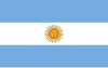
အာဂျင်တီးနားနိုင်ငံ အာဂျင်တီးနား သမ္မတနိုင်ငံ ARG |
စပိန်: Argentina — República Argentina | ဗျူနိုအေးရိစ်မြို့ စပိန်: Ciudad de Buenos Aires |
ဖော်ပြချက် အမှား - နားမလည်သော ပုဒ်ဖြတ် စာလုံး "["။ | ၂,၇၈၀,၄၀၀ km2 (၁,၀၇၃,၅၁၈ sq mi) |
 |
 |
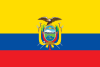
အီကွေဒေါနိုင်ငံ အီကွေဒေါ သမ္မတနိုင်ငံ ECU |
စပိန်: Ecuador — República del Ecuador တမ်းပလိတ်:Lang-qu |
ကီတိုမြို့ စပိန်: Quito |
ဖော်ပြချက် အမှား - နားမလည်သော ပုဒ်ဖြတ် စာလုံး "["။ | ၂၈၃,၅၆၁ km2 (၁၀၉,၄၈၄ sq mi) |
 |
 |
ဥရုဂွေးနိုင်ငံ ဥရုဂွေး အရှေ့တိုင်း သမ္မတ နိုင်ငံ[n ၄] URY |
စပိန်: Uruguay — República Oriental del Uruguay | မွန်တီဗွီဒီယိုမြို့ စပိန်: Montevideo |
ဖော်ပြချက် အမှား - နားမလည်သော ပုဒ်ဖြတ် စာလုံး "["။ | ၁၇၆,၂၁၅ km2 (၆၈,၀၃၇ sq mi) |
အချုပ်အခြာအာဏာပိုင်နိုင်ငံများ၏ ဖွဲ့စည်းပုံအရ အစိတ်အပိုင်းများ
[ပြင်ဆင်ရန်]| Flag | Map | English Name and ISO code[၆][၈] |
Legal Status | Local Name | Capital[၉] | Population[၁၁] | Area[၁၂] |
|---|---|---|---|---|---|---|---|
 |
.svg) |
French Guiana GUF |
Overseas region and constituent part of the French Republic[n ၅] |
ပြင်သစ်: Guyane | Cayenne ပြင်သစ်: Cayenne |
296711[၁၃] | ၈၃,၅၃၄ km2 (၃၂,၂၅၃ sq mi) |
အချုပ်အခြာအာဏာပိုင်နိုင်ငံများ၏ အမှီအခိုနယ်မြေများ
[ပြင်ဆင်ရန်]| Flag | Map | English Name and ISO Code[၆][၈] |
Legal Status | Local Name | Capital[၉] | Population[၁၁] | Area[၁၂] |
|---|---|---|---|---|---|---|---|
 |
 |
Bouvet Island[None ၁] BVT |
Dependent territory of Norway | နော်ဝေး: Bouvetøya | No permanent population | ၄၉ km2 (၁၉ sq mi) | |
 |
.svg) |
Falkland Islands FLK |
British overseas territory | အင်္ဂလိပ်: Falkland Islands စပိန်: Islas Malvinas |
Stanley အင်္ဂလိပ်: Stanley |
ဖော်ပြချက် အမှား - နားမလည်သော ပုဒ်ဖြတ် စာလုံး "["။[၁၄] | ၁၂,၁၇၃ km2 (၄,၇၀၀ sq mi) |
 |
 |
South Georgia and the South Sandwich Islands[n ၆] SGS |
British overseas territory | အင်္ဂလိပ်: South Georgia and the South Sandwich Islands | King Edward Point အင်္ဂလိပ်: King Edward Point |
No permanent population[n ၇] | ၃,၉၀၃ km2 (၁,၅၀၇ sq mi) |
စီးပွားရေးဆိုင်ရာ စာရင်းအင်းများ
[ပြင်ဆင်ရန်]| Name | Currency | GDP (PPP) per capita[n ၈] (2008 est. in U.S. dollars) |
Notes |
|---|---|---|---|
| Argentina | Argentine peso | 14200 | [၁၅] |
| Bolivia | Boliviano | 4500 | [၁၆] |
| Bouvet Island† (Norway) | N/A | N/A | |
| Brazil | Brazilian real | 10100 | [၁၇] |
| Chile | Chilean peso | 14900 | [၁၈] |
| Colombia | Colombian peso | 8900 | [၁၉] |
| Ecuador | United States dollar | 7500 | [၂၀] |
| Falkland Islands (United Kingdom) | Falkland Islands pound | 35400 (2002 est.) | [၂၁] |
| French Guiana (France) | Euro | 6000 (2001 est.) | [၂၂][၂၃] |
| Guyana | Guyanese dollar | 3900 | [၂၄] |
| Paraguay | Paraguayan guaraní | 4200 | [၂၅] |
| Peru | Peruvian nuevo sol | 8400 | [၂၆] |
| South Georgia and the South Sandwich Islands† (United Kingdom) |
N/A | N/A | |
| Suriname | Surinamese dollar | 8900 | [၂၇] |
| Uruguay | Uruguayan peso | 12200 | [၂၈] |
| Venezuela | Venezuelan bolívar | 13500 | [၂၉] |
† Geographically a part of Antarctica, the United Nations geoscheme includes Bouvet Island and South Georgia and the South Sandwich Islands in South America.
ဆက်လက်ကြည့်ရှုရန်
[ပြင်ဆင်ရန်]မှတ်စုများ
[ပြင်ဆင်ရန်]- ↑ Includes Easter Island in the Pacific Ocean, a Chilean territory frequently reckoned in Oceania.
- ↑ While Santiago is the constitutional capital of Chile, Valparaíso is the site of legislative meetings.
- ↑ While Sucre is the constitutional capital, La Paz is the seat of the government.
- ↑ Also translated as "Oriental Republic of Uruguay".
- ↑ The territory has been fully integrated into the French central state.
- ↑ Sometimes grouped with Antarctica rather than South America.
- ↑ Present inhabitants are the British Government officer, deputy postmaster, scientists, and support staff from the British Antarctic Survey who maintain scientific bases on Bird Island and in the capital, King Edward Point, as well as museum staff at Grytviken.
- ↑ The CIA's estimate for GDP per capita (PPP) is used in the article. For the World Bank and International Monetary Fund's estimates, see List of countries by GDP (PPP) per capita.
ကိုးကား
[ပြင်ဆင်ရန်]- ↑ The New York Times Guide to Essential Knowledge: A Desk Reference for the Curious Mind (2nd ed.)၊ New York: St. Martin's Press၊ 2007၊ p. 598၊ ISBN 0-312-37659-6၊ OCLC 173243876
- ↑ Ashley, Richard K (1 June 1988). "Untying the Sovereign State: A Double Reading of the Anarchy Problematique". Millennium - Journal of International Studies 4 (2): 227–262. Sage Journals Online. doi:. Retrieved on ၁၃ အောက်တိုဘာ ၂၀၂၀. မော်ကွန်းတင်ပြီးမိတ္တူ။ 11 December 2019 တွင် မူရင်းအား မော်ကွန်းတင်ပြီး။ 13 October 2020 တွင် ပြန်စစ်ပြီး။
- ↑ Montevideo Convention on the Rights and Duties of States။ Council on Foreign Relations (26 December 1933)။ 28 June 2011 တွင် မူရင်းအား မော်ကွန်းတင်ပြီး။ ၁၃ အောက်တိုဘာ ၂၀၂၀ တွင် ပြန်စစ်ပြီး။
- ↑ United Nations Member States။ United Nations။ ၁၃ အောက်တိုဘာ ၂၀၂၀ တွင် ပြန်စစ်ပြီး။
- ↑ Estados Miembros (in Spanish)။ Secretaria General de UNASUR။ 27 June 2012 တွင် မူရင်းအား မော်ကွန်းတင်ပြီး။ ၁၃ အောက်တိုဘာ ၂၀၂၀ တွင် ပြန်စစ်ပြီး။
- ↑ ၆.၀ ၆.၁ ၆.၂ ၆.၃ Field Listing :: Names။ Central Intelligence Agency။ 7 January 2019 တွင် မူရင်းအား မော်ကွန်းတင်ပြီး။ 7 February 2012 တွင် ပြန်စစ်ပြီး။
- ↑ ၇.၀ ၇.၁ UNGEGN List of Country Names။ United Nations Statistics Division (2007)။ 2011-02-24 တွင် ပြန်စစ်ပြီး။
- ↑ ၈.၀ ၈.၁ ၈.၂ ၈.၃ List of countries, territories and currencies။ Europa (7 February 2012)။ 7 February 2012 တွင် ပြန်စစ်ပြီး။
- ↑ ၉.၀ ၉.၁ ၉.၂ Field Listing :: Capital။ Central Intelligence Agency။ 7 January 2019 တွင် မူရင်းအား မော်ကွန်းတင်ပြီး။ 7 February 2012 တွင် ပြန်စစ်ပြီး။
- ↑ UNGEGN World Geographical Names။ United Nations Group of Experts on Geographical Names (9 December 2011)။ 7 February 2012 တွင် ပြန်စစ်ပြီး။
- ↑ ၁၁.၀ ၁၁.၁ ၁၁.၂ Country Comparison :: Population။ Central Intelligence Agency။ 27 September 2011 တွင် မူရင်းအား မော်ကွန်းတင်ပြီး။ 7 February 2012 တွင် ပြန်စစ်ပြီး။
- ↑ ၁၂.၀ ၁၂.၁ ၁၂.၂ Field Listing :: Area။ Central Intelligence Agency။ 7 January 2019 တွင် မူရင်းအား မော်ကွန်းတင်ပြီး။ 7 February 2012 တွင် ပြန်စစ်ပြီး။
- ↑ INSEE။ Estimation de population par région, sexe et grande classe d'âge – Années 1975 à 2019 (in fr)။ 6 February 2019 တွင် မူရင်းအား မော်ကွန်းတင်ပြီး။ 2019-01-15 တွင် ပြန်စစ်ပြီး။
- ↑ 2016 Census Report (PDF)။ Policy and Economic Development Unit, Falkland Islands Government (2017)။ 24 January 2018 တွင် မူရင်းအား မော်ကွန်းတင်ပြီး။ 13 October 2020 တွင် ပြန်စစ်ပြီး။
- ↑ The World Factbook: Argentina။ CIA Directorate of Intelligence (2008-05-15)။ 12 June 2007 တွင် မူရင်းအား မော်ကွန်းတင်ပြီး။ 2008-06-12 တွင် ပြန်စစ်ပြီး။
- ↑ The World Factbook: Bolivia။ CIA Directorate of Intelligence (2008-05-15)။ 25 December 2018 တွင် မူရင်းအား မော်ကွန်းတင်ပြီး။ 2008-06-12 တွင် ပြန်စစ်ပြီး။
- ↑ The World Factbook: Brazil။ CIA Directorate of Intelligence (2008-05-15)။ 22 December 2015 တွင် မူရင်းအား မော်ကွန်းတင်ပြီး။ 2008-06-12 တွင် ပြန်စစ်ပြီး။
- ↑ The World Factbook: Chile။ CIA Directorate of Intelligence (2008-05-15)။ 6 November 2015 တွင် မူရင်းအား မော်ကွန်းတင်ပြီး။ 2008-06-12 တွင် ပြန်စစ်ပြီး။
- ↑ The World Factbook: Colombia။ CIA Directorate of Intelligence (2008-05-15)။ 13 May 2009 တွင် မူရင်းအား မော်ကွန်းတင်ပြီး။ 2008-06-12 တွင် ပြန်စစ်ပြီး။
- ↑ The World Factbook: Ecuador။ CIA Directorate of Intelligence (2008-05-15)။ 12 June 2007 တွင် မူရင်းအား မော်ကွန်းတင်ပြီး။ 2008-06-12 တွင် ပြန်စစ်ပြီး။
- ↑ The World Factbook: Falkland Islands (Islas Malvinas)။ CIA Directorate of Intelligence (2008-05-15)။ 1 February 2010 တွင် မူရင်းအား မော်ကွန်းတင်ပြီး။ 2008-06-12 တွင် ပြန်စစ်ပြီး။
- ↑ Americas Review 2003/2004: Economic and Business Report (21st ed.)။ London: Kogan Page။ 2003။ p. 79။ ISBN 0-7494-4064-3။ ISSN 1351-4571။
- ↑ Résultats régionaux des enquêtes de recensement de 2004 à 2007 (in fr)။ INSEE။ 2008-06-12 တွင် ပြန်စစ်ပြီး။
- ↑ The World Factbook: Guyana။ CIA Directorate of Intelligence (2008-05-15)။ 26 December 2018 တွင် မူရင်းအား မော်ကွန်းတင်ပြီး။ 2008-06-12 တွင် ပြန်စစ်ပြီး။
- ↑ The World Factbook: Paraguay။ CIA Directorate of Intelligence (2008-05-15)။ 4 November 2015 တွင် မူရင်းအား မော်ကွန်းတင်ပြီး။ 2008-06-12 တွင် ပြန်စစ်ပြီး။
- ↑ The World Factbook: Peru။ CIA Directorate of Intelligence (2008-05-15)။ 5 November 2016 တွင် မူရင်းအား မော်ကွန်းတင်ပြီး။ 2008-06-12 တွင် ပြန်စစ်ပြီး။
- ↑ The World Factbook: Suriname။ CIA Directorate of Intelligence (2008-05-15)။ 7 January 2019 တွင် မူရင်းအား မော်ကွန်းတင်ပြီး။ 2008-06-12 တွင် ပြန်စစ်ပြီး။
- ↑ The World Factbook: Uruguay။ CIA Directorate of Intelligence (2008-05-15)။ 7 January 2019 တွင် မူရင်းအား မော်ကွန်းတင်ပြီး။ 2008-06-12 တွင် ပြန်စစ်ပြီး။
- ↑ The World Factbook: Venezuela။ CIA Directorate of Intelligence (2008-05-15)။ 24 November 2015 တွင် မူရင်းအား မော်ကွန်းတင်ပြီး။ 2008-06-12 တွင် ပြန်စစ်ပြီး။
ကိုးကား အမှား - <ref> tags exist for a group named "None", but no corresponding <references group="None"/> tag was found