
ဖိုင်:Japan natural location map with side map of the Ryukyu Islands.jpg

ဤနမူနာ၏ အရွယ်အစား - ၆၆၄ × ၆၀၀ ပစ်ဇယ်။ အခြား ပုံရိပ်ပြတ်သားမှု: ၂၆၆ × ၂၄၀ ပစ်ဇယ် | ၅၃၁ × ၄၈၀ ပစ်ဇယ် | ၈၅၀ × ၇၆၈ ပစ်ဇယ် | ၁၁၃၃ × ၁၀၂၄ ပစ်ဇယ် | ၂၄၉၇ × ၂၂၅၆ ပစ်ဇယ်။
မူရင်းဖိုင် (၂၄၉၇ × ၂၂၅၆ pixels, ဖိုင်အရွယ်အစား - ၈၃၀ KB, MIME အမျိုးအစား image/jpeg)
| ဤဖိုင်သည် Wikimedia Commons မှဖြစ်ပြီး အခြားပရောဂျက်များတွင် သုံးကောင်းသုံးလိမ့်မည်။ ယင်း၏ ဖိုင်အကြောင်းစာမျက်နှာ တွင် ဖော်ပြထားချက်ကို အောက်တွင် ပြထားသည်။ Commons သည် မူပိုင်ခွင့်လွတ်လပ်သော မီဒီယာဖိုင်များ သိုလှောင်ထားရာ နေရာ ဖြစ်သည်။ သင်လည်း ပါဝင်ကူညီနိုင်ပါသည်။ |
အကျဉ်းချုပ်
| ဖော်ပြချက် |
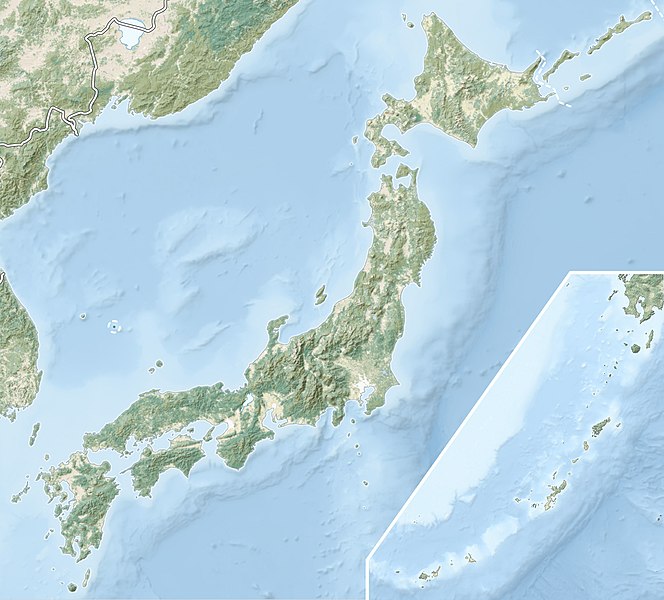
English: Natural Location map of Japan
Equirectangular projection. Geographic limits to locate objects in the main map with the main islands:
Geographic limits to locate objects in the side map with the Ryukyu Islands:
|
||
| ရက်စွဲ | |||
| ရင်းမြစ် |
|
||
| စာရေးသူ | Alexrk2 | ||
| ခွင့်ပြုချက် (ဤဖိုင်ကို ပြန်လည်အသုံးပြုခြင်း) |
ဤဖိုင်ကို Creative Commons Attribution-Share Alike 3.0 Unported လိုင်စင်ဖြင့် သတ်မှတ်ထားသည်။
|
||
| အခြား ဗားရှင်းများ |
|


ဖိုင်မှတ်တမ်း
ဖိုင်ကို ယင်းနေ့စွဲ အတိုင်း မြင်နိုင်ရန် နေ့စွဲ/အချိန် တစ်ခုခုပေါ်တွင် ကလစ်နှိပ်ပါ။
| နေ့စွဲ/အချိန် | နမူနာပုံငယ် | မှတ်တမ်း ဒိုင်မန်းရှင်းများ | အသုံးပြုသူ | မှတ်ချက် | |
|---|---|---|---|---|---|
| ကာလပေါ် | ၂၁:၄၁၊ ၉ မတ် ၂၀၂၂ | | ၂၄၉၇ × ၂၂၅၆ (၈၃၀ KB) | Sting | Natural Earth land cover data for Ryukyu Islands |
| ၀၉:၄၄၊ ၂၂ ဇွန် ၂၀၁၈ |  | ၂၄၉၇ × ၂၂၅၆ (၇၉၄ KB) | Mardetanha | Reverted to version as of 19:56, 22 March 2011 (UTC) | |
| ၁၉:၅၆၊ ၂၂ မတ် ၂၀၁၁ |  | ၂၄၉၇ × ၂၂၅၆ (၇၉၄ KB) | Alexrk2 | RGB | |
| ၁၉:၀၇၊ ၂၂ မတ် ၂၀၁၁ |  | ၂၄၉၇ × ၂၂၅၆ (၇၄၅ KB) | Chumwa | RGB mode | |
| ၂၁:၀၈၊ ၂၁ မတ် ၂၀၁၁ |  | ၂၄၉၇ × ၂၂၅၆ (၁.၅၄ MB) | Alexrk2 | == {{int:filedesc}} == {{Information |Description= {{en|Natural Location map of Japan Equirectangular projection. Geographic limits to locate objects in the main map with the main islands: * N: 45°51'37" N (45.86°N) * S: 30°01'13" N (30. |
ဖိုင်သုံးစွဲမှု
အောက်ပါ 39 စာမျက်နှာများ သည် ဤဖိုင်ကို အသုံးပြုထားသည်:
- ခိတရှောဂျိရေတံခွန်
- ခုရိုခုမရေတံခွန်
- ခဲဂွန်ရေတံခွန်
- ချဂမရေတံခွန်
- ချူးဇင်းဂျိကန်
- ဂျောရင်းရေတံခွန်
- ဆင်းဂရေတံခွန်
- ဆနုခိဗုဒ္ဓရုပ်ပွားတော်
- ဆန်းခိုင်ရေတံခွန်
- ဆန်းဂျောရေတံခွန်
- ဆုဝကန်
- ဒိုင်းဟိစန်ကျောက်ဆင်းတုဗုဒ္ဓရုပ်ပွားတော်
- နချိရေတံခွန်
- နနဆုရေတံခွန်
- နနတခိရေတံခွန်
- နမဲခဝရေတံခွန်ကြီး
- ဖုခိဝရဲရေတံခွန်
- ဖုခုရိုဒရေတံခွန်
- ဖုဒိုးရေတံခွန်
- မဆုမိရေတံခွန်
- မိဝတောင်
- မိုတို - ဟခိုနဲ ကျောက်ဆင်းတုဗုဒ္ဓရုပ်ပွားတော်များ
- ယဆုရေတံခွန်
- ယောနခိုရေတံခွန်
- ရူးဆိုးရေတံခွန်
- ရှဆုအိရေတံခွန်
- ရှိရအိတိုရေတံခွန် (ယာမဂတ)
- ဟယတိုရေတံခွန်ကြီး
- ဟိဘရကန်
- ဟော့တိုင်းရေတံခွန်
- အခန်ကန်
- အခါရှိ ခိုင်ခရော တံတား
- အခိအုရေတံခွန်ကြီး
- အတဲရရေတံခွန် ၇ ခု
- အဘဲရေတံခွန်ကြီး
- အရှိကန်
- အိခဲဒကန်
- ၂၀၁၁ ဆန်ဒိုင် ငလျင်နှင့် ဆူနာမီ
- တမ်းပလိတ်:Location map Japan
ဂလိုဘယ် ဖိုင်သုံးစွဲမှု
အောက်ပါ အခြားဝီကီများတွင် ဤဖိုင်ကို အသုံးပြုထားသည်-
- ace.wikipedia.org တွင် အသုံးပြုမှု
- als.wikipedia.org တွင် အသုံးပြုမှု
- ar.wikipedia.org တွင် အသုံးပြုမှု
- arz.wikipedia.org တွင် အသုံးပြုမှု
- ast.wikipedia.org တွင် အသုံးပြုမှု
- as.wikipedia.org တွင် အသုံးပြုမှု
- azb.wikipedia.org တွင် အသုံးပြုမှု
- az.wikipedia.org တွင် အသုံးပြုမှု
- Hokkaydo
- Kyuşu
- Fuci
- Honşu
- İtsukuşima
- Asama dağı
- Şablon:Yer xəritəsi Yaponiya
- Tohoku zəlzələsi və sunamisi (2011)
- Fukuşima-1 AES
- Böyük Hanşin zəlzələsi
- Böyük Kanto zəlzələsi
- Hoey zəlzələsi
- Mino-Ovari zəlzələsi (1891)
- Yapon çökəkliyi
- Ryukyu adaları
- Osumi boğazı
- Sanqar boğazı
- Koreya boğazı
- Tsuşima boğazı
- Harim dənizi
- Yatsuşiro dənizi
- Hiuqa dənizi
- Daxili Yapon dənizi
- Atsumi yarımadası
- Naqasaki yarımadası
- İzu yarımadası
- Simabara yarımadası
- Şiretoko yarımadası
- Nosuke yarımadası
ဤဖိုင်ကို အခြားနေရာများတွင် အသုံးပြုထားမှုများအား ကြည့်ရှုရန်။