တမ်းပလိတ်:Infobox military installation/doc
ပုံပန်းသွင်ပြင်
| ဤစာမျက်နှာမှာ တမ်းပလိတ်:Infobox military installation တမ်းပလိတ်အတွက် အသုံးပြုပုံ လက်စွဲ (documentation) ၏ စာမျက်နှာခွဲ (subpage) တစ်ခုဖြစ်သည်။ ဤစာမျက်နှာတွင် မူရင်း တမ်းပလိတ် page ၌ တစိတ်တပိုင်းအဖြစ် မပါဝင်သည့် အသုံးပြုပုံပြုနည်းနှင့် သက်ဆိုင်သည့် သတင်းအချက်များ၊ ကဏ္ဍများ နှင့် အခြားအချက်အလက်များ ပါဝင်သည်။ |
| Uses Lua: |
အသုံးပြုပုံ
[ပြင်ဆင်ရန်]| Loring Air Force Base | |||||||||
|---|---|---|---|---|---|---|---|---|---|
| Limestone Air Force Base | |||||||||
| United States ရှိ Limestone and Caswell, Maine | |||||||||
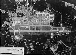
 USGS 1970 Aerial Photo | |||||||||
 Logo of Air Combat Command | |||||||||
Location of Loring AFB | |||||||||
| ကိုဩဒိနိတ် | 46°56′59″N 67°53′20″W / 46.94972°N 67.88889°W | ||||||||
| အမျိုးအစား | Air Force Base | ||||||||
| ဧရိယာ | ၉,၀၀၀ ဧက (၃,၆၀၀ ဟက်တာ; ၁၄ စတုရန်းမိုင်) | ||||||||
| နေရာအချက်အလက် | |||||||||
| ပိုင်ဆိုင်သူ | United States Air Force | ||||||||
| အော်ပရေတာ | 42nd Bomb Wing | ||||||||
| ထိန်းချုပ်သူ | |||||||||
| အများပြည်သူ ဝင်ထွက်ခွင့် | Yes | ||||||||
| Stations | Caribou Air Force Station (East Loring), Caswell Air Force Station | ||||||||
| သမိုင်းကြောင်း | |||||||||
| တည်ဆောက် | ၁၉၄၇–1953 | ||||||||
| တည်ဆောက်သူ | United States Army Corps of Engineers | ||||||||
| အသုံးပြုခြင်း | 1950–၁၉၉၄ | ||||||||
| Fate | Mainly intact, partial demolition | ||||||||
| ဖြစ်ရပ်များ | Cold War | ||||||||
| တပ် အချက်အလက်များ | |||||||||
| လက်ရှိ အုပ်ချုပ်သူ အရာရှိ | Robert J. Pavelko | ||||||||
| အစောင့်တပ် | 42nd Bomb Wing | ||||||||
| နေထိုင်သူ | 69th Bombardment Squadron, 70th Bombardment Squadron, en:75th Bombardment Squadron, 42d Air Refueling Squadron, 407th Air Refueling Squadron, 2192nd Communications Squadron, 101st Fighter Squadron | ||||||||
| လေယာဉ်ကွင်း အချက်အလက်များ | |||||||||
| Identifiers | IATA: KLIZ, ICAO: LIZ | ||||||||
| ပင်လယ်ရေ မျက်နှာပြင်အမြင့် | ၇၄၆ ပေ (၂၂၇ မီတာ) | ||||||||
| |||||||||
စစ်ဖက်ဆိုင်ရာ အဆောက်အအုံများ သို့မဟုတ် စစ်တပ်စခန်းများအကြောင်း အကျဉ်းချုပ်ဖော်ပြရာတွင် အသုံးပြုသည်။
အောက်ပါ ပုံစံဖြင့် {{Infobox military installation}} ကို အသုံးပြုနိုင်သည်။
{{Infobox military installation
| name =
| ensign =
| native_name =
| partof = <!-- for elements within a larger site -->
| location =
| nearest_town = <!-- used in military test site infobox -->
| country =
| image =
| alt =
| caption =
| image2 = <!--secondary image, major command emblems for airfields -->
| alt2 =
| caption2 =
| type =
| coordinates = <!-- {{Coord}} -->
| gridref =
| image_map =
| image_mapsize =
| image_map_alt =
| image_map_caption =
| pushpin_map =
| pushpin_mapsize =
| pushpin_map_alt =
| pushpin_map_caption =
| pushpin_relief =
| pushpin_image =
| pushpin_label =
| pushpin_label_position =
| pushpin_mark =
| pushpin_marksize =
| ownership = <!-- government department such as the MoD or the United States DoD -->
| operator = <!-- where different from ownership such as the RAF or the USAF -->
| controlledby = <!-- such as RAF Bomber Command or the Eighth Air Force -->
| open_to_public = <!-- for out of use sites/sites with museums etc -->
| site_other_label = <!-- for renaming "Other facilities" in infobox -->
| site_other = <!-- for other sorts of facilities - radar types etc -->
| site_area = <!-- area of site m2, km2 square mile etc -->
| code = <!--facility/installation code, applies to US -->
| built = <!-- {{Start date|YYYY}} -->
| used = <!--{{End date|1946}} -->
| builder =
| materials =
| height = <!-- height of tallest part, not above sea level -->
| length = <!-- for border fences or other DMZs -->
| fate = <!--changed from demolished parameter-->
| condition =
| battles =
| events =
| current_commander = <!-- current commander -->
| past_commanders = <!-- past notable commander(s) -->
| garrison = <!-- such as the 25th Bombardment Group -->
| occupants = <!-- squadrons only -->
| website =
| footnotes = <!-- catchall in case it's needed to preserve something in infobox that doesn't work in new code -->
}}
အောက်ပါ နောက်ဆက်တွဲများကို အလျဉ်းသင့်သလို ထည့်သွင်းနိုင်ပြီး "footnotes" ပါရာမီတာ၏ အပေါ်တွင် ကူးယူထည့်သွင်းနိုင်သည်။
- စမ်းသပ်မှု နေရာများ
<!-- begin test site information -->
| subcritical_tests =
| nuclear_tests =
| thermonuclear_tests =
| other_tests_label = <!-- changed from "Other tests" to wording of your choice -->
| other_tests =
| remediation =
| image3 =
| alt3 =
| caption3 =
<!--  end test site information  -->
- လေယာဉ်ကွင်းများ
<!-- begin airfield information  -->
| IATA =
| ICAO =
| FAA =
| TC =
| LID =
| GPS =
| WMO =
| elevation = <!-- {{Convert| |m|0}} -->
| r1-number =
| r1-length = <!-- {{Convert| |m|0}} -->
| r1-surface =
| h1-number =
| h1-length = <!-- {{Convert| |m|0}} -->
| h1-surface =
| airfield_other_label = <!-- for renaming "Other facilities" in infobox -->
| airfield_other = <!-- for other sorts of airfield facilities -->
<!--  end airfield information   -->

