Cần Thơ
| Haiphong Thành phố Hải Phòng - Total | ||
|---|---|---|
| Municipality (Class-1) | ||
| Hải Phòng City | ||
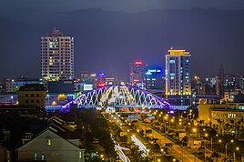
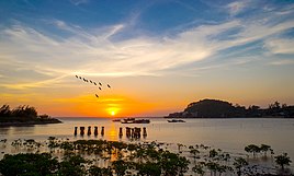
From top, left to right: Downtown Haiphong, Haiphong seen from Haiphong Opera House, Lê Chân statue, Nguyen Binh Khiem overpass, Hai Phong Port, Đồ Sơn. | ||
| ||
| နာမည်ပြောင်(များ): Flamboyant City (Thành phố Hoa Phượng Đỏ) | ||
<mapframe>: The JSON content is not valid GeoJSON+simplestyle. The list below shows all attempts to interpret it according to the JSON Schema. Not all are errors.
| ||
 Provincial location in Vietnam | ||
| Country | ||
| Region | Red River Delta | |
| Seat | Hồng Bàng | |
| Subdivision | 7 urban districts, 8 rural districts | |
| အစိုးရ | ||
| • အမျိုးအစား | Municipality | |
| • အစိုးရအဖွဲ့ | Haiphong People's Council | |
| • Secretary of the Party | Trần Lưu Quang | |
| ဧရိယာ[၁] | ||
| • Municipality (Class-1) | ၁၅၆၁.၇၆ စတုရန်းကီလိုမီတာ (၆၀၃�၀၀ စတုရန်းမိုင်) | |
| လူဦးရေ (2021)[၂] | ||
| • Municipality (Class-1) | ၂,၃၅၈,၇၄၁ | |
| • သိပ်သည်းမှု | ၁၅၀၀/km၂ (၃၉၀၀/sq mi) | |
| • မြို့ပေါ် | ၉၅၁,၇၂၃ | |
| Ethnic groups[၂] | ||
| • Vietnamese | {{{demographics1_info1}}} | |
| Postal code | 04000 - 05000 | |
| Area codes | 225 | |
| ယာဉ်မှတ်ပုံတင် | 15, 16 | |
| International airport | Cat Bi International Airport | |
| ဝက်ဘ်ဆိုဒ် | Haiphong.gov.vn | |
Haiphong ( ဗီယက်နမ်: Hải Phòng , IPA: [haːj˧˩ fawŋ͡m˨˩] ( </img> ) သို့မဟုတ် Hải Phòng သည် ဗီယက်နမ်တွင် အဓိကစက်မှုမြို့တော်နှင့် တတိယအကြီးဆုံးမြို့တော်ဖြစ်သည်။ [၃] ဟိုင်ဖုန်သည် မြစ်နီမြစ်ဝကျွန်းပေါ်ဒေသ ရှိ နည်းပညာ၊ စီးပွားရေး၊ ယဉ်ကျေးမှု၊ ဆေးပညာ၊ ပညာရေး၊ သိပ္ပံပညာနှင့် ကုန်သွယ်ရေးတို့၏ ဗဟိုချက်ဖြစ်သည်။
ဟိုင်ဖုန်ကို ဗီယက်နမ်နိုင်ငံ၏ အဓိက ဆိတ်ကမ်းမြို့အဖြစ် ၁၈၈၇ ခုနစ်တွင် တည်ထောင်ခဲ့ပါသည်။ ၁၈၈၈ခုနစ် တွင် ပြင်သစ်တတိယသမ္မတနိုင်ငံသမ္မတ Sadi Carnot က ဟိုင်ဖုန် ကိုတည်ထောင်ရန် အမိန်ထုတ်ပြန်ခဲ့သည်။ ၁၉၅၄ ခုနှစ်မှ ၁၉၇၅ ခုနှစ်အထိ ဟိုင်ဖုန် သည် မြောက်ဗီယက်နမ်၏ အရေးကြီးဆုံးသော ရေကြောင်းသွားလာရေးမြို့တော်အဖြစ် တာဝန်ထမ်းဆောင်ခဲ့ပြီး ၁၉၇၆ ခုနှစ်တွင် ဟနွိုင်း နှင့် ဟိုချီမင်းမြို့ တို့နှင့် ပြန်လည်ပေါင်းစည်းထားသော ဗီယက်နမ်၏ တိုက်ရိုက်ထိန်းချုပ်သော မြူနီစီပယ်များထဲမှ တစ်ခုဖြစ်လာခဲ့သည်။
ဟိုင်ဖုန် တွင် လူ့စွမ်းအားဖွံ့ဖြိုးတိုးတက်မှုအညွှန်းကိန်း ၀.၇၈၂ (မြင့်မားသည်) သည် ဗီယက်နမ်နိုင်ငံ၏ မြူနီစီပယ်များနှင့် ပြည်နယ်များအားလုံးတွင် စတုတ္ထ အဆင့်ရှိသည်။ [၄]
သမိုင်း
[ပြင်ဆင်ရန်]Dynastic ဗီယက်နမ်
[ပြင်ဆင်ရန်]ဟိုင်ဖုန်သည် အေဒီ ၄၀ တွင် တရုတ်အုပ်စိုးမှုကို ဆန့်ကျင်ကာ အေဒီ ၄၃ တွင် ရှုံးနိမ့်သည်အထိ အုပ်ချုပ်ခဲ့သော ထရန် ညီအစ်မ များ၏ ကွပ်ကဲမှုအောက်တွင် အမျိုးသမီးဗိုလ်ချုပ်များထဲမှ လီချန် ၏ မွေးရပ်မြေ ဖြစ်သည်။ မက်ခ်မင်းဆက်လက်ထက် ရာစုနှစ်များစွာကြာပြီးနောက် ထိုဒေသသည် မက်ခ်ဘုရင်များ၏ဇာတ ပြည်နယ်အရှေ့ဘက်ခြမ်းကို ကာကွယ်ထားသောကြောင့် Hải -dương thương-chính quan- phòng ("ကုန်သွယ်ရေးကာကွယ်ရေးနယ်မြေ") ဟု အမည်တွင်ခဲ့သည်။
- ↑ "Phê duyệt và công bố kết quả thống kê diện tích đất đai của cả nước năm 2018" [Announcements of area statistics for the whole country in 2018]။ Act No. 2908/QĐ-BTNMT of (Vietnameseဘာသာစကားဖြင့်)။ Ministry of Natural Resources and Environment (Vietnam)။CS1 maint: အသိအမှတ်မပြုသော ဘာသာစကား (link) – the data in the report are in hectares, rounded to integers
- ↑ ၂.၀ ၂.၁ General Statistics Office of Vietnam (2019)။ "Completed Results of the 2019 Viet Nam Population and Housing Census" (PDF)။ Statistical Publishing House (Vietnam)။ ISBN 978-604-75-1532-5။
- ↑ DEEP C - Living and Working in Vietnam။ 2020-06-25 တွင် မူရင်းအား မော်ကွန်းတင်ပြီး။ 2020-06-22 တွင် ပြန်စစ်ပြီး။
- ↑ Vietnam's Human Development Index (2016–2020) (အစီရင်ခံစာ)။ 2021။ p. 29။ 1 April 2022 တွင် ပြန်စစ်ပြီး။


