
ဖိုင်:Tochigi-ken géolocalisation relief.svg

Size of this PNG preview of this SVG file: ၄၃၂ × ၅၉၉ ပစ်ဇယ်. အခြား ပုံရိပ်ပြတ်သားမှု: ၁၇၃ × ၂၄၀ ပစ်ဇယ် | ၃၄၆ × ၄၈၀ ပစ်ဇယ် | ၅၅၄ × ၇၆၈ ပစ်ဇယ် | ၇၃၈ × ၁၀၂၄ ပစ်ဇယ် | ၁၄၇၇ × ၂၀၄၈ ပစ်ဇယ် | ၁၇၁၉ × ၂၃၈၄ ပစ်ဇယ်။
မူရင်းဖိုင် (SVG ဖိုင်, ၁၇၁၉ × ၂၃၈၄ pixels ကို အကြံပြုသည်, ဖိုင်အရွယ်အစား - ၂.၁ MB)
| ဤဖိုင်သည် Wikimedia Commons မှဖြစ်ပြီး အခြားပရောဂျက်များတွင် သုံးကောင်းသုံးလိမ့်မည်။ ယင်း၏ ဖိုင်အကြောင်းစာမျက်နှာ တွင် ဖော်ပြထားချက်ကို အောက်တွင် ပြထားသည်။ Commons သည် မူပိုင်ခွင့်လွတ်လပ်သော မီဒီယာဖိုင်များ သိုလှောင်ထားရာ နေရာ ဖြစ်သည်။ သင်လည်း ပါဝင်ကူညီနိုင်ပါသည်။ |
အကျဉ်းချုပ်
| Camera location | | View this and other nearby images on: OpenStreetMap |
|---|
| ဖော်ပြချက် |
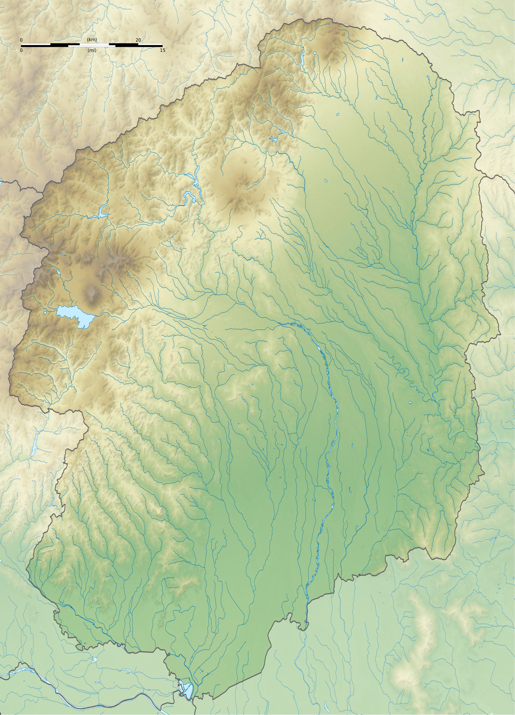
Français : Carte topographique vierge de la Préfecture de Tochigi, au Japon, destinée à la géolocalisation.
Deutsch: Topographische Karte der Präfektur Tochigi.
English: Topographic blank map of the Tochigi Prefecture, for geolocalisation purpose.
Español: Mapa topográfico de la Prefectura de Tochigi.
Italiano: Mappa topografica della Prefettura di Tochigi.
日本語: 栃木県の地図.
Português: Carta topográfica de la província de Tochigi.
|
||
| ရက်စွဲ | (UTC) | ||
| ရင်းမြစ် |
Création personnelle ;
|
||
| စာရေးသူ | © Bourrichon (talk) - fr:Bourrichon | ||
| ခွင့်ပြုချက် (ဤဖိုင်ကို ပြန်လည်အသုံးပြုခြင်း) |
|
||
| အခြား ဗားရှင်းများ | File:Tochigi-ken géolocalisation.svg |
This W3C-unspecified vector image was created with Inkscape .
လိုင်စင်သတ်မှတ်ခြင်း
ကျွန်ုပ်၊ ဤလုပ်ဆောင်ချက်၏ မူပိုင်ခွင့်ပိုင်ရှင်အနေဖြင့် ဤနေရာမှ အောက်ပါလိုင်စင်အောက်တွင် ထုတ်လွှင့်ပါသည်:
ဤဖိုင်သည် Creative Commons Attribution-Share Alike 2.0 ပြင်သစ် လိုင်စင်အောက်တွင် လိုင်စင်သတ်မှတ်ထားပါသည်။
မှတ်ယူနိုင်ခြင်း: Bourrichon (atelier graphique)
- သင်သည် လွတ်လပ်စွာ:
- မျှဝေရန် – ဖန်တီးမှုကို ကူးယူရန်၊ ဖြန့်ဖြူးရန်နှင့် ထုတ်လွှင့်ရန်
- ပြန်ရောနှောရန် – ဖန်တီးမှုကို ပြင်ဆင်ညှိနှိုင်းရန်
- အောက်ပါ အခြေအနေများတွင်:
- မှတ်ယူနိုင်ခြင်း – ပြောင်းလဲမှုများ ပြုလုပ်ခဲ့ပါက ဖန်တီးသူ သို့မဟုတ် လိုင်စင်ရှိသူမှ သတ်မှတ်သော အမျိုးအစားကို လိုက်နာရမည် (ဆိုလိုသည်မှာ သင့်အား သို့မဟုတ် သင့်ဖန်တီးမှုတွင် အသုံးပြုခြင်းအား ထောက်ခံချက်ပေးသည်ဟု မဆိုလိုပါ)။
- ထပ်တူမျှဝေ – ဤဖန်တီးမှုအား ပြင်ဆင်ခြင်း၊ ပြောင်းလဲခြင်း သို့မဟုတ် ထပ်ဆင့် ဖန်တီးခြင်း ပြုလုပ်ပါက ရရှိလာသော ဖန်တီးမှုကို ဤဖန်တီးမှုနှင့် သို့မဟုတ် ဆင်တူသော လိုင်စင်ဖြင့်သာ ဖြန့်ချိသင့်သည်။

ဖိုင်မှတ်တမ်း
ဖိုင်ကို ယင်းနေ့စွဲ အတိုင်း မြင်နိုင်ရန် နေ့စွဲ/အချိန် တစ်ခုခုပေါ်တွင် ကလစ်နှိပ်ပါ။
| နေ့စွဲ/အချိန် | နမူနာပုံငယ် | မှတ်တမ်း ဒိုင်မန်းရှင်းများ | အသုံးပြုသူ | မှတ်ချက် | |
|---|---|---|---|---|---|
| ကာလပေါ် | ၁၈:၀၈၊ ၈ ဇူလိုင် ၂၀၁၃ | | ၁၇၁၉ × ၂၃၈၄ (၂.၁ MB) | Bourrichon | == {{int:filedesc}} == {{Location|37|00|00|N|140|00|00|E|scale:10000}} {{Information |Description= {{fr|Carte topographique vierge de la fr:Préfecture de Tochigi, au Japon, destinée à la géolocalisation.}} {{de|Topographische Ka... |
ဖိုင်သုံးစွဲမှု
အောက်ပါ စာမျက်နှာ သည် ဤဖိုင်ကို အသုံးပြုထားသည်:
ဂလိုဘယ် ဖိုင်သုံးစွဲမှု
အောက်ပါ အခြားဝီကီများတွင် ဤဖိုင်ကို အသုံးပြုထားသည်-
- ar.wikipedia.org တွင် အသုံးပြုမှု
- ca.wikipedia.org တွင် အသုံးပြုမှု
- ceb.wikipedia.org တွင် အသုံးပြုမှု
- ce.wikipedia.org တွင် အသုံးပြုမှု
- de.wikipedia.org တွင် အသုံးပြုမှု
- en.wikipedia.org တွင် အသုံးပြုမှု
- Futarasan shrine
- Cedar Avenue of Nikkō
- Gene Sarazen Jun Classic
- Ōya-ji
- Ashikaga Gakkō
- Module:Location map/data/Japan Tochigi Prefecture/doc
- Mibu Castle
- Ōtawara Castle
- Karasuyama Castle
- Utsunomiya Castle
- Banna-ji
- Babul Islam Mosque
- Sano Castle
- Karasawa Castle
- Brex Arena Utsunomiya
- Module:Location map/data/Japan Tochigi Prefecture
- User:Ty654/List of earthquakes from 1940-1949 exceeding magnitude 6+
- Atagozuka Kofun (Mibu)
- Otomefudōhara Tile Kiln
- Shimotsuke Provincial Capital
- Shimotsuke Kokubun-ji
- Shimotsuke Yakushi-ji
- Kabasaki-ji
- Ushizuka Kofun (Mibu)
- Azuma Kofun
- Negoyadai Site
- Sanuki Stone Buddha
- Sakuramachi Jin'ya
- Samuraizuka Kofun
- Teranohigashi Site
- Kurumazuka Kofun (Mibu)
- Kogane Ichirizuka
- Oyama Castle
- Kamikōnushi-Mobara Kanga ruins
- Mibu Ichirizuka
- Chausuyama Kofun (Mibu)
ဤဖိုင်ကို အခြားနေရာများတွင် အသုံးပြုထားမှုများအား ကြည့်ရှုရန်။