တမ်ဘကန်
ပုံပန်းသွင်ပြင်
| တမ်ဘကန် | |
|---|---|
 seen from space (false color) | |
| ကိုဩဒိနိတ် | 0°50′S 18°0′E / 0.833°S 18.000°Eကိုဩဒိနိတ်: 0°50′S 18°0′E / 0.833°S 18.000°E |
| ရေချိုင့်ဝှမ်းရှိရာ နိုင်ငံများ | Democratic Republic of the Congo |
| မျက်နှာပြင် ဧရိယာ | ၅၀၀ km2 (၁၉၃ sq mi) |
| အနက်ဆုံး အနက်အရှိုင်း | ၆ m (၂၀ ft) |

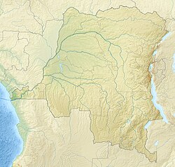
တမ်ဘကန် သည် ကွန်ဂိုဒီမိုကရက်တစ်သမ္မတနိုင်ငံအနောက်မြောက်ပိုင်းရှိ ရေတိမ်သည့် ကန်တစ်ခု ဖြစ်သည်။ [၁]
ကန်သည် ရာသီအပေါ်မူတည်ကာ ၇၆၅ စတုရန်းကီလိုမီတာ (၂၉၅စတုရန်းမိုင်) ရှိသည်။ ကွန်ဂိုမြစ်နှင့် Irebu ချောင်းမှတစ်ဆင့် ချိတ်ဆက်တည်ရှိသည်။ ထိုချောင်းမှတစ်ဆင့် ကန်အထဲသို့ ရေစီးဝင်ခြင်း သို့မဟုတ် ရေထွက်ခြင်းများ ဖြစ်ပေါ်သည်။ ကန်တွင် ငါးမျိုးစိတ် ၁၁၄ မျိုး တည်ရှိကာ ငါးဖမ်းလုပ်ငန်းများအတွက် အရေးပါသည့် ကန်တစ်ခု ဖြစ်သည်။ ဤကန်သည် Tumba-Ngiri-Maindombe ဧရိယာ၏ အလယ်ဗဟိုတွင် တည်ရှိသည်။ [၂][၃]
ကိုးကား
[ပြင်ဆင်ရန်]- ↑ Blaes၊ X. (October 2008)။ Découpage administratif de la République Démocratique du Congo။ PNUD-SIG။ 1 April 2010 တွင် မူရင်းအား မော်ကွန်းတင်ပြီး။ 26 July 2021 တွင် ပြန်စစ်ပြီး။
- ↑ INFORMATION ON FISHERIES MANAGEMENT IN THE DEMOCRATIC REPUBLIC OF THE CONGO။ Food and Agriculture Organization of the United Nations (January 2001)။ 14 March 2008 တွင် မူရင်းအား မော်ကွန်းတင်ပြီး။ 26 July 2021 တွင် ပြန်စစ်ပြီး။
- ↑ DR Congo Announces World's Largest Protected Wetland။ Environment News Service (July 24, 2008)။ 3 March 2016 တွင် မူရင်းအား မော်ကွန်းတင်ပြီး။ 26 July 2021 တွင် ပြန်စစ်ပြီး။


