ဆက်ခဟဖွန့်
ပုံပန်းသွင်ပြင်
| ဆက်ခဟဖွန့် | |
|---|---|
| Mowdok Taung | |
 Saka Haphong | |
| အမြင့်ဆုံးအမှတ် | |
| အမြင့် | ၁,၀၅၂ m (၃,၄၅၁ ft)[၁] |
| ပေါ်လွင်မှု | ၈၂၀ m (၂,၆၉၀ ft)[၂] |
| Isolation | ၄၂ km (၂၆ mi) |
| စာရင်းသွင်းခြင်း | Country high point |
| ကိုဩဒိနိတ် | 21°47′19″N 92°36′31″E / 21.78861°N 92.60861°Eကိုဩဒိနိတ်: 21°47′19″N 92°36′31″E / 21.78861°N 92.60861°E |
| ပထဝီဝင် | |
| တည်နေရာ | ဘင်္ဂလားဒေ့ရှ်–မြန်မာ နယ်စပ် |
| ပင်မတောင်တန်း | Mowdok range |
| ဘူမိဗေဒ | |
| တောင်အမျိုးအစား | တောင် |
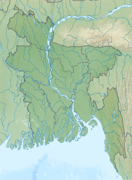
ဆက်ခဟဖွန့် သည် ဘင်္ဂလားဒေ့ရှ် − မြန်မာ နယ်နိမိတ်တွင် တည်ရှိသည့် တောင်ဖြစ်သည်။ အမြင့်မှာ ၁၀၅၂ မီတာ (၃၄၅၁ ပေ) ရှိသည်။[၃][၄]
ဆက်စပ်ဖတ်ရှုရန်
[ပြင်ဆင်ရန်]မြန်မာနိုင်ငံရှိ တောင်များစာရင်း
ကိုးကား
[ပြင်ဆင်ရန်]- ↑ Mowdok Mual, Bangladesh။ Peakbagger.com။ 2014-07-28 တွင် ပြန်စစ်ပြီး။[ကိုယ်တိုင်ရေး ရင်းမြစ်]
- ↑ SRTM data in agreement with 1:200,000 Soviet topographic mapping
- ↑ Bao-Rong Lu, General information of the areas visited and the collecting routes, A Report On BRRI-IRRI Cooperative Collection of Wild Oryza Species In Bangladesh[လင့်ခ်သေ], page 5, International Rice Research Institute, October 1529, 1998[လင့်ခ်သေ]
- ↑ Country-wise highest points, HighPoint.com[လင့်ခ်သေ]

