
ဖိုင်:India Uttar Pradesh location map.svg

မူရင်းဖိုင် (SVG ဖိုင်, ၁၀၀၆ × ၉၈၁ pixels ကို အကြံပြုသည်, ဖိုင်အရွယ်အစား - ၇၇၆ KB)
| ဤဖိုင်သည် Wikimedia Commons မှဖြစ်ပြီး အခြားပရောဂျက်များတွင် သုံးကောင်းသုံးလိမ့်မည်။ ယင်း၏ ဖိုင်အကြောင်းစာမျက်နှာ တွင် ဖော်ပြထားချက်ကို အောက်တွင် ပြထားသည်။ Commons သည် မူပိုင်ခွင့်လွတ်လပ်သော မီဒီယာဖိုင်များ သိုလှောင်ထားရာ နေရာ ဖြစ်သည်။ သင်လည်း ပါဝင်ကူညီနိုင်ပါသည်။ |
အကျဉ်းချုပ်
| ဖော်ပြချက် |
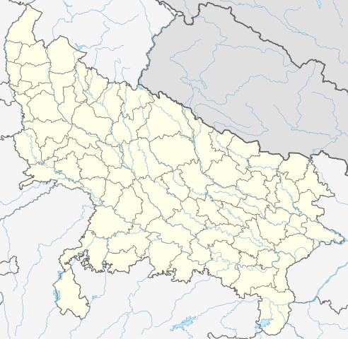
Quadratische Plattkarte, N-S-Streckung 112 %. Geographische Begrenzung der Karte:
Equirectangular projection, N/S stretching 112 %. Geographic limits of the map:
|
|
| ရက်စွဲ | ||
| ရင်းမြစ် |
ကိုယ်ပိုင်ဖန်တီးမှု, using
|
|
| စာရေးသူ | NordNordWest | |
| ခွင့်ပြုချက် (ဤဖိုင်ကို ပြန်လည်အသုံးပြုခြင်း) |
ဤဖိုင်သည် Creative Commons Attribution-Share Alike 3.0 ဂျာမနီ လိုင်စင်အောက်တွင် လိုင်စင်သတ်မှတ်ထားပါသည်။
 ဤဖိုင်သည် Creative Commons Attribution-Share Alike 3.0 ဂျာမနီ လိုင်စင်အောက်တွင် လိုင်စင်သတ်မှတ်ထားပါသည်။
|


|
This map has been made or improved in the German Kartenwerkstatt (Map Lab). You can propose maps to improve as well.
|
ဖိုင်မှတ်တမ်း
ဖိုင်ကို ယင်းနေ့စွဲ အတိုင်း မြင်နိုင်ရန် နေ့စွဲ/အချိန် တစ်ခုခုပေါ်တွင် ကလစ်နှိပ်ပါ။
| နေ့စွဲ/အချိန် | နမူနာပုံငယ် | မှတ်တမ်း ဒိုင်မန်းရှင်းများ | အသုံးပြုသူ | မှတ်ချက် | |
|---|---|---|---|---|---|
| ကာလပေါ် | ၀၆:၄၀၊ ၁ မေ ၂၀၂၃ | | ၁၀၀၆ × ၉၈၁ (၇၇၆ KB) | C1MM | c borders |
| ၀၄:၄၄၊ ၅ ဇန်နဝါရီ ၂၀၂၂ |  | ၁၀၆၆ × ၉၂၇ (၇၇၇ KB) | C1MM | Corrected rivers and dist boundaries | |
| ၂၂:၅၄၊ ၁၂ ဖေဖော်ဝါရီ ၂၀၂၁ |  | ၉၀၉ × ၈၈၆ (၂၆၂ KB) | C1MM | Added Chhattisgarh | |
| ၀၀:၄၁၊ ၈ ဇန်နဝါရီ ၂၀၂၁ |  | ၉၀၉ × ၈၈၆ (၂၆၁ KB) | C1MM | Added Amethi district | |
| ၂၁:၂၉၊ ၂၂ ဧပြီ ၂၀၂၀ |  | ၉၀၉ × ၈၈၆ (၂၄၉ KB) | NordNordWest | Reverted to version as of 19:51, 9 October 2012 (UTC); no need to change colours | |
| ၂၁:၀၀၊ ၂၂ ဧပြီ ၂၀၂၀ |  | ၉၀၉ × ၈၈၆ (၂၉၂ KB) | C1MM | Fixed rivers | |
| ၂၀:၅၁၊ ၂၂ ဧပြီ ၂၀၂၀ |  | ၉၀၉ × ၈၈၆ (၂၉၀ KB) | C1MM | Fixed colors and made rivers along borders | |
| ၁၉:၅၁၊ ၉ အောက်တိုဘာ ၂၀၁၂ |  | ၉၀၉ × ၈၈၆ (၂၄၉ KB) | NordNordWest | =={{int:filedesc}}== {{Information |Description= {{de|Positionskarte von Uttar Pradesh, Indien}} Quadratische Plattkarte, N-S-Streckung 112 %. Geographische Begrenzung der Karte: * N: 30.5° N * S: 23.8° N * W: 77.... |
ဖိုင်သုံးစွဲမှု
အောက်ပါ 5 စာမျက်နှာများ သည် ဤဖိုင်ကို အသုံးပြုထားသည်:
ဂလိုဘယ် ဖိုင်သုံးစွဲမှု
အောက်ပါ အခြားဝီကီများတွင် ဤဖိုင်ကို အသုံးပြုထားသည်-
- ar.wikipedia.org တွင် အသုံးပြုမှု
- as.wikipedia.org တွင် အသုံးပြုမှု
- awa.wikipedia.org တွင် အသုံးပြုမှု
- azb.wikipedia.org တွင် အသုံးပြုမှု
- اتاوه
- کینتور
- علیپورا
- فولپور
- فولی (هیندوستان)
- ففنا (هیندوستان)
- فارندا
- سارسای ناوار
- ساروخیپورا
- ساراوان, جاونپور
- ساراسارا, یوتار پرادش
- ساراییا بور
- سارایبیرو
- مداوارا کالا
- سانخنی
- ماوجامپور
- ماسکانوا
- سانای, بوداون
- سامرر (هیندوستان)
- کالاند, ایندیا
- مارتین پوروا
- سامبالهرا
- کاکورا
- سالارپور, بوداون
- کایتورا, جاونپور
- ساییان, آقرا
- ساینتال, یوتار پرادش
- سایفای
- کاقارول
- سایدناقار
- ساهاجانپور
- هالاور
- سافدارقانج
- سادپور, یوتار پرادش
- روپایدیها
- رابارلی
- کادار چووک
ဤဖိုင်ကို အခြားနေရာများတွင် အသုံးပြုထားမှုများအား ကြည့်ရှုရန်။