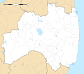
ဖိုင်:Fukushima-ken géolocalisation.svg
ပုံပန်းသွင်ပြင်

Size of this PNG preview of this SVG file: ၆၈၃ × ၆၀၀ ပစ်ဇယ်. အခြား ပုံရိပ်ပြတ်သားမှု: ၂၇၃ × ၂၄၀ ပစ်ဇယ် | ၅၄၇ × ၄၈၀ ပစ်ဇယ် | ၈၇၅ × ၇၆၈ ပစ်ဇယ် | ၁၁၆၇ × ၁၀၂၄ ပစ်ဇယ် | ၂၃၃၃ × ၂၀၄၈ ပစ်ဇယ် | ၁၇၁၉ × ၁၅၀၉ ပစ်ဇယ်။
မူရင်းဖိုင် (SVG ဖိုင်, ၁၇၁၉ × ၁၅၀၉ pixels ကို အကြံပြုသည်, ဖိုင်အရွယ်အစား - ၂.၉၉ MB)
ဖိုင်မှတ်တမ်း
ဖိုင်ကို ယင်းနေ့စွဲ အတိုင်း မြင်နိုင်ရန် နေ့စွဲ/အချိန် တစ်ခုခုပေါ်တွင် ကလစ်နှိပ်ပါ။
| နေ့စွဲ/အချိန် | နမူနာပုံငယ် | မှတ်တမ်း ဒိုင်မန်းရှင်းများ | အသုံးပြုသူ | မှတ်ချက် | |
|---|---|---|---|---|---|
| ကာလပေါ် | ၁၅:၁၉၊ ၁၀ ဇူလိုင် ၂၀၁၃ |  | ၁၇၁၉ × ၁၅၀၉ (၂.၉၉ MB) | Bourrichon | == {{int:filedesc}} == {{Location|37|00|00|N|140|00|00|E|scale:10000}} {{Information |Description= {{fr|Carte vierge de la fr:Préfecture de Fukushima, au Japon, destinée à la géolocalisation.}} {{de|Karte der [[:de:Präfektur F... |
ဖိုင်သုံးစွဲမှု
အောက်ပါ စာမျက်နှာ သည် ဤဖိုင်ကို အသုံးပြုထားသည်:
ဂလိုဘယ် ဖိုင်သုံးစွဲမှု
အောက်ပါ အခြားဝီကီများတွင် ဤဖိုင်ကို အသုံးပြုထားသည်-
- ar.wikipedia.org တွင် အသုံးပြုမှု
- ceb.wikipedia.org တွင် အသုံးပြုမှု
- de.wikipedia.org တွင် အသုံးပြုမှု
- en.wikipedia.org တွင် အသုံးပြုမှု
- Fukushima Station (Fukushima)
- Fukushima Airport
- Shin-Shirakawa Station
- Kōriyama Station (Fukushima)
- Sasakino Station
- Niwasaka Station
- Akaiwa Station
- Iwaki Station (Fukushima)
- Nakoso Station
- Yumoto Station
- Uchigō Station
- Yotsukura Station
- Hisanohama Station
- Suetsugi Station
- Ueda Station (Fukushima)
- Izumi Station (Iwaki)
- Kusano Station (Fukushima)
- Nittaki Station
- Soma Station
- Komagamine Station
- Shinchi Station
- Hirono Station (Fukushima)
- Kido Station
- Tatsuta Station
- Tomioka Station
- Yonomori Station
- Aizu-Wakamatsu Station
- Futaba Station
- Namie Station
- Momouchi Station
- Odaka Station
- Iwaki-Ōta Station
- Haranomachi Station
- Kashima Station (Fukushima)
- Ōno Station (Fukushima)
- Fukushima University
- Shirasaka Station
- Shirakawa Station
- Kutano Station
- Izumizaki Station
- Yabuki Station
- Kagamiishi Station
- Sukagawa Station
ဤဖိုင်ကို အခြားနေရာများတွင် အသုံးပြုထားမှုများအား ကြည့်ရှုရန်။

