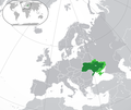
ဖိုင်:Europe-Ukraine (и не контролируемые).png

ဤနမူနာ၏ အရွယ်အစား - ၇၁၃ × ၆၀၀ ပစ်ဇယ်။ အခြား ပုံရိပ်ပြတ်သားမှု: ၂၈၆ × ၂၄၀ ပစ်ဇယ် | ၅၇၁ × ၄၈၀ ပစ်ဇယ် | ၉၁၃ × ၇၆၈ ပစ်ဇယ် | ၁၀၂၄ × ၈၆၁ ပစ်ဇယ်။
မူရင်းဖိုင် (၁၀၂၄ × ၈၆၁ pixels, ဖိုင်အရွယ်အစား - ၂၂၈ KB, MIME အမျိုးအစား image/png)
ဖိုင်မှတ်တမ်း
ဖိုင်ကို ယင်းနေ့စွဲ အတိုင်း မြင်နိုင်ရန် နေ့စွဲ/အချိန် တစ်ခုခုပေါ်တွင် ကလစ်နှိပ်ပါ။
| နေ့စွဲ/အချိန် | နမူနာပုံငယ် | မှတ်တမ်း ဒိုင်မန်းရှင်းများ | အသုံးပြုသူ | မှတ်ချက် | |
|---|---|---|---|---|---|
| ကာလပေါ် | ၀၀:၃၅၊ ၃၀ မေ ၂၀၂၂ |  | ၁၀၂၄ × ၈၆၁ (၂၂၈ KB) | RadomirZinovyev | Redrew 2015 borders for accuracy |
| ၀၆:၂၇၊ ၂၈ မေ ၂၀၂၂ |  | ၁၀၂၄ × ၈၆၁ (၂၃၁ KB) | Durranistan | nagorno-karabakh | |
| ၀၂:၂၉၊ ၁၈ ဧပြီ ၂၀၂၂ |  | ၁၀၂၄ × ၈၆၁ (၂၂၈ KB) | Seabourn101 | Reverted to version as of 17:19, 30 April 2015 (UTC)- reverting back to the longstanding version before the 2022 Russian invasion as the battles have not yet settled down | |
| ၁၅:၁၄၊ ၆ ဧပြီ ၂၀၂၂ |  | ၁၀၂၄ × ၈၆၁ (၁၈၂ KB) | Fogener Haus | update | |
| ၁၈:၂၅၊ ၂ ဧပြီ ၂၀၂၂ |  | ၁၀၂၄ × ၈၆၁ (၂၂၇ KB) | Fogener Haus | Update around Kyiv | |
| ၁၉:၃၂၊ ၂၇ မတ် ၂၀၂၂ |  | ၁၀၂၄ × ၈၆၁ (၁၈၂ KB) | Fogener Haus | update | |
| ၁၈:၀၀၊ ၂၅ မတ် ၂၀၂၂ |  | ၁၀၂၄ × ၈၆၁ (၁၈၂ KB) | Jan-LV | Little correstions | |
| ၁၃:၁၅၊ ၁၉ မတ် ၂၀၂၂ |  | ၁၀၁၄ × ၈၆၀ (၂၅၈ KB) | Fogener Haus | Update | |
| ၁၅:၁၀၊ ၁၈ မတ် ၂၀၂၂ |  | ၁၀၁၄ × ၈၆၀ (၂၅၈ KB) | Fogener Haus | Small fixes | |
| ၁၃:၄၁၊ ၁၈ မတ် ၂၀၂၂ |  | ၁၀၁၄ × ၈၆၀ (၂၅၆ KB) | Fogener Haus | Russian invasion |
ဖိုင်သုံးစွဲမှု
အောက်ပါ စာမျက်နှာ သည် ဤဖိုင်ကို အသုံးပြုထားသည်:
ဂလိုဘယ် ဖိုင်သုံးစွဲမှု
အောက်ပါ အခြားဝီကီများတွင် ဤဖိုင်ကို အသုံးပြုထားသည်-
- alt.wikipedia.org တွင် အသုံးပြုမှု
- blk.wikipedia.org တွင် အသုံးပြုမှု
- bn.wikipedia.org တွင် အသုံးပြုမှု
- br.wikipedia.org တွင် အသုံးပြုမှု
- cy.wikipedia.org တွင် အသုံးပြုမှု
- en.wikipedia.org တွင် အသုံးပြုမှု
- en.wiktionary.org တွင် အသုံးပြုမှု
- es.wikipedia.org တွင် အသုံးပြုမှု
- ext.wikipedia.org တွင် အသုံးပြုမှု
- fa.wikipedia.org တွင် အသုံးပြုမှု
- gn.wikipedia.org တွင် အသုံးပြုမှု
- guw.wikipedia.org တွင် အသုံးပြုမှု
- gv.wikipedia.org တွင် အသုံးပြုမှု
- he.wikipedia.org တွင် အသုံးပြုမှု
- kcg.wikipedia.org တွင် အသုံးပြုမှု
- lez.wikipedia.org တွင် အသုံးပြုမှု
- mn.wikipedia.org တွင် အသုံးပြုမှု
- mzn.wikipedia.org တွင် အသုံးပြုမှု
- nl.wikipedia.org တွင် အသုံးပြုမှု
- pnb.wikipedia.org တွင် အသုံးပြုမှု
- sat.wikipedia.org တွင် အသုံးပြုမှု
- si.wikipedia.org တွင် အသုံးပြုမှု
- si.wiktionary.org တွင် အသုံးပြုမှု
- sv.wikipedia.org တွင် အသုံးပြုမှု
- th.wikipedia.org တွင် အသုံးပြုမှု
- tl.wikipedia.org တွင် အသုံးပြုမှု
- tr.wikipedia.org တွင် အသုံးပြုမှု
- ur.wikipedia.org တွင် အသုံးပြုမှု
- vls.wikipedia.org တွင် အသုံးပြုမှု
- zh-yue.wikipedia.org တွင် အသုံးပြုမှု
- zh.wiktionary.org တွင် အသုံးပြုမှု
