
ဖိုင်:Argentina (orthographic projection).svg

Size of this PNG preview of this SVG file: ၅၄၁ × ၅၄၁ ပစ်ဇယ်. အခြား ပုံရိပ်ပြတ်သားမှု: ၂၄၀ × ၂၄၀ ပစ်ဇယ် | ၄၈၀ × ၄၈၀ ပစ်ဇယ် | ၇၆၈ × ၇၆၈ ပစ်ဇယ် | ၁၀၂၄ × ၁၀၂၄ ပစ်ဇယ် | ၂၀၄၈ × ၂၀၄၈ ပစ်ဇယ်။
မူရင်းဖိုင် (SVG ဖိုင်, ၅၄၁ × ၅၄၁ pixels ကို အကြံပြုသည်, ဖိုင်အရွယ်အစား - ၃၇၆ KB)
| ဤဖိုင်သည် Wikimedia Commons မှဖြစ်ပြီး အခြားပရောဂျက်များတွင် သုံးကောင်းသုံးလိမ့်မည်။ ယင်း၏ ဖိုင်အကြောင်းစာမျက်နှာ တွင် ဖော်ပြထားချက်ကို အောက်တွင် ပြထားသည်။ Commons သည် မူပိုင်ခွင့်လွတ်လပ်သော မီဒီယာဖိုင်များ သိုလှောင်ထားရာ နေရာ ဖြစ်သည်။ သင်လည်း ပါဝင်ကူညီနိုင်ပါသည်။ |
| ဖော်ပြချက် |
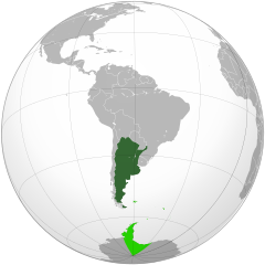
Deutsch: Geographische Lage Argentiniens in orthographischer Projektion.
souveränes Gebiet
beanspruchte Gebiete English: Location of Argentina in orthographic projection.
Sovereign territory.
Claimed territories. Español: Ubicación geográfica de la República Argentina en proyección ortográfica.
Territorio soberano.
Territorios en reclamo. Nederlands: Geografische ligging van Argentinië in orthografische projectie.
Soeverein gebied
Opgeëiste gebieden |
||
| ရက်စွဲ | |||
| ရင်းမြစ် | Own work, based on the Image:Brazil (orthographic projection).svg, created by the Wikimedia Commons user Ssolbergj, under a Creative Commons Licence. | ||
| စာရေးသူ | Dexxter | ||
| ခွင့်ပြုချက် (ဤဖိုင်ကို ပြန်လည်အသုံးပြုခြင်း) |
ကျွန်ုပ်၊ ဤလုပ်ဆောင်ချက်၏ မူပိုင်ခွင့်ပိုင်ရှင်အနေဖြင့် ဤနေရာမှ အောက်ပါလိုင်စင်အောက်တွင် ထုတ်လွှင့်ပါသည်: ဤဖိုင်သည် Creative Commons Attribution 3.0 Unported လိုင်စင်အောက်တွင် လိုင်စင်သတ်မှတ်ထားပါသည်။
|
||
| အခြား ဗားရှင်းများ |
Derivative works of this file: Chile orthographic projection.png .svg)
|
||
| SVG genesis |
.svg)
.svg)
.svg)
.svg)
.svg)
.svg)
.svg)
.svg)
.svg)
.svg)
.svg)
.svg)
.svg)
.svg)
.svg)
.svg)
.svg)
.svg)
.svg)
.svg)
.svg)
.svg)
.svg)
.svg)
.svg)
.svg)
.svg)
.svg)
.svg)
.svg)
.svg)
.svg)
.svg)
.svg)
.svg)
.svg)
.svg)
.svg)
.svg)
.svg)
.svg)
.svg)
.svg)
.svg)
.svg)
.svg)
.svg)
.svg)
.svg)
.svg)
.svg)
.svg)
.svg)
.svg)
.svg)
.svg)
.svg)
.svg)
.svg)
.svg)
.svg)
.svg)
.svg)
.svg)
.svg)
.svg)
.svg)
.svg)
.svg)
.svg)
.svg)
.svg)
.svg)

.svg)

.svg)

.svg)
.svg)
.svg)
.svg)
.svg)
.svg)
.svg)


.svg)
.svg)
.svg)
.svg)
.svg)
.svg)
.svg)

.svg)
.svg)
.svg)
.svg)
.svg)
.svg)
.svg)
.svg)
.svg)

.svg)
.svg)
.svg)
.svg)
.svg)
.svg)
.svg)
_without_national_boundaries.svg)
.svg)
.svg)
.svg)
.svg)
.svg)
.svg)

.svg)
.svg)
.png)
.svg)
.svg)
.svg)
.svg)

.svg)
.svg)
.svg)
.svg)
.svg)
.svg)
.svg)
.svg)
.svg)
.svg)
.svg)

.svg)
.svg)
.svg)
.svg)
.svg)
.svg)
.svg)
.svg)
.svg)

.svg)
.svg)

.svg)
.svg)
.svg)
.svg)
.svg)
.svg)
.svg)
.svg)
.svg)
.svg)
.svg)
.svg)
.svg)
.svg)
.svg)
.svg)
.svg)
.svg)
.svg)
.svg)
.svg)
.svg)
.svg)
.svg)
.svg)
.svg)
.svg)
_-_Crimea_disputed.svg)
.svg)
.svg)
.svg)
.svg)
.svg)
.svg)
.svg)
.svg)
.svg)
.svg)
.svg)
_political.svg)
.svg)
.svg)
.svg)
.svg)
_-_Crimea_disputed_-_no_borders.svg)
.svg)
.svg)
.svg)
.svg)
.svg)
.svg)
.svg)
.svg)
.svg)
.svg)
.svg)

.svg)
.svg)
.svg)

.png)
.svg)
.svg)
.svg)
.svg)
.svg)
.svg)
.svg)
.svg)
.svg)
.svg)
.svg)
.svg)
.svg)
.svg)
.svg)
.svg)
.svg)
.svg)
.svg)
.svg)
.svg)
.svg)
.svg)
.svg)
.svg)
.svg)
.svg)
.svg)
.svg)
.svg)
.svg)
.svg)
.svg)
.svg)
.png)
.svg)
.svg)
.svg)
_(orthographic_projection).png)
.svg)
.svg)
.svg)
ဖိုင်မှတ်တမ်း
ဖိုင်ကို ယင်းနေ့စွဲ အတိုင်း မြင်နိုင်ရန် နေ့စွဲ/အချိန် တစ်ခုခုပေါ်တွင် ကလစ်နှိပ်ပါ။
| နေ့စွဲ/အချိန် | နမူနာပုံငယ် | မှတ်တမ်း ဒိုင်မန်းရှင်းများ | အသုံးပြုသူ | မှတ်ချက် | |
|---|---|---|---|---|---|
| ကာလပေါ် | ၀၀:၂၈၊ ၂၆ ဇွန် ၂၀၁၄ | | ၅၄၁ × ၅၄၁ (၃၇၆ KB) | Chipmunkdavis | Reverted to version as of 23:59, 15 November 2009 Re-adding the Antarctic claims. Argentina has gone as far as to put people in Antarctica. Claims are generally included on these maps. |
| ၁၈:၀၄၊ ၂၃ ဇွန် ၂၀၁၄ |  | ၅၄၁ × ၅၄၁ (၃၁၈ KB) | Goran tek-en | antarctic claims removed on request | |
| ၂၃:၅၉၊ ၁၅ နိုဝင်ဘာ ၂၀၀၉ |  | ၅၄၁ × ၅၄၁ (၃၇၆ KB) | Shibo77 | Claimed baselines different from latitude-longitudes. | |
| ၀၇:၅၄၊ ၃ မေ ၂၀၀၉ |  | ၅၄၁ × ၅၄၁ (၃၇၆ KB) | Dexxter | uploading the latest alternative version without conflicts | |
| ၀၇:၅၂၊ ၃ မေ ၂၀၀၉ |  | ၅၄၁ × ၅၄၁ (၃၇၂ KB) | Dexxter | uploading the first alternative version | |
| ၂၂:၀၁၊ ၂၈ ဧပြီ ၂၀၀၉ |  | ၅၄၁ × ၅၄၁ (၅၃၇ KB) | Dexxter | - | |
| ၁၉:၃၄၊ ၂၆ ဧပြီ ၂၀၀၉ |  | ၅၄၁ × ၅၄၁ (၅၄၆ KB) | RoyFocker 12 | ||
| ၂၁:၁၁၊ ၂၁ ဧပြီ ၂၀၀၉ |  | ၅၄၁ × ၅၄၁ (၅၃၅ KB) | Addicted04 | Grosor | |
| ၂၀:၅၉၊ ၂၁ ဧပြီ ၂၀၀၉ |  | ၅၄၁ × ၅၄၁ (၅၃၅ KB) | Addicted04 | {{Information |Description={{en|1=Argentina}} |Source=Own work, {{inkscape}}<br />[http://www.aquarius.geomar.de/omc/make_map.html Aquarius.geomar.de]<br />{{GFDL-GMT}} |Author=Addicted04 |Date=2009 - Abr - 21 |Permissi |
ဖိုင်သုံးစွဲမှု
ဤဖိုင်ကို အသုံးပြုထားသော စာမျက်နှာများမရှိပါ။
ဂလိုဘယ် ဖိုင်သုံးစွဲမှု
အောက်ပါ အခြားဝီကီများတွင် ဤဖိုင်ကို အသုံးပြုထားသည်-
- ady.wikipedia.org တွင် အသုံးပြုမှု
- af.wikipedia.org တွင် အသုံးပြုမှု
- ar.wikipedia.org တွင် အသုံးပြုမှု
- az.wikipedia.org တွင် အသုံးပြုမှု
- az.wiktionary.org တွင် အသုံးပြုမှု
- ba.wikipedia.org တွင် အသုံးပြုမှု
- be.wikipedia.org တွင် အသုံးပြုမှု
- bs.wikipedia.org တွင် အသုံးပြုမှု
- ca.wikinews.org တွင် အသုံးပြုမှု
- ckb.wikipedia.org တွင် အသုံးပြုမှု
- de.wikipedia.org တွင် အသုံးပြုမှု
- dv.wikipedia.org တွင် အသုံးပြုမှု
- eml.wikipedia.org တွင် အသုံးပြုမှု
- en.wikipedia.org တွင် အသုံးပြုမှု
- en.wikibooks.org တွင် အသုံးပြုမှု
- en.wikinews.org တွင် အသုံးပြုမှု
- Category:Argentina
- Wikinews:Template messages/Infoboxes/Countries
- Template:Argentina
- Argentine Supreme Court declares Riveros pardon unconstitutional
- Cristina Kirchner set to win Argentinian presidential elections
- Vatican accepts Juan Pablo Cafiero as Argentine Ambassador
- Human remains in mass grave confirm Argentina secret death camp
- User:RNL89
- Trial of former Argentine president Jorge Videla begins
- Same-sex marriage legalized in Argentina
- Last surviving participant of the 1930 FIFA World Cup Francisco Varallo dies aged 100
- Argentine admiral Emilio Eduardo Massera dies at age 85
- Ten killed in helicopter crash in Argentina, French Olympians among the dead
- Template:Infobox/lookup/Argentina
- eo.wikipedia.org တွင် အသုံးပြုမှု
- eo.wiktionary.org တွင် အသုံးပြုမှု
- es.wikipedia.org တွင် အသုံးပြုမှု
- Wikiproyecto:Ilustración/Taller gráfico/Peticiones/Archivo 6
- Discusión:América del Sur
- Diversidad sexual en Argentina
- Usuario:Casual Girl
- Usuario:Fero/Sudamerica Hispana
- Usuario:EuropeoyEspañol
- Adrián Nahuel Martínez
- Wikiproyecto:Ilustración/Taller de Cartografía/Realizaciones/Mapas ortográficos/América del Sur
- Discusión:Argentina/2011
- Usuario:ExeRomero CN
ဤဖိုင်ကို အခြားနေရာများတွင် အသုံးပြုထားမှုများအား ကြည့်ရှုရန်။
.svg)
.svg)