
ဖိုင်:VIRREINATOsur.png

ဤနမူနာ၏ အရွယ်အစား - ၅၃၈ × ၆၀၀ ပစ်ဇယ်။ အခြား ပုံရိပ်ပြတ်သားမှု: ၂၁၅ × ၂၄၀ ပစ်ဇယ် | ၄၃၁ × ၄၈၀ ပစ်ဇယ် | ၇၉၃ × ၈၈၄ ပစ်ဇယ်။
မူရင်းဖိုင် (၇၉၃ × ၈၈၄ pixels, ဖိုင်အရွယ်အစား - ၁၆၁ KB, MIME အမျိုးအစား image/png)
| ဤဖိုင်သည် Wikimedia Commons မှဖြစ်ပြီး အခြားပရောဂျက်များတွင် သုံးကောင်းသုံးလိမ့်မည်။ ယင်း၏ ဖိုင်အကြောင်းစာမျက်နှာ တွင် ဖော်ပြထားချက်ကို အောက်တွင် ပြထားသည်။ Commons သည် မူပိုင်ခွင့်လွတ်လပ်သော မီဒီယာဖိုင်များ သိုလှောင်ထားရာ နေရာ ဖြစ်သည်။ သင်လည်း ပါဝင်ကူညီနိုင်ပါသည်။ |
အကျဉ်းချုပ်
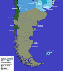
| ဖော်ပြချက် | mapa del sur del virreinato.png |
| ရက်စွဲ | |
| ရင်းမြစ် | trabajo propio sobre virreinato.png |
| စာရေးသူ | pruxo |
လိုင်စင်သတ်မှတ်ခြင်း
| I, the copyright holder of this work, release this work into the public domain. This applies worldwide. In some countries this may not be legally possible; if so: အကျွန်ုပ်သည် ဤဖန်တီးမှုလက်ရာကို ဥပဒေအရလိုအပ်ခြင်းမရှိသည့် မည်သည့်အခြေအနေမျိုးတွက်မဆို၊ မည်သို့သော ရည်ရွယ်ချက်အတွက်မဆို ၎င်းကို မည်သူမဆို အသုံးပြုပိုင်ခွင့်အား ပေးအပ်သည်။ |
ဖိုင်မှတ်တမ်း
ဖိုင်ကို ယင်းနေ့စွဲ အတိုင်း မြင်နိုင်ရန် နေ့စွဲ/အချိန် တစ်ခုခုပေါ်တွင် ကလစ်နှိပ်ပါ။
| နေ့စွဲ/အချိန် | နမူနာပုံငယ် | မှတ်တမ်း ဒိုင်မန်းရှင်းများ | အသုံးပြုသူ | မှတ်ချက် | |
|---|---|---|---|---|---|
| ကာလပေါ် | ၁၄:၃၅၊ ၁၆ ဩဂုတ် ၂၀၂၃ | | ၇၉၃ × ၈၈၄ (၁၆၁ KB) | Janitoalevic | Jurisdicciones superpuestas en Chiloé |
| ၁၇:၂၇၊ ၈ ဒီဇင်ဘာ ၂၀၂၂ |  | ၇၉၃ × ၈၈၄ (၁၆၁ KB) | Janitoalevic | Límite no vigente en el año de los asentamientos | |
| ၀၁:၂၅၊ ၃ ဇွန် ၂၀၁၂ |  | ၇၉၃ × ၈၈၄ (၁၈၀ KB) | Franco-eisenhower | ||
| ၁၅:၂၄၊ ၁၂ မေ ၂၀၁၁ |  | ၇၇၃ × ၈၂၅ (၄၂ KB) | Franco-eisenhower | Bigger font. | |
| ၁၄:၅၃၊ ၁၂ မေ ၂၀၁၁ |  | ၇၇၃ × ၈၂၅ (၄၁ KB) | Franco-eisenhower | Clearer version, no borders over indigenous territory. | |
| ၁၄:၂၀၊ ၂၈ မေ ၂၀၀၇ |  | ၃၁၀ × ၃၄၁ (၁၈ KB) | Pruxo | {{Information |Description=mapa del sur del virreinato.png |Source=trabajo propio sobre virreinato.png |Date=2007 |Author=pruxo |Permission= |other_versions= }} |
ဖိုင်သုံးစွဲမှု
ဤဖိုင်ကို အသုံးပြုထားသော စာမျက်နှာများမရှိပါ။
ဂလိုဘယ် ဖိုင်သုံးစွဲမှု
အောက်ပါ အခြားဝီကီများတွင် ဤဖိုင်ကို အသုံးပြုထားသည်-
- en.wikipedia.org တွင် အသုံးပြုမှု
- es.wikipedia.org တွင် အသုံးပြုမှု
- fr.wikipedia.org တွင် အသုံးပြုမှု