
ဖိုင်:United Kingdom relief location map.jpg

ဤနမူနာ၏ အရွယ်အစား - ၃၈၈ × ၆၀၀ ပစ်ဇယ်။ အခြား ပုံရိပ်ပြတ်သားမှု: ၁၅၅ × ၂၄၀ ပစ်ဇယ် | ၃၁၀ × ၄၈၀ ပစ်ဇယ် | ၄၉၇ × ၇၆၈ ပစ်ဇယ် | ၆၆၂ × ၁၀၂၄ ပစ်ဇယ် | ၁၃၄၈ × ၂၀၈၃ ပစ်ဇယ်။
မူရင်းဖိုင် (၁၃၄၈ × ၂၀၈၃ pixels, ဖိုင်အရွယ်အစား - ၈၃၁ KB, MIME အမျိုးအစား image/jpeg)
| ဤဖိုင်သည် Wikimedia Commons မှဖြစ်ပြီး အခြားပရောဂျက်များတွင် သုံးကောင်းသုံးလိမ့်မည်။ ယင်း၏ ဖိုင်အကြောင်းစာမျက်နှာ တွင် ဖော်ပြထားချက်ကို အောက်တွင် ပြထားသည်။ Commons သည် မူပိုင်ခွင့်လွတ်လပ်သော မီဒီယာဖိုင်များ သိုလှောင်ထားရာ နေရာ ဖြစ်သည်။ သင်လည်း ပါဝင်ကူညီနိုင်ပါသည်။ |
Du
အကျဉ်းချုပ်
| ဖော်ပြချက် |
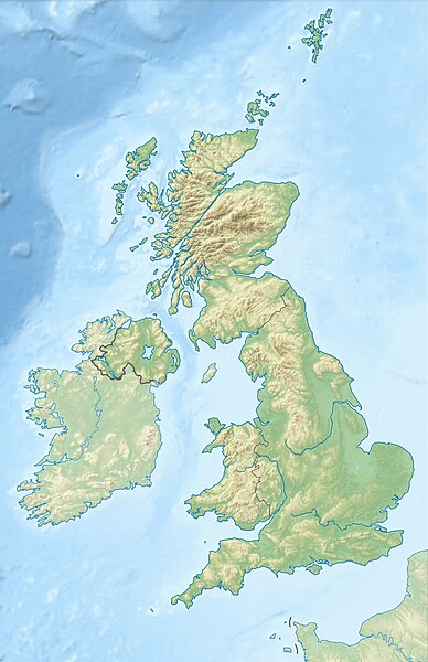
Deutsch: Positionskarte des Vereinigten Königreichs
Quadratische Plattkarte, N-S-Streckung 170 %. Geographische Begrenzung der Karte:
English: Location map of the United Kingdom
Equirectangular projection, N/S stretching 170 %. Geographic limits of the map:
|
| ရက်စွဲ | |
| ရင်းမြစ် |
own work, using SRTM Data, |
| စာရေးသူ | Alexrk2 |
| အခြား ဗားရှင်းများ |
|


|
This map has been made or improved in the German Kartenwerkstatt (Map Lab). You can propose maps to improve as well.
|
ПРИВЕТ ВСЕМ
လိုင်စင်သတ်မှတ်ခြင်း
ကျွန်ုပ်၊ ဤလုပ်ဆောင်ချက်၏ မူပိုင်ခွင့်ပိုင်ရှင်အနေဖြင့် ဤနေရာမှ အောက်ပါလိုင်စင်များအောက်တွင် ထုတ်လွှင့်ပါသည်:

|
ဤစာတမ်းကို GNU Free Documentation License, ဗားရှင်း ၁.၂ သို့မဟုတ် Free Software Foundation မှ ဖြန့်ချီထားသော မည်သည့်ယခင်ဗားရှင်းတစ်ခုခုအောက်တွင် Invariant Sections, Front-Cover Texts နှင့် Back-Cover Texts များမပါဝင်ဘဲ ကူးယူခြင်း၊ ဖြန့်ချီခြင်း နှင့်/သို့မဟုတ် ပြင်ဆင်ပြောင်းလဲနိုင်ရန် ခွင့်ပြုသည်။ လိုင်စင်မူပွားကို GNU Free Documentation License ခေါင်းစဉ်အောက်တွင် ထည့်သွင်းထားသည်။ |
ဤဖိုင်ကို Creative Commons Attribution-Share Alike 3.0 Unported လိုင်စင်ဖြင့် သတ်မှတ်ထားသည်။
- သင်သည် လွတ်လပ်စွာ:
- မျှဝေရန် – ဖန်တီးမှုကို ကူးယူရန်၊ ဖြန့်ဖြူးရန်နှင့် ထုတ်လွှင့်ရန်
- ပြန်ရောနှောရန် – ဖန်တီးမှုကို ပြင်ဆင်ညှိနှိုင်းရန်
- အောက်ပါ အခြေအနေများတွင်:
- မှတ်ယူနိုင်ခြင်း – ပြောင်းလဲမှုများ ပြုလုပ်ခဲ့ပါက ဖန်တီးသူ သို့မဟုတ် လိုင်စင်ရှိသူမှ သတ်မှတ်သော အမျိုးအစားကို လိုက်နာရမည် (ဆိုလိုသည်မှာ သင့်အား သို့မဟုတ် သင့်ဖန်တီးမှုတွင် အသုံးပြုခြင်းအား ထောက်ခံချက်ပေးသည်ဟု မဆိုလိုပါ)။
- ထပ်တူမျှဝေ – ဤဖန်တီးမှုအား ပြင်ဆင်ခြင်း၊ ပြောင်းလဲခြင်း သို့မဟုတ် ထပ်ဆင့် ဖန်တီးခြင်း ပြုလုပ်ပါက ရရှိလာသော ဖန်တီးမှုကို ဤဖန်တီးမှုနှင့် သို့မဟုတ် ဆင်တူသော လိုင်စင်ဖြင့်သာ ဖြန့်ချိသင့်သည်။
သင်အလိုရှိရာ လိုင်စင်ကို ရွေးချယ်နိုင်ပါသည်။
ဖိုင်မှတ်တမ်း
ဖိုင်ကို ယင်းနေ့စွဲ အတိုင်း မြင်နိုင်ရန် နေ့စွဲ/အချိန် တစ်ခုခုပေါ်တွင် ကလစ်နှိပ်ပါ။
| နေ့စွဲ/အချိန် | နမူနာပုံငယ် | မှတ်တမ်း ဒိုင်မန်းရှင်းများ | အသုံးပြုသူ | မှတ်ချက် | |
|---|---|---|---|---|---|
| ကာလပေါ် | ၁၈:၁၃၊ ၁၇ ဇွန် ၂၀၁၂ | | ၁၃၄၈ × ၂၀၈၃ (၈၃၁ KB) | Alexrk2 | inland water |
| ၁၈:၁၂၊ ၁၇ ဇွန် ၂၀၁၂ |  | ၁၃၅၄ × ၂၀၉၀ (၈၂၉ KB) | Alexrk2 | == {{int:filedesc}} == {{Information |Description= {{de|Positionskarte des Vereinigten Königreichs}} Quadratische Plattkarte, N-S-Streckung 170 %. Geographische Begrenzung der Karte: * N: 61.0° N * S: 49.0° N * W: 11.... |
ဖိုင်သုံးစွဲမှု
အောက်ပါ 3 စာမျက်နှာများ သည် ဤဖိုင်ကို အသုံးပြုထားသည်:
ဂလိုဘယ် ဖိုင်သုံးစွဲမှု
အောက်ပါ အခြားဝီကီများတွင် ဤဖိုင်ကို အသုံးပြုထားသည်-
- ab.wikipedia.org တွင် အသုံးပြုမှု
- ar.wikipedia.org တွင် အသုံးပြုမှု
- arz.wikipedia.org တွင် အသုံးပြုမှု
- ast.wikipedia.org တွင် အသုံးပြုမှု
- azb.wikipedia.org တွင် အသုံးပြုမှု
- az.wikipedia.org တွင် အသုံးပြုမှု
- Şablon:Yer xəritəsi Böyük Britaniya
- İrland dənizi
- Ben Nevis
- Pa-de-Kale boğazı
- Şimal boğazı
- Orkney adaları
- Lox Ness
- Arran (ada)
- Fer adası
- Qrampian dağları
- Flanan adaları
- Finqal mağarası
- Hebrid dənizi
- Kelt dənizi
- Menay boğazı
- Nort-Minç boğazı
- Pentlənd-Ferd boğazı
- Yell boğazı
- Lya-Kupe bərzəxi
- Böyük Britaniya (ada)
- Solent
- Leskov adası
- Kernqorms Milli Parkı
- Kembri dağları
- Llin yarımadası
- Ardnamerxan
- Kintayr yarımadası
- Qrinviç yarımadası
- Qauer yarımadası
- Lends End
- Trevos burnu
- Müqəddəs Yekaterina burnu
- Lizard burnu
- Ayona
ဤဖိုင်ကို အခြားနေရာများတွင် အသုံးပြုထားမှုများအား ကြည့်ရှုရန်။