
ဖိုင်:USGS 1950s mapping field camp.jpg

ဤနမူနာ၏ အရွယ်အစား - ၈၀၀ × ၄၉၇ ပစ်ဇယ်။ အခြား ပုံရိပ်ပြတ်သားမှု: ၃၂၀ × ၁၉၉ ပစ်ဇယ် | ၆၄၀ × ၃၉၈ ပစ်ဇယ် | ၁၀၂၄ × ၆၃၇ ပစ်ဇယ် | ၁၂၈၀ × ၇၉၆ ပစ်ဇယ် | ၂၆၇၂ × ၁၆၆၁ ပစ်ဇယ်။
မူရင်းဖိုင် (၂၆၇၂ × ၁၆၆၁ pixels, ဖိုင်အရွယ်အစား - ၃.၅ MB, MIME အမျိုးအစား image/jpeg)
| ဤဖိုင်သည် Wikimedia Commons မှဖြစ်ပြီး အခြားပရောဂျက်များတွင် သုံးကောင်းသုံးလိမ့်မည်။ ယင်း၏ ဖိုင်အကြောင်းစာမျက်နှာ တွင် ဖော်ပြထားချက်ကို အောက်တွင် ပြထားသည်။ Commons သည် မူပိုင်ခွင့်လွတ်လပ်သော မီဒီယာဖိုင်များ သိုလှောင်ထားရာ နေရာ ဖြစ်သည်။ သင်လည်း ပါဝင်ကူညီနိုင်ပါသည်။ |
အကျဉ်းချုပ်
| ဖော်ပြချက် |
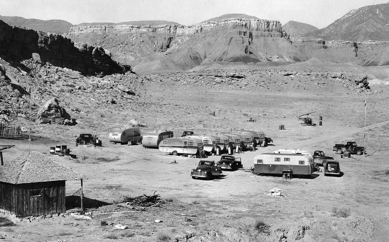
English: A typical USGS mapping field camp. Note the helicopter parked near the trailers. Helicopters were first used by the USGS for topographic mapping in Death Valley in 1948. (Description from USGS.) |
| ရက်စွဲ | circa ၁၉၅၀ - circa ၁၉၅၅ |
| ရင်းမြစ် | USGS Historical Photographs: Mapping Field Camp: http://online.wr.usgs.gov/outreach/historicPhotos/enlarged/mapping_camp_1950.html |
| စာရေးသူ | US Geological Survey |
လိုင်စင်သတ်မှတ်ခြင်း
This image is in the public domain in the United States because it only contains materials that originally came from the United States Geological Survey, an agency of the United States Department of the Interior. For more information, see the official USGS copyright policy.
|
ဖိုင်မှတ်တမ်း
ဖိုင်ကို ယင်းနေ့စွဲ အတိုင်း မြင်နိုင်ရန် နေ့စွဲ/အချိန် တစ်ခုခုပေါ်တွင် ကလစ်နှိပ်ပါ။
| နေ့စွဲ/အချိန် | နမူနာပုံငယ် | မှတ်တမ်း ဒိုင်မန်းရှင်းများ | အသုံးပြုသူ | မှတ်ချက် | |
|---|---|---|---|---|---|
| ကာလပေါ် | ၂၀:၅၀၊ ၃၀ ဇန်နဝါရီ ၂၀၀၉ | | ၂၆၇၂ × ၁၆၆၁ (၃.၅ MB) | Awickert | {{Information |Description={{en|1=A typical USGS mapping field camp. Note the helicopter parked near the trailers. Helicopters were first used by the USGS for topographic mapping in Death Valley in 1948. (Description from USGS.)}} |Source=USGS Historical |
ဖိုင်သုံးစွဲမှု
ဤဖိုင်ကို အသုံးပြုထားသော စာမျက်နှာများမရှိပါ။
ဂလိုဘယ် ဖိုင်သုံးစွဲမှု
အောက်ပါ အခြားဝီကီများတွင် ဤဖိုင်ကို အသုံးပြုထားသည်-
- en.wikipedia.org တွင် အသုံးပြုမှု
- la.wikipedia.org တွင် အသုံးပြုမှု
- sv.wikipedia.org တွင် အသုံးပြုမှု
- vi.wikipedia.org တွင် အသုံးပြုမှု