
ဖိုင်:Tokyo-to géolocalisation.svg

Size of this PNG preview of this SVG file: ၈၀၀ × ၄၈၈ ပစ်ဇယ်. အခြား ပုံရိပ်ပြတ်သားမှု: ၃၂၀ × ၁၉၅ ပစ်ဇယ် | ၆၄၀ × ၃၉၀ ပစ်ဇယ် | ၁၀၂၄ × ၆၂၅ ပစ်ဇယ် | ၁၂၈၀ × ၇၈၁ ပစ်ဇယ် | ၂၅၆၀ × ၁၅၆၁ ပစ်ဇယ် | ၁၇၂၀ × ၁၀၄၉ ပစ်ဇယ်။
မူရင်းဖိုင် (SVG ဖိုင်, ၁၇၂၀ × ၁၀၄၉ pixels ကို အကြံပြုသည်, ဖိုင်အရွယ်အစား - ၁.၈၉ MB)
| ဤဖိုင်သည် Wikimedia Commons မှဖြစ်ပြီး အခြားပရောဂျက်များတွင် သုံးကောင်းသုံးလိမ့်မည်။ ယင်း၏ ဖိုင်အကြောင်းစာမျက်နှာ တွင် ဖော်ပြထားချက်ကို အောက်တွင် ပြထားသည်။ Commons သည် မူပိုင်ခွင့်လွတ်လပ်သော မီဒီယာဖိုင်များ သိုလှောင်ထားရာ နေရာ ဖြစ်သည်။ သင်လည်း ပါဝင်ကူညီနိုင်ပါသည်။ |
အကျဉ်းချုပ်
| Camera location | | View this and other nearby images on: OpenStreetMap |
|---|
| ဖော်ပြချက် |
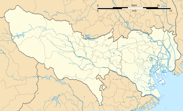
Français : Carte vierge de la préfecture métropolitaine de Tokyo (東京都, Tōkyō-to), au Japon, destinée à la géolocalisation.
Deutsch: Karte der Präfektur Tokio.
English: Blank map of the prefecture of en:Tokyo, for geolocalisation purpose.
Español: Mapa de la prefectura de Tokio.
Italiano: Mappa della metropoli di it:Tokyo.
日本語: 東京都の地図.
한국어: 도쿄도의 지도.
Português: Carta de la Metrópole de Tóquio.
|
||
| ရက်စွဲ | (UTC) | ||
| ရင်းမြစ် |
Création personnelle ;
|
||
| စာရေးသူ | © Bourrichon (talk) - fr:Bourrichon | ||
| ခွင့်ပြုချက် (ဤဖိုင်ကို ပြန်လည်အသုံးပြုခြင်း) |
|
||
| အခြား ဗားရှင်းများ | File:Tokyo-to géolocalisation relief.svg |

|
This SVG file contains embedded text that can be translated into your language, using any capable SVG editor, text editor or the SVG Translate tool. For more information see: About translating SVG files. |
This W3C-unspecified vector image was created with Inkscape .
လိုင်စင်သတ်မှတ်ခြင်း
ကျွန်ုပ်၊ ဤလုပ်ဆောင်ချက်၏ မူပိုင်ခွင့်ပိုင်ရှင်အနေဖြင့် ဤနေရာမှ အောက်ပါလိုင်စင်အောက်တွင် ထုတ်လွှင့်ပါသည်:
ဤဖိုင်သည် Creative Commons Attribution-Share Alike 2.0 ပြင်သစ် လိုင်စင်အောက်တွင် လိုင်စင်သတ်မှတ်ထားပါသည်။
မှတ်ယူနိုင်ခြင်း: Bourrichon (atelier graphique)
- သင်သည် လွတ်လပ်စွာ:
- မျှဝေရန် – ဖန်တီးမှုကို ကူးယူရန်၊ ဖြန့်ဖြူးရန်နှင့် ထုတ်လွှင့်ရန်
- ပြန်ရောနှောရန် – ဖန်တီးမှုကို ပြင်ဆင်ညှိနှိုင်းရန်
- အောက်ပါ အခြေအနေများတွင်:
- မှတ်ယူနိုင်ခြင်း – ပြောင်းလဲမှုများ ပြုလုပ်ခဲ့ပါက ဖန်တီးသူ သို့မဟုတ် လိုင်စင်ရှိသူမှ သတ်မှတ်သော အမျိုးအစားကို လိုက်နာရမည် (ဆိုလိုသည်မှာ သင့်အား သို့မဟုတ် သင့်ဖန်တီးမှုတွင် အသုံးပြုခြင်းအား ထောက်ခံချက်ပေးသည်ဟု မဆိုလိုပါ)။
- ထပ်တူမျှဝေ – ဤဖန်တီးမှုအား ပြင်ဆင်ခြင်း၊ ပြောင်းလဲခြင်း သို့မဟုတ် ထပ်ဆင့် ဖန်တီးခြင်း ပြုလုပ်ပါက ရရှိလာသော ဖန်တီးမှုကို ဤဖန်တီးမှုနှင့် သို့မဟုတ် ဆင်တူသော လိုင်စင်ဖြင့်သာ ဖြန့်ချိသင့်သည်။

ဖိုင်မှတ်တမ်း
ဖိုင်ကို ယင်းနေ့စွဲ အတိုင်း မြင်နိုင်ရန် နေ့စွဲ/အချိန် တစ်ခုခုပေါ်တွင် ကလစ်နှိပ်ပါ။
| နေ့စွဲ/အချိန် | နမူနာပုံငယ် | မှတ်တမ်း ဒိုင်မန်းရှင်းများ | အသုံးပြုသူ | မှတ်ချက် | |
|---|---|---|---|---|---|
| ကာလပေါ် | ၁၉:၂၉၊ ၂ ဇူလိုင် ၂၀၁၃ | | ၁၇၂၀ × ၁၀၄၉ (၁.၈၉ MB) | Bourrichon | +quelques rivières |
| ၁၈:၄၃၊ ၂ ဇူလိုင် ၂၀၁၃ |  | ၁၇၂၀ × ၁၀၄၉ (၁.၀၆ MB) | Bourrichon | == {{int:filedesc}} == {{Location|35|70|00|N|139|00|00|E|scale:10000}} {{Information |Description= {{fr|Carte vierge de la préfecture métropolitaine de Tokyo (東京都, ''Tōkyō-to''), au Japon, destinée ... |
ဖိုင်သုံးစွဲမှု
အောက်ပါ 4 စာမျက်နှာများ သည် ဤဖိုင်ကို အသုံးပြုထားသည်:
ဂလိုဘယ် ဖိုင်သုံးစွဲမှု
အောက်ပါ အခြားဝီကီများတွင် ဤဖိုင်ကို အသုံးပြုထားသည်-
- ar.wikipedia.org တွင် အသုံးပြုမှု
- az.wikipedia.org တွင် အသုံးပြုမှု
- ceb.wikipedia.org တွင် အသုံးပြုမှု
- de.wikipedia.org တွင် အသုံးပြုမှု
- en.wikipedia.org တွင် အသုံးပြုမှု
- Akihabara
- Shibuya
- Harajuku
- Ōta, Tokyo
- Tokyo Station
- Ōsaki Station
- Shinagawa Station
- Tamachi Station (Tokyo)
- Hamamatsuchō Station
- Harajuku Station
- Shinjuku Station
- Yūrakuchō Station
- Gotanda Station
- Meguro Station
- Ebisu Station (Tokyo)
- Ueno Station
- Ikebukuro Station
- Shibuya Station
- Shimbashi Station
- Yoyogi Station
- Keiō-hachiōji Station
- Okachimachi Station
- Akihabara Station
- Kanda Station (Tokyo)
- Yokota Air Base
- Nakano Station (Tokyo)
- Ochanomizu Station
- Iidabashi Station
- Tokyo Metropolitan University
- Chōfu Airport
- Takadanobaba Station
- Kyōbashi Station (Tokyo)
- Kabukichō
- Sengaku-ji
- Mejiro Station
- Nishi-Nippori Station
- Nippori Station
- Shin-Ōkubo Station
- Ōtsuka Station
- Sugamo Station
- Komagome Station
- Tachikawa Station
- Futako-tamagawa Station
- Shimo-kitazawa Station
ဤဖိုင်ကို အခြားနေရာများတွင် အသုံးပြုထားမှုများအား ကြည့်ရှုရန်။