
ဖိုင်:Namur JPG07.jpg
ဤနမူနာ၏ အရွယ်အစား - ၈၀၀ × ၆၀၀ ပစ်ဇယ်။ အခြား ပုံရိပ်ပြတ်သားမှု: ၃၂၀ × ၂၄၀ ပစ်ဇယ် | ၆၄၀ × ၄၈၀ ပစ်ဇယ် | ၁၀၂၄ × ၇၆၈ ပစ်ဇယ် | ၁၂၈၀ × ၉၆၀ ပစ်ဇယ် | ၂၂၇၂ × ၁၇၀၄ ပစ်ဇယ်။
မူရင်းဖိုင် (၂၂၇၂ × ၁၇၀၄ pixels, ဖိုင်အရွယ်အစား - ၁.၄၁ MB, MIME အမျိုးအစား image/jpeg)
| ဤဖိုင်သည် Wikimedia Commons မှဖြစ်ပြီး အခြားပရောဂျက်များတွင် သုံးကောင်းသုံးလိမ့်မည်။ ယင်း၏ ဖိုင်အကြောင်းစာမျက်နှာ တွင် ဖော်ပြထားချက်ကို အောက်တွင် ပြထားသည်။ Commons သည် မူပိုင်ခွင့်လွတ်လပ်သော မီဒီယာဖိုင်များ သိုလှောင်ထားရာ နေရာ ဖြစ်သည်။ သင်လည်း ပါဝင်ကူညီနိုင်ပါသည်။ |
|
This is a photo of a monument in Wallonia, number: 92094-CLT-0195-01
|
| ဖော်ပြချက် |
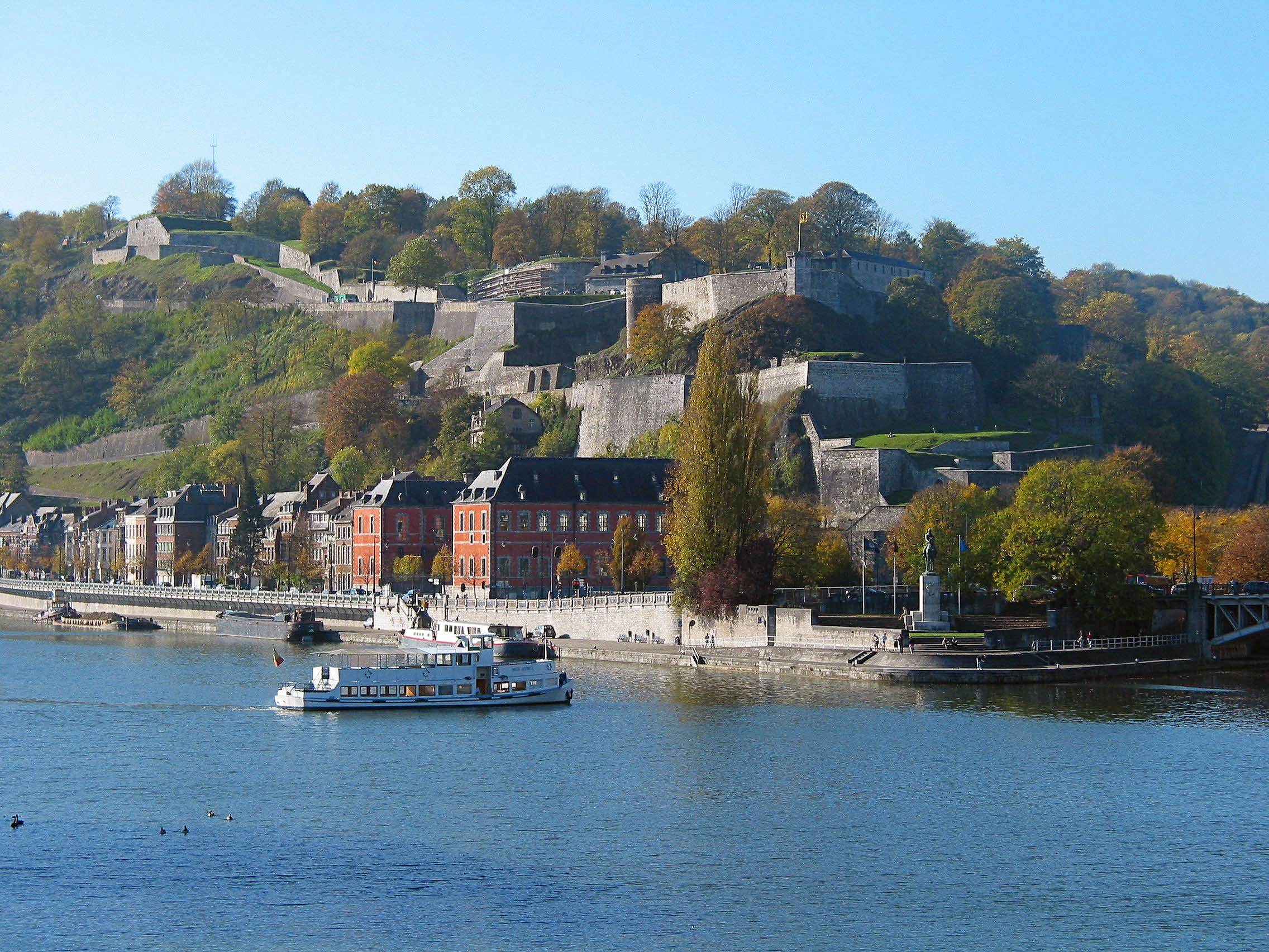
Français : Namur (Belgique), la Meuse, le Parlement Wallon et la citadelle.
English: Namur (Belgium), the Meuse river, the Walloon Parliament and the citadel.
Nederlands: Namen (België), de Maas, de Waalse Parlement en de citadel.
Walon : Nameur (Bèljike), li Moûse, li Parlèmint walon èt l’citadèle. |
||
| ရက်စွဲ | |||
| ရင်းမြစ် |
|
||
| စာရေးသူ | Jean-Pol GRANDMONT | ||
| ခွင့်ပြုချက် (ဤဖိုင်ကို ပြန်လည်အသုံးပြုခြင်း) |
ကျွန်ုပ်၊ ဤလုပ်ဆောင်ချက်၏ မူပိုင်ခွင့်ပိုင်ရှင်အနေဖြင့် ဤနေရာမှ အောက်ပါလိုင်စင်အောက်တွင် ထုတ်လွှင့်ပါသည်: ဤဖိုင်ကို Creative Commons Attribution-Share Alike 3.0 Unported လိုင်စင်ဖြင့် သတ်မှတ်ထားသည်။
|

| Camera location | | View this and other nearby images on: OpenStreetMap |
|---|
ဖိုင်မှတ်တမ်း
ဖိုင်ကို ယင်းနေ့စွဲ အတိုင်း မြင်နိုင်ရန် နေ့စွဲ/အချိန် တစ်ခုခုပေါ်တွင် ကလစ်နှိပ်ပါ။
| နေ့စွဲ/အချိန် | နမူနာပုံငယ် | မှတ်တမ်း ဒိုင်မန်းရှင်းများ | အသုံးပြုသူ | မှတ်ချက် | |
|---|---|---|---|---|---|
| ကာလပေါ် | ၁၅:၁၇၊ ၁၇ ဒီဇင်ဘာ ၂၀၀၆ | | ၂၂၇၂ × ၁၇၀၄ (၁.၄၁ MB) | Jean-Pol GRANDMONT | {{Information |Description={{fr|'''Namur''' (Belgique), la Meuse, le Parlement Wallon et la citadelle. }} {{en|'''Namur''' (Belgium), the Meuse river, the Walloon Parliament and the citadel.}} {{nl|'''Namen''' (België), de Maas, de Waalse Parlement e |
| ၀၇:၅၅၊ ၃၀ အောက်တိုဘာ ၂၀၀၆ |  | ၂၂၇၂ × ၁၇၀၄ (၁.၁၇ MB) | Jean-Pol GRANDMONT | {{fr|'''Namur''' (Belgique), la citadelle. *Auteur : Jean-Pol Grandmont (Collection personnelle). *Document publié avec l'accord de l'auteur (Jean-Pol Grandmont).}} {{en|'''Namur''' (Belgium), the citadel. *Author : Jean-Pol Grandmont (Private collec |
ဖိုင်သုံးစွဲမှု
ဤဖိုင်ကို အသုံးပြုထားသော စာမျက်နှာများမရှိပါ။
ဂလိုဘယ် ဖိုင်သုံးစွဲမှု
အောက်ပါ အခြားဝီကီများတွင် ဤဖိုင်ကို အသုံးပြုထားသည်-
- af.wikipedia.org တွင် အသုံးပြုမှု
- az.wikipedia.org တွင် အသုံးပြုမှု
- ca.wikipedia.org တွင် အသုံးပြုမှု
- cs.wikipedia.org တွင် အသုံးပြုမှု
- de.wikipedia.org တွင် အသုံးပြုမှု
- de.wikivoyage.org တွင် အသုံးပြုမှု
- en.wikipedia.org တွင် အသုံးပြုမှု
- en.wikivoyage.org တွင် အသုံးပြုမှု
- eo.wikipedia.org တွင် အသုံးပြုမှု
- es.wikipedia.org တွင် အသုံးပြုမှု
- fr.wikipedia.org တွင် အသုံးပြုမှု
- fr.wikivoyage.org တွင် အသုံးပြုမှု
- fy.wikipedia.org တွင် အသုံးပြုမှု
- gl.wikipedia.org တွင် အသုံးပြုမှု
- id.wikipedia.org တွင် အသုံးပြုမှု
- it.wikipedia.org တွင် အသုံးပြုမှု
- it.wikivoyage.org တွင် အသုံးပြုမှု
- ja.wikibooks.org တွင် အသုံးပြုမှု
- kk.wikipedia.org တွင် အသုံးပြုမှု
- mr.wikipedia.org တွင် အသုံးပြုမှု
- mt.wikipedia.org တွင် အသုံးပြုမှု
- nds-nl.wikipedia.org တွင် အသုံးပြုမှု
- nl.wikipedia.org တွင် အသုံးပြုမှု
- no.wikipedia.org တွင် အသုံးပြုမှု
- oc.wikipedia.org တွင် အသုံးပြုမှု
- pt.wikipedia.org တွင် အသုံးပြုမှု
- ro.wikipedia.org တွင် အသုံးပြုမှု
- ru.wikipedia.org တွင် အသုံးပြုမှု
- uk.wikipedia.org တွင် အသုံးပြုမှု
ဤဖိုင်ကို အခြားနေရာများတွင် အသုံးပြုထားမှုများအား ကြည့်ရှုရန်။