
ဖိုင်:Map of Japan with highlight on 02edit Hokkaido prefecture.svg

မူရင်းဖိုင် (SVG ဖိုင်, ၁၀၂၄ × ၁၀၂၄ pixels ကို အကြံပြုသည်, ဖိုင်အရွယ်အစား - ၉၀ KB)
| ဤဖိုင်သည် Wikimedia Commons မှဖြစ်ပြီး အခြားပရောဂျက်များတွင် သုံးကောင်းသုံးလိမ့်မည်။ ယင်း၏ ဖိုင်အကြောင်းစာမျက်နှာ တွင် ဖော်ပြထားချက်ကို အောက်တွင် ပြထားသည်။ Commons သည် မူပိုင်ခွင့်လွတ်လပ်သော မီဒီယာဖိုင်များ သိုလှောင်ထားရာ နေရာ ဖြစ်သည်။ သင်လည်း ပါဝင်ကူညီနိုင်ပါသည်။ |
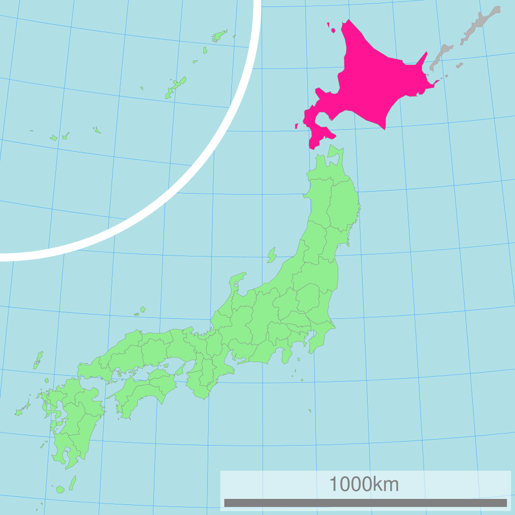
This image was a edited version of File:Map of Japan with highlight on 01 Hokkaido prefecture.svg and File:Map of Japan with highlight on 01edit Hokkaido prefecture.svg due to the following reasons:
Using of Hokkaido map where Kuril Islands belong to Japan its violation of principle "neutral point of view", abuse of independence, contravention of law and can not be placed in encyclopedia article. In this article must be placed map without Kuril Islands.
This edited version contain the en:Kuril Islands dispute shaded in Gray
| 概要 Description |
日本全図 北海道の位置図 Map of Japan with highlight on Hokkaido
| |||||
| 作成者 Author |
Lincun | |||||
| 使用データ Source |
国土交通省 国土数値情報(行政区域) | |||||
| Permission |
|

မူရင်းတင်ထားသောမှတ်တမ်း
| date/time | username | resolution | size | edit summary |
|---|---|---|---|---|
| 11:36, 3 March 2007 | User:Lincun | 1,024×1,024 | 15 KB |
Image description page history
| link | date/time | username | edit summary |
|---|---|---|---|
| [1] | 13:02, 7 September 2007 | User:LERK | |
| [2] | 11:51, 17 July 2007 | User:BilabialBoxing | |
| [3] | 11:36, 3 March 2007 | User:Lincun | ({{都道府県地図情報 |都道府県=北海道 |都道府県Latin=Hokkaido }}) |
![[1]](https://commons.wikimedia.org/w/index.php?title=Image:Map_of_Japan_with_highlight_on_01_Hokkaido_北海道.svg&redirect=no&oldid=7415936)
![[2]](https://commons.wikimedia.org/w/index.php?title=Image:Map_of_Japan_with_highlight_on_01_Hokkaido_北海道.svg&redirect=no&oldid=6614205)
![[3]](https://commons.wikimedia.org/w/index.php?title=Image:Map_of_Japan_with_highlight_on_01_Hokkaido_北海道.svg&redirect=no&oldid=4606209)
ဖိုင်မှတ်တမ်း
ဖိုင်ကို ယင်းနေ့စွဲ အတိုင်း မြင်နိုင်ရန် နေ့စွဲ/အချိန် တစ်ခုခုပေါ်တွင် ကလစ်နှိပ်ပါ။
| နေ့စွဲ/အချိန် | နမူနာပုံငယ် | မှတ်တမ်း ဒိုင်မန်းရှင်းများ | အသုံးပြုသူ | မှတ်ချက် | |
|---|---|---|---|---|---|
| ကာလပေါ် | ၂၂:၄၀၊ ၂၄ ဇန်နဝါရီ ၂၀၀၉ | | ၁၀၂၄ × ၁၀၂၄ (၉၀ KB) | ASDFGHJ | {{Information |Description= |Source= |Date= |Author= |Permission= |other_versions= }} |
| ၂၂:၀၁၊ ၂၄ ဇန်နဝါရီ ၂၀၀၉ |  | ၁၀၂၄ × ၁၀၂၄ (၃၀ KB) | ASDFGHJ | This image was a edited version of Image:Map of Japan with highlight on 01 Hokkaido prefecture.svg and Image:ap of Japan with highlight on 01edit Hokkaido prefecture.svg due to the following reasons: Using of Hokkaido map where Kuril Islands be |
ဖိုင်သုံးစွဲမှု
အောက်ပါ 2 စာမျက်နှာများ သည် ဤဖိုင်ကို အသုံးပြုထားသည်:
ဂလိုဘယ် ဖိုင်သုံးစွဲမှု
အောက်ပါ အခြားဝီကီများတွင် ဤဖိုင်ကို အသုံးပြုထားသည်-
- ace.wikipedia.org တွင် အသုံးပြုမှု
- ang.wikipedia.org တွင် အသုံးပြုမှု
- az.wikipedia.org တွင် အသုံးပြုမှု
- be.wikipedia.org တွင် အသုံးပြုမှု
- bn.wikipedia.org တွင် အသုံးပြုမှု
- bo.wikipedia.org တွင် အသုံးပြုမှု
- cdo.wikipedia.org တွင် အသုံးပြုမှု
- ceb.wikipedia.org တွင် အသုံးပြုမှု
- de.wikipedia.org တွင် အသုံးပြုမှု
- en.wikipedia.org တွင် အသုံးပြုမှု
- eu.wikipedia.org တွင် အသုံးပြုမှု
- fo.wikipedia.org တွင် အသုံးပြုမှု
- gd.wikipedia.org တွင် အသုံးပြုမှု
- hak.wikipedia.org တွင် အသုံးပြုမှု
- hr.wikipedia.org တွင် အသုံးပြုမှု
- hu.wikipedia.org တွင် အသုံးပြုမှု
- id.wikipedia.org တွင် အသုံးပြုမှု
- ilo.wikipedia.org တွင် အသုံးပြုမှု
- incubator.wikimedia.org တွင် အသုံးပြုမှု
- is.wikipedia.org တွင် အသုံးပြုမှု
- km.wikipedia.org တွင် အသုံးပြုမှု
- ko.wikipedia.org တွင် အသုံးပြုမှု
- lt.wikipedia.org တွင် အသုံးပြုမှု
- mr.wikipedia.org တွင် အသုံးပြုမှု
- ms.wikipedia.org တွင် အသုံးပြုမှု
- nov.wikipedia.org တွင် အသုံးပြုမှု
- or.wikipedia.org တွင် အသုံးပြုမှု
- pa.wikipedia.org တွင် အသုံးပြုမှု
- pl.wikipedia.org တွင် အသုံးပြုမှု
- pl.wiktionary.org တွင် အသုံးပြုမှု
- pnb.wikipedia.org တွင် အသုံးပြုမှု
- pt.wikipedia.org တွင် အသုံးပြုမှု
- rm.wikipedia.org တွင် အသုံးပြုမှု
- ru.wikipedia.org တွင် အသုံးပြုမှု
- simple.wikipedia.org တွင် အသုံးပြုမှု
- si.wikipedia.org တွင် အသုံးပြုမှု
- sq.wikipedia.org တွင် အသုံးပြုမှု
- th.wikipedia.org တွင် အသုံးပြုမှု
- tl.wikipedia.org တွင် အသုံးပြုမှု
- ug.wikipedia.org တွင် အသုံးပြုမှု
- ur.wikipedia.org တွင် အသုံးပြုမှု
ဤဖိုင်ကို အခြားနေရာများတွင် အသုံးပြုထားမှုများအား ကြည့်ရှုရန်။