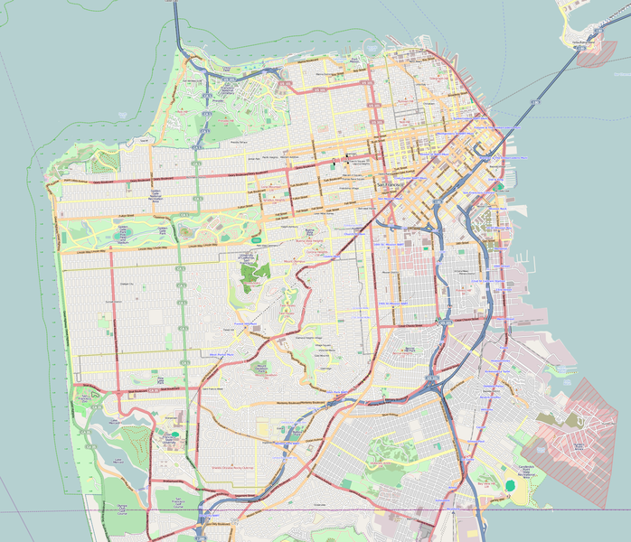
ဖိုင်:Location map San Francisco County.png

ဤနမူနာ၏ အရွယ်အစား - ၆၉၈ × ၆၀၀ ပစ်ဇယ်။ အခြား ပုံရိပ်ပြတ်သားမှု: ၂၇၉ × ၂၄၀ ပစ်ဇယ် | ၅၅၉ × ၄၈၀ ပစ်ဇယ် | ၈၉၄ × ၇၆၈ ပစ်ဇယ် | ၁၁၉၂ × ၁၀၂၄ ပစ်ဇယ် | ၂၁၅၅ × ၁၈၅၁ ပစ်ဇယ်။
မူရင်းဖိုင် (၂၁၅၅ × ၁၈၅၁ pixels, ဖိုင်အရွယ်အစား - ၂.၄၂ MB, MIME အမျိုးအစား image/png)
ဖိုင်မှတ်တမ်း
ဖိုင်ကို ယင်းနေ့စွဲ အတိုင်း မြင်နိုင်ရန် နေ့စွဲ/အချိန် တစ်ခုခုပေါ်တွင် ကလစ်နှိပ်ပါ။
| နေ့စွဲ/အချိန် | နမူနာပုံငယ် | မှတ်တမ်း ဒိုင်မန်းရှင်းများ | အသုံးပြုသူ | မှတ်ချက် | |
|---|---|---|---|---|---|
| ကာလပေါ် | ၁၉:၀၃၊ ၉ ဒီဇင်ဘာ ၂၀၁၆ |  | ၂၁၅၅ × ၁၈၅၁ (၂.၄၂ MB) | Jeanjung212 | Lossless Compressed/optimized png decreasing file size by 399140 bytes |
| ၀၆:၀၉၊ ၈ ဖေဖော်ဝါရီ ၂၀၁၁ |  | ၂၁၅၅ × ၁၈၅၁ (၂.၈၁ MB) | Droll | {{OpenStreetMap |location=San Francisco and vicinity |authors=Droll |top= 37.8191 |bottom= 37.7013 |left= -122.5265 |right= -122.353 }} Category:OpenStreetMap maps of the United States Category:Maps of San Francisco |
ဖိုင်သုံးစွဲမှု
အောက်ပါ 3 စာမျက်နှာများ သည် ဤဖိုင်ကို အသုံးပြုထားသည်:
ဂလိုဘယ် ဖိုင်သုံးစွဲမှု
အောက်ပါ အခြားဝီကီများတွင် ဤဖိုင်ကို အသုံးပြုထားသည်-
- ar.wikipedia.org တွင် အသုံးပြုမှု
- bh.wikipedia.org တွင် အသုံးပြုမှု
- bs.wikipedia.org တွင် အသုံးပြုမှု
- ceb.wikipedia.org တွင် အသုံးပြုမှု
- en.wikipedia.org တွင် အသုံးပြုမှု
- City Lights Bookstore
- Castro Theatre
- Richmond District, San Francisco
- Sunset District, San Francisco
- Oracle Park
- Coit Tower
- Asian Art Museum (San Francisco)
- Bayview–Hunters Point, San Francisco
- Grandview Park
- California Academy of Sciences
- San Francisco Botanical Garden
- Bernal Heights, San Francisco
- Mission Dolores Park
- Buena Vista Park
- Yerba Buena Gardens
- Lowell High School (San Francisco)
- Balclutha (1886)
- West Portal, San Francisco
- John McLaren Park
- Ghirardelli Square
- Cartoon Art Museum
- Glen Park, San Francisco
- Washington Square (San Francisco)
- Excelsior District, San Francisco
- Curran Theatre
- Crocker-Amazon, San Francisco
- Twin Peaks (San Francisco)
- Mount Davidson (California)
- American Conservatory Theater
- San Francisco Mint
- Candlestick Point State Recreation Area
- Cliff House, San Francisco
- Saint Ignatius Church (San Francisco)
- Fleishhacker Pool
- Lincoln Park (San Francisco)
- Columbus Tower (San Francisco)
- Musée Mécanique
- Lotta's Fountain
- San Francisco War Memorial and Performing Arts Center
- Holy Name of Jesus Church (San Francisco)
- Lone Mountain (California)
- Sutro Heights Park
- Visitacion Valley, San Francisco
- Rincon Center
ဤဖိုင်ကို အခြားနေရာများတွင် အသုံးပြုထားမှုများအား ကြည့်ရှုရန်။

