
ဖိုင်:Iran location map.svg

Size of this PNG preview of this SVG file: ၆၇၂ × ၆၀၀ ပစ်ဇယ်. အခြား ပုံရိပ်ပြတ်သားမှု: ၂၆၉ × ၂၄၀ ပစ်ဇယ် | ၅၃၈ × ၄၈၀ ပစ်ဇယ် | ၈၆၁ × ၇၆၈ ပစ်ဇယ် | ၁၁၄၇ × ၁၀၂၄ ပစ်ဇယ် | ၂၂၉၅ × ၂၀၄၈ ပစ်ဇယ် | ၁၂၀၀ × ၁၀၇၁ ပစ်ဇယ်။
မူရင်းဖိုင် (SVG ဖိုင်, ၁၂၀၀ × ၁၀၇၁ pixels ကို အကြံပြုသည်, ဖိုင်အရွယ်အစား - ၂၉၉ KB)
| ဤဖိုင်သည် Wikimedia Commons မှဖြစ်ပြီး အခြားပရောဂျက်များတွင် သုံးကောင်းသုံးလိမ့်မည်။ ယင်း၏ ဖိုင်အကြောင်းစာမျက်နှာ တွင် ဖော်ပြထားချက်ကို အောက်တွင် ပြထားသည်။ Commons သည် မူပိုင်ခွင့်လွတ်လပ်သော မီဒီယာဖိုင်များ သိုလှောင်ထားရာ နေရာ ဖြစ်သည်။ သင်လည်း ပါဝင်ကူညီနိုင်ပါသည်။ |
အကျဉ်းချုပ်
| ဖော်ပြချက် |
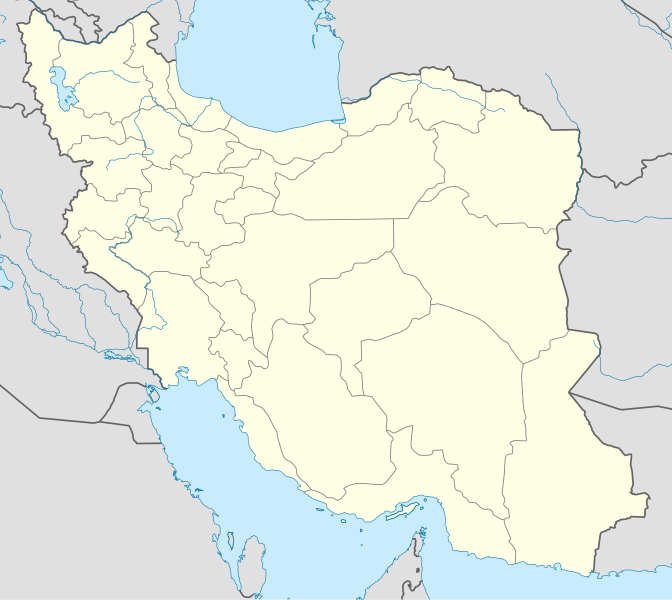
English: Location map of Iran.
Equirectangular projection. Stretched by 118.0%. Geographic limits of the map: * N: 40.0° N * S: 24.5° N * W: 43.5° E * E: 64.0° EMade with Natural Earth. Free vector and raster map data @ naturalearthdata.com. |
| ရက်စွဲ | |
| ရင်းမြစ် | ကိုယ်ပိုင်ဖန်တီးမှု |
| စာရေးသူ | Uwe Dedering |
| အခြား ဗားရှင်းများ |
Derivative works of this file:
|
| SVG genesis | This W3C-invalid map was created with Adobe Illustrator, and with Inkscape. |

လိုင်စင်သတ်မှတ်ခြင်း
ကျွန်ုပ်၊ ဤလုပ်ဆောင်ချက်၏ မူပိုင်ခွင့်ပိုင်ရှင်အနေဖြင့် ဤနေရာမှ အောက်ပါလိုင်စင်များအောက်တွင် ထုတ်လွှင့်ပါသည်:
ဤဖိုင်ကို Creative Commons Attribution-Share Alike 3.0 Unported လိုင်စင်ဖြင့် သတ်မှတ်ထားသည်။
- သင်သည် လွတ်လပ်စွာ:
- မျှဝေရန် – ဖန်တီးမှုကို ကူးယူရန်၊ ဖြန့်ဖြူးရန်နှင့် ထုတ်လွှင့်ရန်
- ပြန်ရောနှောရန် – ဖန်တီးမှုကို ပြင်ဆင်ညှိနှိုင်းရန်
- အောက်ပါ အခြေအနေများတွင်:
- မှတ်ယူနိုင်ခြင်း – ပြောင်းလဲမှုများ ပြုလုပ်ခဲ့ပါက ဖန်တီးသူ သို့မဟုတ် လိုင်စင်ရှိသူမှ သတ်မှတ်သော အမျိုးအစားကို လိုက်နာရမည် (ဆိုလိုသည်မှာ သင့်အား သို့မဟုတ် သင့်ဖန်တီးမှုတွင် အသုံးပြုခြင်းအား ထောက်ခံချက်ပေးသည်ဟု မဆိုလိုပါ)။
- ထပ်တူမျှဝေ – ဤဖန်တီးမှုအား ပြင်ဆင်ခြင်း၊ ပြောင်းလဲခြင်း သို့မဟုတ် ထပ်ဆင့် ဖန်တီးခြင်း ပြုလုပ်ပါက ရရှိလာသော ဖန်တီးမှုကို ဤဖန်တီးမှုနှင့် သို့မဟုတ် ဆင်တူသော လိုင်စင်ဖြင့်သာ ဖြန့်ချိသင့်သည်။

|
ဤစာတမ်းကို GNU Free Documentation License, ဗားရှင်း ၁.၂ သို့မဟုတ် Free Software Foundation မှ ဖြန့်ချီထားသော မည်သည့်ယခင်ဗားရှင်းတစ်ခုခုအောက်တွင် Invariant Sections, Front-Cover Texts နှင့် Back-Cover Texts များမပါဝင်ဘဲ ကူးယူခြင်း၊ ဖြန့်ချီခြင်း နှင့်/သို့မဟုတ် ပြင်ဆင်ပြောင်းလဲနိုင်ရန် ခွင့်ပြုသည်။ လိုင်စင်မူပွားကို GNU Free Documentation License ခေါင်းစဉ်အောက်တွင် ထည့်သွင်းထားသည်။ |
သင်အလိုရှိရာ လိုင်စင်ကို ရွေးချယ်နိုင်ပါသည်။
ဖိုင်မှတ်တမ်း
ဖိုင်ကို ယင်းနေ့စွဲ အတိုင်း မြင်နိုင်ရန် နေ့စွဲ/အချိန် တစ်ခုခုပေါ်တွင် ကလစ်နှိပ်ပါ။
| နေ့စွဲ/အချိန် | နမူနာပုံငယ် | မှတ်တမ်း ဒိုင်မန်းရှင်းများ | အသုံးပြုသူ | မှတ်ချက် | |
|---|---|---|---|---|---|
| ကာလပေါ် | ၀၇:၅၉၊ ၂၂ အောက်တိုဘာ ၂၀၁၃ | | ၁၂၀၀ × ၁၀၇၁ (၂၉၉ KB) | NordNordWest | Reverted to version as of 17:55, 15 April 2013; no reason for change given |
| ၁၃:၄၄၊ ၂၁ အောက်တိုဘာ ၂၀၁၃ |  | ၁၂၀၀ × ၁၀၇၁ (၆၄၀ KB) | Ekivalan | Reverted to version as of 17:38, 12 April 2013 | |
| ၁၃:၄၃၊ ၂၁ အောက်တိုဘာ ၂၀၁၃ |  | ၁၂၀၀ × ၁၀၇၁ (၆၄၀ KB) | Ekivalan | Reverted to version as of 17:38, 12 April 2013 | |
| ၁၇:၅၅၊ ၁၅ ဧပြီ ၂၀၁၃ |  | ၁၂၀၀ × ၁၀၇၁ (၂၉၉ KB) | NordNordWest | according to http://images.persianblog.ir/516041_B0b76ypr.jpg + Tabas -> South Khorasan province | |
| ၁၇:၄၀၊ ၁၂ ဧပြီ ၂၀၁၃ |  | ၁၂၀၀ × ၁၀၇၁ (၆၄၀ KB) | Yamaha5 | Reverted to version as of 20:08, 11 July 2010 | |
| ၁၇:၃၈၊ ၁၂ ဧပြီ ၂၀၁၃ |  | ၁၂၀၀ × ၁၀၇၁ (၆၄၀ KB) | Yamaha5 | Reverted to version as of 20:08, 11 July 2010 in all maps khorasan is like past! | |
| ၁၁:၃၀၊ ၁၇ မတ် ၂၀၁၃ |  | ၁၂၀၀ × ၁၀၇၁ (၂၉၄ KB) | NordNordWest | upd | |
| ၂၀:၀၈၊ ၁၁ ဇူလိုင် ၂၀၁၀ |  | ၁၂၀၀ × ၁၀၇၁ (၆၄၀ KB) | Uwe Dedering | 31. province Alborz | |
| ၁၇:၄၄၊ ၁၈ ဖေဖော်ဝါရီ ၂၀၁၀ |  | ၁၂၀၀ × ၁၀၇၁ (၇၀၅ KB) | Uwe Dedering | Bahrain above water, no disputed countries | |
| ၁၃:၀၀၊ ၁၈ ဖေဖော်ဝါရီ ၂၀၁၀ |  | ၁၂၀၀ × ၁၀၇၁ (၇၀၉ KB) | Uwe Dedering | {{Information |Description={{en|1=Location map of Iran. Equirectangular projection. Strechted by 118.0%. Geographic limits of the map: * N: 40.0° N * S: 24.5° N * W: 43.5° E * E: 64.0° E Made with Natural Earth. Free vector and raster map data @ |
ဖိုင်သုံးစွဲမှု
အောက်ပါ 3 စာမျက်နှာများ သည် ဤဖိုင်ကို အသုံးပြုထားသည်:
ဂလိုဘယ် ဖိုင်သုံးစွဲမှု
အောက်ပါ အခြားဝီကီများတွင် ဤဖိုင်ကို အသုံးပြုထားသည်-
- af.wikipedia.org တွင် အသုံးပြုမှု
- als.wikipedia.org တွင် အသုံးပြုမှု
- an.wikipedia.org တွင် အသုံးပြုမှု
- ar.wikipedia.org တွင် အသုံးပြုမှု
- محمد بن إسماعيل البخاري
- طهران
- صحيح مسلم
- محافظات إيران
- فخر الدين الرازي
- كأس آسيا 1968
- كأس آسيا 1976
- مسلم بن الحجاج
- قالب:خريطة مواقع إیران
- مشهد
- زلزال بم 2003
- تفجيرات زاهدان 2010
- زلزال طبس 1978
- بطولة آسيا للناشئين تحت 16 عاما 2012
- قائمة المفكرين المسيحيين في العلم
- مرتضى الأنصاري
- زلزال تبريز 2012
- شعيطة (رامشير)
ဤဖိုင်ကို အခြားနေရာများတွင် အသုံးပြုထားမှုများအား ကြည့်ရှုရန်။