
ဖိုင်:Greater Manchester UK relief location map.jpg

ဤနမူနာ၏ အရွယ်အစား - ၈၀၀ × ၅၅၇ ပစ်ဇယ်။ အခြား ပုံရိပ်ပြတ်သားမှု: ၃၂၀ × ၂၂၃ ပစ်ဇယ် | ၆၄၀ × ၄၄၆ ပစ်ဇယ် | ၁၀၂၄ × ၇၁၄ ပစ်ဇယ် | ၁၂၈၀ × ၈၉၂ ပစ်ဇယ် | ၁၉၉၉ × ၁၃၉၃ ပစ်ဇယ်။
မူရင်းဖိုင် (၁၉၉၉ × ၁၃၉၃ pixels, ဖိုင်အရွယ်အစား - ၃၃၂ KB, MIME အမျိုးအစား image/jpeg)
| ဤဖိုင်သည် Wikimedia Commons မှဖြစ်ပြီး အခြားပရောဂျက်များတွင် သုံးကောင်းသုံးလိမ့်မည်။ ယင်း၏ ဖိုင်အကြောင်းစာမျက်နှာ တွင် ဖော်ပြထားချက်ကို အောက်တွင် ပြထားသည်။ Commons သည် မူပိုင်ခွင့်လွတ်လပ်သော မီဒီယာဖိုင်များ သိုလှောင်ထားရာ နေရာ ဖြစ်သည်။ သင်လည်း ပါဝင်ကူညီနိုင်ပါသည်။ |
| ဖော်ပြချက် |
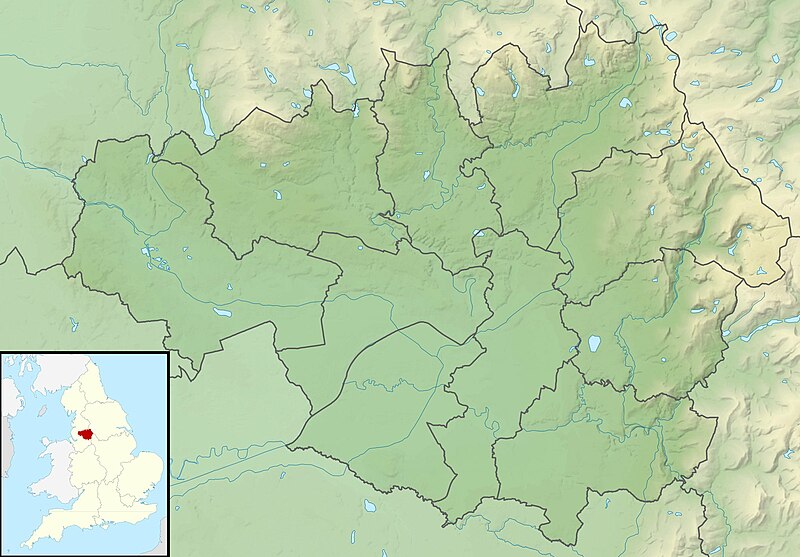
Relief map of Greater Manchester, UK. Equirectangular map projection on WGS 84 datum, with N/S stretched 165% Geographic limits:
|
| ရက်စွဲ | |
| ရင်းမြစ် |
|
| စာရေးသူ | Nilfanion, created using Ordnance Survey data |
| ခွင့်ပြုချက် (ဤဖိုင်ကို ပြန်လည်အသုံးပြုခြင်း) |
ဤဖိုင်ကို Creative Commons Attribution-Share Alike 3.0 Unported လိုင်စင်ဖြင့် သတ်မှတ်ထားသည်။ မှတ်ယူနိုင်ခြင်း: Contains Ordnance Survey data © Crown copyright and database right
|
| အခြား ဗားရှင်းများ | File:Greater Manchester UK district map (blank).svg - Blank map |
.svg)
ဖိုင်မှတ်တမ်း
ဖိုင်ကို ယင်းနေ့စွဲ အတိုင်း မြင်နိုင်ရန် နေ့စွဲ/အချိန် တစ်ခုခုပေါ်တွင် ကလစ်နှိပ်ပါ။
| နေ့စွဲ/အချိန် | နမူနာပုံငယ် | မှတ်တမ်း ဒိုင်မန်းရှင်းများ | အသုံးပြုသူ | မှတ်ချက် | |
|---|---|---|---|---|---|
| ကာလပေါ် | ၀၁:၃၇၊ ၂၉ နိုဝင်ဘာ ၂၀၁၁ | | ၁၉၉၉ × ၁၃၉၃ (၃၃၂ KB) | Nilfanion | {{Information |Description=Relief map of Greater Manchester, UK. Equirectangular map projection on WGS 84 datum, with N/S stretched 165% Geographic limits: *West: 2.80W *East: 1.90W *North: 53.70N *South: 53.32N |Source=[[w:Ordn |
ဖိုင်သုံးစွဲမှု
အောက်ပါ စာမျက်နှာ သည် ဤဖိုင်ကို အသုံးပြုထားသည်:
ဂလိုဘယ် ဖိုင်သုံးစွဲမှု
အောက်ပါ အခြားဝီကီများတွင် ဤဖိုင်ကို အသုံးပြုထားသည်-
- ar.wikipedia.org တွင် အသုံးပြုမှု
- bg.wikipedia.org တွင် အသုံးပြုမှု
- bn.wikipedia.org တွင် အသုံးပြုမှု
- ceb.wikipedia.org တွင် အသုံးပြုမှု
- el.wikipedia.org တွင် အသုံးပြုမှု
- en.wikipedia.org တွင် အသုံးပြုမှု
- Chetham's Library
- River Irk
- Werneth Low
- Dovestone Reservoir
- Strinesdale Reservoir
- Winter Hill transmitting station
- Battle of Wigan Lane
- Hollingworth Lake
- Winter Hill (North West England)
- Saddleworth Moor
- Blackstone Edge
- Chew Valley, Greater Manchester
- Chew Reservoir
- Hollingworth Reservoir
- Black Chew Head
- Hartshead Pike
- Crompton Moor
- Ogden Reservoir (Greater Manchester)
- Geography of Greater Manchester
- Oceânico Group Pro-Am Challenge
- Kersal Moor
- Manchester Bolton & Bury Reservoir
- Kitcliffe Reservoir
- Piethorne Reservoir
- Rooden Reservoir
- Norman Hill Reservoir
- Hanging Lees Reservoir
- Watergrove Reservoir
- Blackstone Edge Reservoir
- Brown Wardle Hill
- Yeoman Hey Reservoir
- Ashworth Moor Reservoir
- Brushes Clough Reservoir
ဤဖိုင်ကို အခြားနေရာများတွင် အသုံးပြုထားမှုများအား ကြည့်ရှုရန်။