
ဖိုင်:China Tibet location map.svg

မူရင်းဖိုင် (SVG ဖိုင်, ၂၀၁၃ × ၁၁၃၇ pixels ကို အကြံပြုသည်, ဖိုင်အရွယ်အစား - ၄၆၅ KB)
| ဤဖိုင်သည် Wikimedia Commons မှဖြစ်ပြီး အခြားပရောဂျက်များတွင် သုံးကောင်းသုံးလိမ့်မည်။ ယင်း၏ ဖိုင်အကြောင်းစာမျက်နှာ တွင် ဖော်ပြထားချက်ကို အောက်တွင် ပြထားသည်။ Commons သည် မူပိုင်ခွင့်လွတ်လပ်သော မီဒီယာဖိုင်များ သိုလှောင်ထားရာ နေရာ ဖြစ်သည်။ သင်လည်း ပါဝင်ကူညီနိုင်ပါသည်။ |
အကျဉ်းချုပ်
| ဖော်ပြချက် |
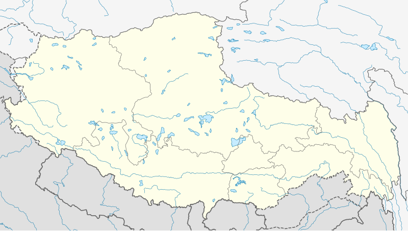
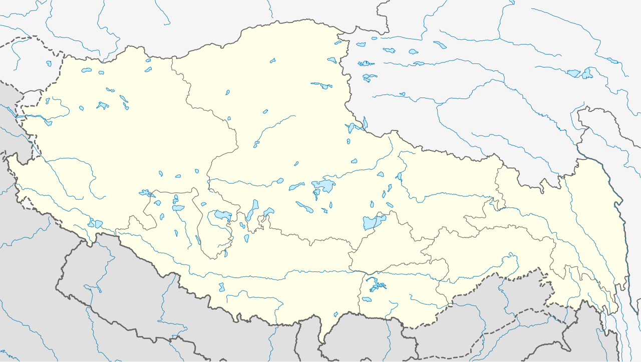
Deutsch: Positionskarte von Autonomes Gebiet Tibet, Volksrepublik China
Quadratische Plattkarte, N-S-Streckung 118 %. Geographische Begrenzung der Karte:
English: Location map of Tibet Autonomous Region, People's Republic of China
Equirectangular projection, N/S stretching 118 %. Geographic limits of the map:
|
||
| ရက်စွဲ | |||
| ရင်းမြစ် |
ကိုယ်ပိုင်ဖန်တီးမှု, using
|
||
| စာရေးသူ | NordNordWest | ||
| ခွင့်ပြုချက် (ဤဖိုင်ကို ပြန်လည်အသုံးပြုခြင်း) |
ဤဖိုင်သည် Creative Commons Attribution-Share Alike 3.0 ဂျာမနီ လိုင်စင်အောက်တွင် လိုင်စင်သတ်မှတ်ထားပါသည်။
 ဤဖိုင်သည် Creative Commons Attribution-Share Alike 3.0 ဂျာမနီ လိုင်စင်အောက်တွင် လိုင်စင်သတ်မှတ်ထားပါသည်။
|
||
| SVG genesis | This W3C-invalid map was created with Adobe Illustrator.
|


ဖိုင်မှတ်တမ်း
ဖိုင်ကို ယင်းနေ့စွဲ အတိုင်း မြင်နိုင်ရန် နေ့စွဲ/အချိန် တစ်ခုခုပေါ်တွင် ကလစ်နှိပ်ပါ။
| နေ့စွဲ/အချိန် | နမူနာပုံငယ် | မှတ်တမ်း ဒိုင်မန်းရှင်းများ | အသုံးပြုသူ | မှတ်ချက် | |
|---|---|---|---|---|---|
| ကာလပေါ် | ၀၈:၂၄၊ ၂၂ မေ ၂၀၂၀ | | ၂၀၁၃ × ၁၁၃၇ (၄၆၅ KB) | NordNordWest | Reverted to version as of 10:41, 29 January 2019 (UTC); AGAIN: only vector data in this svg please |
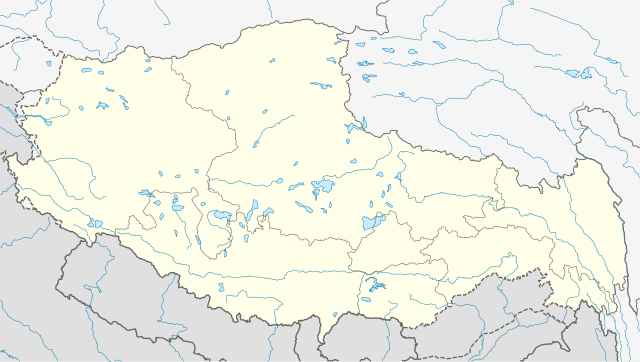
| ၂၁:၃၈၊ ၂၁ မေ ၂၀၂၀ |  | ၂၀၁၃ × ၁၁၃၇ (၅၉၅ KB) | Geographyinitiative | Reverted to version as of 06:29, 29 January 2019 (UTC) part of Aksai Chin is under TAR jurisdiction | |
| ၁၀:၄၁၊ ၂၉ ဇန်နဝါရီ ၂၀၁၉ |  | ၂၀၁၃ × ၁၁၃၇ (၄၆၅ KB) | NordNordWest | Reverted to version as of 12:39, 8 May 2013 (UTC); only vector data in this svg please | |
| ၀၆:၂၉၊ ၂၉ ဇန်နဝါရီ ၂၀၁၉ |  | ၂၀၁၃ × ၁၁၃၇ (၅၉၅ KB) | 复旦大学张超 | edit | |
| ၁၂:၃၉၊ ၈ မေ ၂၀၁၃ |  | ၂၀၁၃ × ၁၁၃၇ (၄၆၅ KB) | NordNordWest | upd | |
| ၁၂:၃၈၊ ၈ မေ ၂၀၁၃ |  | ၂၀၁၃ × ၁၁၃၇ (၄၆၅ KB) | NordNordWest | upd | |
| ၁၃:၂၈၊ ၂၃ ဖေဖော်ဝါရီ ၂၀၁၀ |  | ၂၀၁၃ × ၁၁၃၇ (၆၃၉ KB) | NordNordWest | upd | |
| ၂၀:၄၁၊ ၁၀ ဒီဇင်ဘာ ၂၀၀၉ |  | ၂၀၁၃ × ၁၁၃၈ (၆၃၂ KB) | NordNordWest | =={{int:filedesc}}== {{Information |Description= {{de|Positionskarte von Autonomes Gebiet Tibet, Volksrepublik China}} Quadratische Plattkarte, N-S-Streckung 118 %. Geographische Begrenzung der Ka |
ဖိုင်သုံးစွဲမှု
အောက်ပါ 6 စာမျက်နှာများ သည် ဤဖိုင်ကို အသုံးပြုထားသည်:
ဂလိုဘယ် ဖိုင်သုံးစွဲမှု
အောက်ပါ အခြားဝီကီများတွင် ဤဖိုင်ကို အသုံးပြုထားသည်-
- ar.wikipedia.org တွင် အသုံးပြုမှု
- ba.wikipedia.org တွင် အသုံးပြုမှု
- be.wikipedia.org တွင် အသုံးပြုမှု
- bg.wikipedia.org တွင် အသုံးပြုမှု
- bn.wikipedia.org တွင် အသုံးပြုမှု
- লোৎসে
- কৈলাস পর্বত
- ব্সাম-য়াস বৌদ্ধবিহার
- টেমপ্লেট:অবস্থান মানচিত্র চীন তিব্বত
- খ্রা-ব্রুগ বৌদ্ধবিহার
- টেমপ্লেট:অবস্থান মানচিত্র China Tibet
- র্দো-র্জে-ব্রাগ বৌদ্ধবিহার
- দ্গা'-ল্দান বৌদ্ধবিহার
- 'ব্রাস-স্পুংস বৌদ্ধবিহার
- সাঙ্গা বৌদ্ধবিহার
- মডিউল:অবস্থান মানচিত্র/উপাত্ত/চীন তিব্বত
- মডিউল:অবস্থান মানচিত্র/উপাত্ত/চীন তিব্বত/নথি
- লিপুলেখ গিরিপথ
- পুমোরি
- ca.wikipedia.org တွင် အသုံးပြုမှု
- cdo.wikipedia.org တွင် အသုံးပြုမှု
- ceb.wikipedia.org တွင် အသုံးပြုမှု
- cs.wikipedia.org တွင် အသုံးပြုမှု
- cv.wikipedia.org တွင် အသုံးပြုမှု
- en.wikipedia.org တွင် အသုံးပြုမှု
ဤဖိုင်ကို အခြားနေရာများတွင် အသုံးပြုထားမှုများအား ကြည့်ရှုရန်။