
ဖိုင်:Belgieheneg.png
သည်ထက်ကြီးသော resolution မရှိပါ.
Belgieheneg.png (၃၉၈ × ၃၃၅ pixels, ဖိုင်အရွယ်အစား - ၆ KB, MIME အမျိုးအစား image/png)
| ဤဖိုင်သည် Wikimedia Commons မှဖြစ်ပြီး အခြားပရောဂျက်များတွင် သုံးကောင်းသုံးလိမ့်မည်။ ယင်း၏ ဖိုင်အကြောင်းစာမျက်နှာ တွင် ဖော်ပြထားချက်ကို အောက်တွင် ပြထားသည်။ Commons သည် မူပိုင်ခွင့်လွတ်လပ်သော မီဒီယာဖိုင်များ သိုလှောင်ထားရာ နေရာ ဖြစ်သည်။ သင်လည်း ပါဝင်ကူညီနိုင်ပါသည်။ |
အကျဉ်းချုပ်
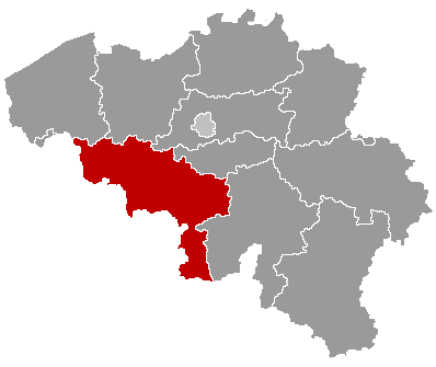
| ဖော်ပြချက် | Map of Belgium with the 3 regions togheter , with the province of Hainaut colored red. |
| ရက်စွဲ | |
| ရင်းမြစ် | Wikimedia Commons (Article 'Maps_of_Belgium') |
| စာရေးသူ | User 'Morwen' |
| ခွင့်ပြုချက် (ဤဖိုင်ကို ပြန်လည်အသုံးပြုခြင်း) |
none needed , seen the GNU Free Documentation License. |
လိုင်စင်သတ်မှတ်ခြင်း

|
ဤစာတမ်းကို GNU Free Documentation License, ဗားရှင်း ၁.၂ သို့မဟုတ် Free Software Foundation မှ ဖြန့်ချီထားသော မည်သည့်ယခင်ဗားရှင်းတစ်ခုခုအောက်တွင် Invariant Sections, Front-Cover Texts နှင့် Back-Cover Texts များမပါဝင်ဘဲ ကူးယူခြင်း၊ ဖြန့်ချီခြင်း နှင့်/သို့မဟုတ် ပြင်ဆင်ပြောင်းလဲနိုင်ရန် ခွင့်ပြုသည်။ လိုင်စင်မူပွားကို GNU Free Documentation License ခေါင်းစဉ်အောက်တွင် ထည့်သွင်းထားသည်။ |
| ဤဖိုင်ကို Creative Commons Attribution-Share Alike 3.0 Unported လိုင်စင်ဖြင့် သတ်မှတ်ထားသည်။ | ||
| ||
| This licensing tag was added to this file as part of the GFDL licensing update. |
ဖိုင်မှတ်တမ်း
ဖိုင်ကို ယင်းနေ့စွဲ အတိုင်း မြင်နိုင်ရန် နေ့စွဲ/အချိန် တစ်ခုခုပေါ်တွင် ကလစ်နှိပ်ပါ။
| နေ့စွဲ/အချိန် | နမူနာပုံငယ် | မှတ်တမ်း ဒိုင်မန်းရှင်းများ | အသုံးပြုသူ | မှတ်ချက် | |
|---|---|---|---|---|---|
| ကာလပေါ် | ၁၈:၅၆၊ ၂၄ မေ ၂၀၀၆ | | ၃၉၈ × ၃၃၅ (၆ KB) | Btrs | {{Information| |Description= Map of Belgium with the 3 regions togheter , with the province of Hainaut colored red. |Source=Wikimedia Commons (Article 'Maps_of_Belgium') |Date=24 May 2006 |Author=User 'Morwen' |Permission=none needed , seen the GNU Free D |
ဖိုင်သုံးစွဲမှု
ဤဖိုင်ကို အသုံးပြုထားသော စာမျက်နှာများမရှိပါ။
ဂလိုဘယ် ဖိုင်သုံးစွဲမှု
အောက်ပါ အခြားဝီကီများတွင် ဤဖိုင်ကို အသုံးပြုထားသည်-
- bg.wikipedia.org တွင် အသုံးပြုမှု
- Шарлероа
- Турне
- Ено
- Бенш
- Монс
- Ат
- Лесин
- Соани
- Понт а Сел
- Сили
- Шаблон:Ено
- Бельой
- Бернисар
- Брюжелет
- Елезел
- Флобек
- Фран лез Анвен
- Шиевър
- Анси (Белгия)
- Бусю
- Дур
- Журбиз
- Кареньон
- Кеви
- Киеврен
- Колфонтен
- Ланс (Белгия)
- Онел
- Сен Гилен
- Фрамери
- Комин-Варнетон
- Анген
- Брен льо Конт
- Екосин
- Лувиер
- Льо Рьолкс
- Антоан
- Брюно
- Естемпюи
- Льоз ан Ено
- Мон дьо л'Анклюс
- Пек (Белгия)
- Перювелз
- Рюм
- Сел
- Ам сюр Йор Налин
- Андерлю
- Бомон
- Еркелин
- Естин
ဤဖိုင်ကို အခြားနေရာများတွင် အသုံးပြုထားမှုများအား ကြည့်ရှုရန်။