
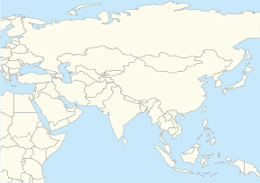
ဖိုင်:Asia location map2.svg

Size of this PNG preview of this SVG file: ၂၉၀ × ၂၀၄ ပစ်ဇယ်. အခြား ပုံရိပ်ပြတ်သားမှု: ၃၂၀ × ၂၂၅ ပစ်ဇယ် | ၆၄၀ × ၄၅၀ ပစ်ဇယ် | ၁၀၂၄ × ၇၂၀ ပစ်ဇယ် | ၁၂၈၀ × ၉၀၀ ပစ်ဇယ် | ၂၅၆၀ × ၁၈၀၁ ပစ်ဇယ်။
မူရင်းဖိုင် (SVG ဖိုင်, ၂၉၀ × ၂၀၄ pixels ကို အကြံပြုသည်, ဖိုင်အရွယ်အစား - ၂၆၃ KB)
| ဤဖိုင်သည် Wikimedia Commons မှဖြစ်ပြီး အခြားပရောဂျက်များတွင် သုံးကောင်းသုံးလိမ့်မည်။ ယင်း၏ ဖိုင်အကြောင်းစာမျက်နှာ တွင် ဖော်ပြထားချက်ကို အောက်တွင် ပြထားသည်။ Commons သည် မူပိုင်ခွင့်လွတ်လပ်သော မီဒီယာဖိုင်များ သိုလှောင်ထားရာ နေရာ ဖြစ်သည်။ သင်လည်း ပါဝင်ကူညီနိုင်ပါသည်။ |
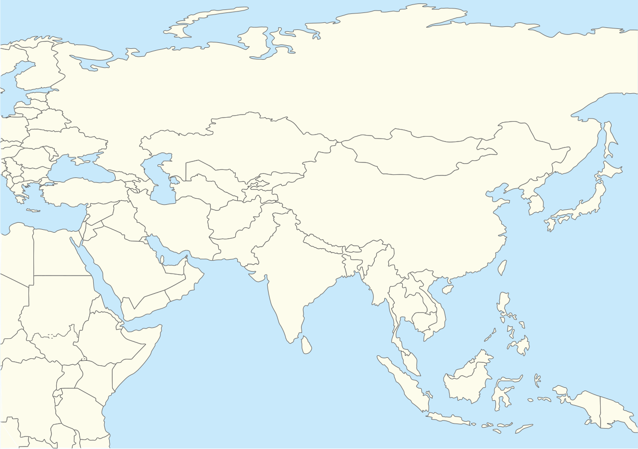
| ဖော်ပြချက် | Location map for Asia with national borders(second version) |
| ရက်စွဲ | (UTC) |
| ရင်းမြစ် | |
| စာရေးသူ |
|
| This is a retouched picture, which means that it has been digitally altered from its original version. The original can be viewed here: World location map.svg:
|
ကျွန်ုပ်၊ ဤလုပ်ဆောင်ချက်၏ မူပိုင်ခွင့်ပိုင်ရှင်အနေဖြင့် ဤနေရာမှ အောက်ပါလိုင်စင်အောက်တွင် ထုတ်လွှင့်ပါသည်:
| I, the copyright holder of this work, release this work into the public domain. This applies worldwide. In some countries this may not be legally possible; if so: အကျွန်ုပ်သည် ဤဖန်တီးမှုလက်ရာကို ဥပဒေအရလိုအပ်ခြင်းမရှိသည့် မည်သည့်အခြေအနေမျိုးတွက်မဆို၊ မည်သို့သော ရည်ရွယ်ချက်အတွက်မဆို ၎င်းကို မည်သူမဆို အသုံးပြုပိုင်ခွင့်အား ပေးအပ်သည်။ |
မူရင်းတင်ထားသောမှတ်တမ်း
This image is a derivative work of the following images:
- File:World_location_map.svg licensed with PD-self
- 2010-04-18T18:53:02Z STyx 800x400 (599024 Bytes) {{Information |Description={{en|1=?}} |Source=? |Author=? |Date= |Permission= |other_versions= }} == {{int:filedesc}} == {{Information |Description={{en}}Blank world map for location map templates ([[:en:Equirectangular proje
Uploaded with derivativeFX
ဖိုင်မှတ်တမ်း
ဖိုင်ကို ယင်းနေ့စွဲ အတိုင်း မြင်နိုင်ရန် နေ့စွဲ/အချိန် တစ်ခုခုပေါ်တွင် ကလစ်နှိပ်ပါ။
| နေ့စွဲ/အချိန် | နမူနာပုံငယ် | မှတ်တမ်း ဒိုင်မန်းရှင်းများ | အသုံးပြုသူ | မှတ်ချက် | |
|---|---|---|---|---|---|
| ကာလပေါ် | ၁၅:၃၁၊ ၁၂ ဧပြီ ၂၀၁၉ | | ၂၉၀ × ၂၀၄ (၂၆၃ KB) | Goran tek-en | Updating South Sudan as requested by {{u|Maphobbyist}}. |
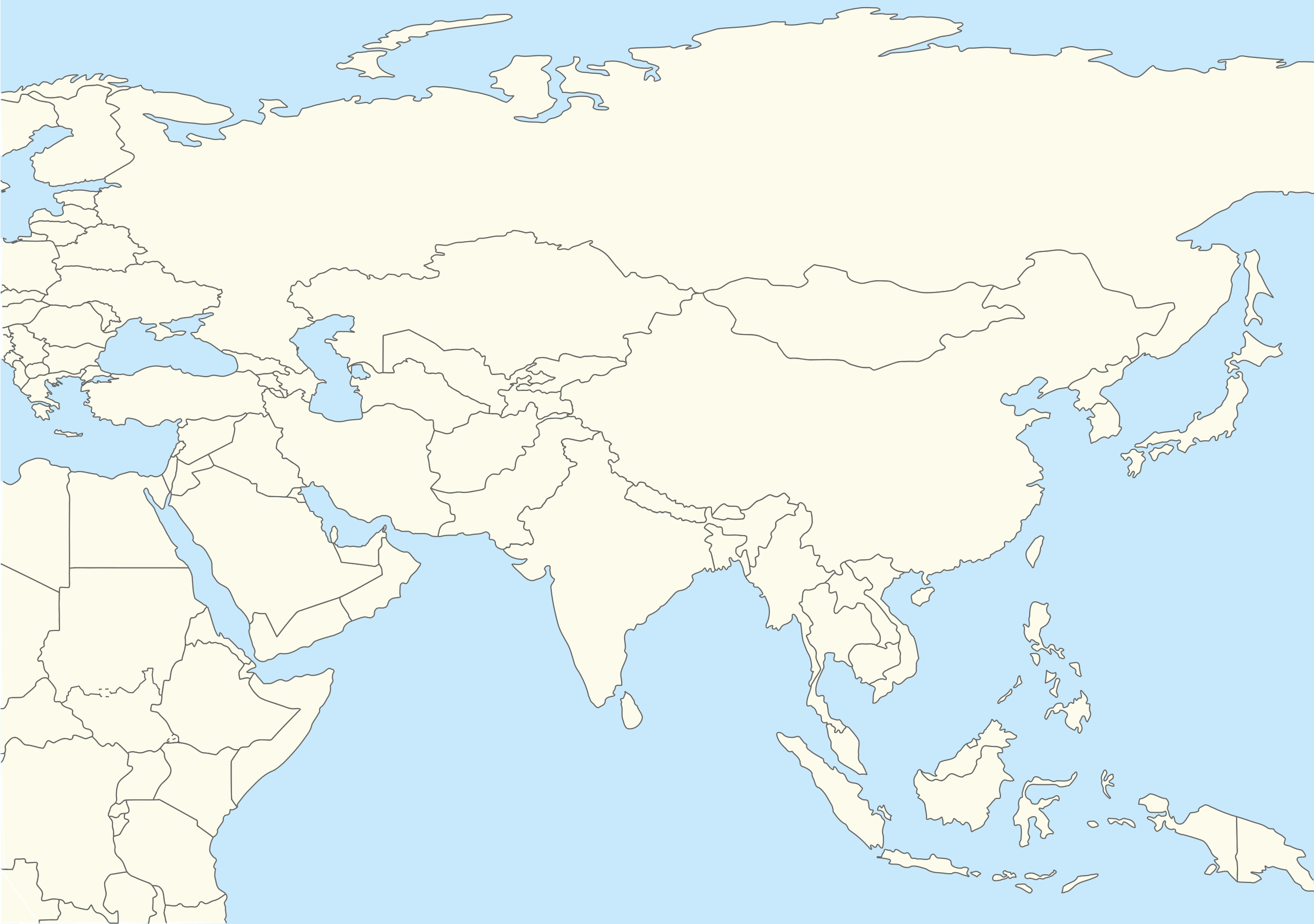
| ၁၁:၅၅၊ ၂၈ အောက်တိုဘာ ၂၀၁၀ |  | ၂၉၀ × ၂၀၄ (၂၅၈ KB) | 배우는사람 | {{Information |Description=Location map for Asia (second version) |Source=*File:World_location_map.svg |Date=2010-10-28 11:54 (UTC) |Author=*File:World_location_map.svg *derivative work: ~~~ |Permission= |other_versions= }} {{RetouchedPicture |
ဖိုင်သုံးစွဲမှု
အောက်ပါ စာမျက်နှာ သည် ဤဖိုင်ကို အသုံးပြုထားသည်:
ဂလိုဘယ် ဖိုင်သုံးစွဲမှု
အောက်ပါ အခြားဝီကီများတွင် ဤဖိုင်ကို အသုံးပြုထားသည်-
- ar.wikipedia.org တွင် အသုံးပြုမှု
- ba.wikipedia.org တွင် အသုံးပြုမှု
- bh.wikipedia.org တွင် အသုံးပြုမှု
- blk.wikipedia.org တွင် အသုံးပြုမှု
- bn.wikipedia.org တွင် အသုံးပြုမှု
- br.wikipedia.org တွင် အသုံးပြုမှု
- ca.wikipedia.org တွင် အသုံးပြုမှု
- ceb.wikipedia.org တွင် အသုံးပြုမှု
- da.wikipedia.org တွင် အသုံးပြုမှု
- diq.wikipedia.org တွင် အသုံးပြုမှု
- dty.wikipedia.org တွင် အသုံးပြုမှု
- en.wikipedia.org တွင် အသုံးပြုမှု
- Ibn Battuta
- Sary Shagan
- Mount Awu
- Kontinental Hockey League
- Module:Location map/data/Asia (equirectangular)/doc
- Template:Location map+/testcases
- Template:Location map+/overlay
- User:Mertborak
- List of places visited by Ibn Battuta
- User:Aidann/sandbox
- User:Joelton Ivson/Gather lists/24675 – Esportes
- Module:Location map/data/Asia (equirectangular)
- en.wikiversity.org တွင် အသုံးပြုမှု
- eu.wikipedia.org တွင် အသုံးပြုမှု
- fa.wikipedia.org တွင် အသုံးပြုမှု
- fo.wikipedia.org တွင် အသုံးပြုမှု
- gu.wikipedia.org တွင် အသုံးပြုမှု
- he.wikipedia.org တွင် အသုံးပြုမှု
- id.wikipedia.org တွင် အသုံးပြုမှု
- ilo.wikipedia.org တွင် အသုံးပြုမှု
ဤဖိုင်ကို အခြားနေရာများတွင် အသုံးပြုထားမှုများအား ကြည့်ရှုရန်။