
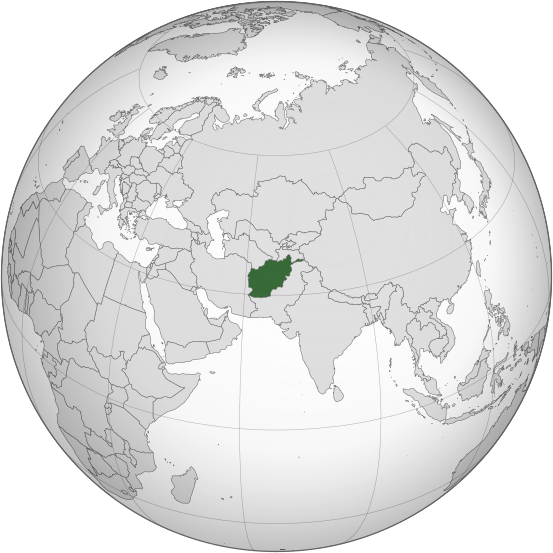
ဖိုင်:Afghanistan (orthographic projection).svg

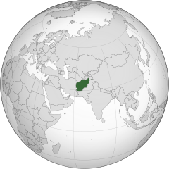
Size of this PNG preview of this SVG file: ၅၅၃ × ၅၅၃ ပစ်ဇယ်. အခြား ပုံရိပ်ပြတ်သားမှု: ၂၄၀ × ၂၄၀ ပစ်ဇယ် | ၄၈၀ × ၄၈၀ ပစ်ဇယ် | ၇၆၈ × ၇၆၈ ပစ်ဇယ် | ၁၀၂၄ × ၁၀၂၄ ပစ်ဇယ် | ၂၀၄၈ × ၂၀၄၈ ပစ်ဇယ်။
မူရင်းဖိုင် (SVG ဖိုင်, ၅၅၃ × ၅၅၃ pixels ကို အကြံပြုသည်, ဖိုင်အရွယ်အစား - ၂၉၈ KB)
| ဤဖိုင်သည် Wikimedia Commons မှဖြစ်ပြီး အခြားပရောဂျက်များတွင် သုံးကောင်းသုံးလိမ့်မည်။ ယင်း၏ ဖိုင်အကြောင်းစာမျက်နှာ တွင် ဖော်ပြထားချက်ကို အောက်တွင် ပြထားသည်။ Commons သည် မူပိုင်ခွင့်လွတ်လပ်သော မီဒီယာဖိုင်များ သိုလှောင်ထားရာ နေရာ ဖြစ်သည်။ သင်လည်း ပါဝင်ကူညီနိုင်ပါသည်။ |
.svg)
အကျဉ်းချုပ်
| ဖော်ပြချက် |
اردو: طرحی متعامد از افغانستان |
| ရက်စွဲ | |
| ရင်းမြစ် | Own work based on: India (orthographic projection).svg by Ssolbergj |
| စာရေးသူ | Shahid Parvez |
| SVG genesis | ဤ SVG ၏ ကုဒ်သည် ခိုင်လုံသည်. This world map was created with unknown tool. |
.svg)
လိုင်စင်သတ်မှတ်ခြင်း
The map has been created with the Generic Mapping Tools: https://www.generic-mapping-tools.org/ using one or more of these public-domain datasets for the relief:
|

|
ဤစာတမ်းကို GNU Free Documentation License, ဗားရှင်း ၁.၂ သို့မဟုတ် Free Software Foundation မှ ဖြန့်ချီထားသော မည်သည့်ယခင်ဗားရှင်းတစ်ခုခုအောက်တွင် Invariant Sections, Front-Cover Texts နှင့် Back-Cover Texts များမပါဝင်ဘဲ ကူးယူခြင်း၊ ဖြန့်ချီခြင်း နှင့်/သို့မဟုတ် ပြင်ဆင်ပြောင်းလဲနိုင်ရန် ခွင့်ပြုသည်။ လိုင်စင်မူပွားကို GNU Free Documentation License ခေါင်းစဉ်အောက်တွင် ထည့်သွင်းထားသည်။ |
မူရင်းတင်ထားသောမှတ်တမ်း
Transferred from en.wikipedia to Commons by Cirt using CommonsHelper.
ဖော်ပြချက် မူရင်းစာမျက်နှာမှာ here ဖြစ်သည်။ အောက်ပါအသုံးပြုသူ အမည်များအားလုံးသည် en.wikipedia ကို ရည်ညွှန်းသည်။
- 2009-10-05 17:28 Parvez gsm 541×541× (517730 bytes) {{Information |Description = Afghanistan orthographic_projection |Source = I have created this work entirely by myself. |Date = October 5 |Author = Shahid Parvez |other_versions = }}
ဖိုင်မှတ်တမ်း
ဖိုင်ကို ယင်းနေ့စွဲ အတိုင်း မြင်နိုင်ရန် နေ့စွဲ/အချိန် တစ်ခုခုပေါ်တွင် ကလစ်နှိပ်ပါ။
| နေ့စွဲ/အချိန် | နမူနာပုံငယ် | မှတ်တမ်း ဒိုင်မန်းရှင်းများ | အသုံးပြုသူ | မှတ်ချက် | |
|---|---|---|---|---|---|
| ကာလပေါ် | ၁၄:၄၆၊ ၂၇ ဇူလိုင် ၂၀၁၉ | | ၅၅၃ × ၅၅၃ (၂၉၈ KB) | Cerebellum | Revert to prior version, please provide a source for those territorial claims |
| ၁၀:၂၉၊ ၂၆ ဇူလိုင် ၂၀၁၉ |  | ၇၂၀ × ၇၂၀ (၃၈၄ KB) | Lakshmisreekanth | Updated color | |
| ၁၇:၀၀၊ ၂၅ ဇူလိုင် ၂၀၁၉ |  | ၇၂၀ × ၇၂၇ (၃၉၇ KB) | Lakshmisreekanth | Added claimed regions | |
| ၂၃:၃၆၊ ၁၆ မတ် ၂၀၁၅ |  | ၅၅၃ × ၅၅၃ (၂၉၈ KB) | Flappiefh | Removed Somaliland and Kosovo. Separated Western Sahara and Morroco. | |
| ၁၂:၄၃၊ ၄ ဩဂုတ် ၂၀၁၃ |  | ၅၅၃ × ၅၅၃ (၃၀၂ KB) | Flappiefh | Added South Sudan. The map is now centered on Afghanistan. | |
| ၂၂:၄၅၊ ၂၀ နိုဝင်ဘာ ၂၀၀၉ |  | ၅၄၁ × ၅၄၁ (၅၀၆ KB) | File Upload Bot (Magnus Manske) | {{BotMoveToCommons|en.wikipedia|year={{subst:CURRENTYEAR}}|month={{subst:CURRENTMONTHNAME}}|day={{subst:CURRENTDAY}}}} {{Information |Description={{en|Afghanistan orthographic_projection}} |Source=Transferred from [http://en.wikipedia.org en.wikipedia]; |
ဖိုင်သုံးစွဲမှု
အောက်ပါ 2 စာမျက်နှာများ သည် ဤဖိုင်ကို အသုံးပြုထားသည်:
ဂလိုဘယ် ဖိုင်သုံးစွဲမှု
အောက်ပါ အခြားဝီကီများတွင် ဤဖိုင်ကို အသုံးပြုထားသည်-
- ady.wikipedia.org တွင် အသုံးပြုမှု
- af.wikipedia.org တွင် အသုံးပြုမှု
- ami.wikipedia.org တွင် အသုံးပြုမှု
- arc.wikipedia.org တွင် အသုံးပြုမှု
- ar.wikipedia.org တွင် အသုံးပြုမှု
- arz.wikipedia.org တွင် အသုံးပြုမှု
- ast.wikipedia.org တွင် အသုံးပြုမှု
- as.wikipedia.org တွင် အသုံးပြုမှု
- av.wikipedia.org တွင် အသုံးပြုမှု
- awa.wikipedia.org တွင် အသုံးပြုမှု
- azb.wikipedia.org တွင် အသုံးပြုမှု
- az.wikipedia.org တွင် အသုံးပြုမှု
- az.wiktionary.org တွင် အသုံးပြုမှု
- ba.wikipedia.org တွင် အသုံးပြုမှု
- bbc.wikipedia.org တွင် အသုံးပြုမှု
- be-tarask.wikipedia.org တွင် အသုံးပြုမှု
- be.wikipedia.org တွင် အသုံးပြုမှု
- bg.wikipedia.org တွင် အသုံးပြုမှု
- bh.wikipedia.org တွင် အသုံးပြုမှု
- bi.wikipedia.org တွင် အသုံးပြုမှု
- bn.wikipedia.org တွင် အသုံးပြုမှု
- bn.wikivoyage.org တွင် အသုံးပြုမှု
- br.wikipedia.org တွင် အသုံးပြုမှု
ဤဖိုင်ကို အခြားနေရာများတွင် အသုံးပြုထားမှုများအား ကြည့်ရှုရန်။
.svg)
.svg)