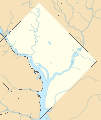
ဖိုင်:USA District of Columbia location map.svg

Size of this PNG preview of this SVG file: ၅၀၅ × ၅၉၉ ပစ်ဇယ်. အခြား ပုံရိပ်ပြတ်သားမှု: ၂၀၂ × ၂၄၀ ပစ်ဇယ် | ၄၀၅ × ၄၈၀ ပစ်ဇယ် | ၆၄၇ × ၇၆၈ ပစ်ဇယ် | ၈၆၃ × ၁၀၂၄ ပစ်ဇယ် | ၁၇၂၆ × ၂၀၄၈ ပစ်ဇယ်။
မူရင်းဖိုင် (SVG ဖိုင်, ၈၀၀ × ၉၄၉ pixels ကို အကြံပြုသည်, ဖိုင်အရွယ်အစား - ၂၇၈ KB)
ဖိုင်မှတ်တမ်း
ဖိုင်ကို ယင်းနေ့စွဲ အတိုင်း မြင်နိုင်ရန် နေ့စွဲ/အချိန် တစ်ခုခုပေါ်တွင် ကလစ်နှိပ်ပါ။
| နေ့စွဲ/အချိန် | နမူနာပုံငယ် | မှတ်တမ်း ဒိုင်မန်းရှင်းများ | အသုံးပြုသူ | မှတ်ချက် | |
|---|---|---|---|---|---|
| ကာလပေါ် | ၁၈:၅၈၊ ၁၆ နိုဝင်ဘာ ၂၀၁၂ |  | ၈၀၀ × ၉၄၉ (၂၇၈ KB) | Alexrk2 | - |
| ၁၈:၅၆၊ ၁၆ နိုဝင်ဘာ ၂၀၁၂ |  | ၈၀၀ × ၉၄၉ (၄၄၈ KB) | Alexrk2 | removed crisp-edges | |
| ၂၂:၃၇၊ ၂၅ ဇန်နဝါရီ ၂၀၁၀ |  | ၈၀၀ × ၉၄၉ (၄၈၂ KB) | Alexrk2 | fixed line width; Kenilworth Park and Aquatic Gardens | |
| ၂၂:၂၃၊ ၂၅ ဇန်နဝါရီ ၂၀၁၀ |  | ၈၀၀ × ၉၄၉ (၄၇၇ KB) | Alexrk2 | == Beschreibung == {{Information |Description= {{de|Positionskarte von District of Columbia, USA}} Quadratische Plattkarte, N-S-Streckung 130.0 %. Geographische Begrenzung der Karte: * N: 39.00° N * S: 38.79° N * |
ဖိုင်သုံးစွဲမှု
အောက်ပါ စာမျက်နှာ သည် ဤဖိုင်ကို အသုံးပြုထားသည်:
ဂလိုဘယ် ဖိုင်သုံးစွဲမှု
အောက်ပါ အခြားဝီကီများတွင် ဤဖိုင်ကို အသုံးပြုထားသည်-
- als.wikipedia.org တွင် အသုံးပြုမှု
- ar.wikipedia.org တွင် အသုံးပြုမှု
- az.wikipedia.org တွင် အသုံးပြုမှု
- bn.wikipedia.org တွင် အသုံးပြုမှု
- ceb.wikipedia.org တွင် အသုံးပြုမှု
- ce.wikipedia.org တွင် အသုံးပြုမှု
- de.wikipedia.org တွင် အသုံးပြုမှု
- Washington Monument
- National Mall
- Vietnam Veterans Memorial
- Smithsonian National Zoological Park
- Washington National Cathedral
- Die Drei Soldaten
- Capital One Arena
- Robert F. Kennedy Memorial Stadium
- Georgetown (Washington, D.C.)
- Adams Memorial
- Watergate-Gebäudekomplex
- Wikipedia:Kartenwerkstatt/Positionskarten/Nordamerika
- Herbert C. Hoover Building
- Korean War Veterans Memorial
- District of Columbia War Memorial
- George Mason Memorial
- Theodore Roosevelt Island
- Nationals Park
- U.S. Department of Agriculture South Building
- U.S. Department of Agriculture Administration Building
- Vorlage:Positionskarte USA District of Columbia
- Kennedy-Warren Apartment Building
- Arlington Memorial Bridge
- Ulysses S. Grant Memorial
- Peace Monument
- Cutts-Madison House
- Old Post Office Pavilion
- Vorlage:Infobox NRHP
- Vorlage:Infobox NRHP/Doku
- Mount Pleasant (Washington, D.C.)
- Ford’s Theatre
- Cosmos Club
- Foggy Bottom
- Commercial National Bank (Washington, D.C.)
- Martin Luther King Jr. Memorial Library
- Dwight D. Eisenhower Memorial
- Folger Shakespeare Library
- Virginia Avenue Tunnel
- The Ellipse
- Audi Field
- St. Elizabeths East Entertainment and Sports Arena
ဤဖိုင်ကို အခြားနေရာများတွင် အသုံးပြုထားမှုများအား ကြည့်ရှုရန်။


