
ဖိုင်:Towada Caldera 3D 2012.jpg

ဤနမူနာ၏ အရွယ်အစား - ၆၃၁ × ၅၉၉ ပစ်ဇယ်။ အခြား ပုံရိပ်ပြတ်သားမှု: ၂၅၃ × ၂၄၀ ပစ်ဇယ် | ၅၀၅ × ၄၈၀ ပစ်ဇယ် | ၈၀၈ × ၇၆၈ ပစ်ဇယ် | ၁၂၀၀ × ၁၁၄၀ ပစ်ဇယ်။
မူရင်းဖိုင် (၁၂၀၀ × ၁၁၄၀ pixels, ဖိုင်အရွယ်အစား - ၈၇၀ KB, MIME အမျိုးအစား image/jpeg)
| ဤဖိုင်သည် Wikimedia Commons မှဖြစ်ပြီး အခြားပရောဂျက်များတွင် သုံးကောင်းသုံးလိမ့်မည်။ ယင်း၏ ဖိုင်အကြောင်းစာမျက်နှာ တွင် ဖော်ပြထားချက်ကို အောက်တွင် ပြထားသည်။ Commons သည် မူပိုင်ခွင့်လွတ်လပ်သော မီဒီယာဖိုင်များ သိုလှောင်ထားရာ နေရာ ဖြစ်သည်။ သင်လည်း ပါဝင်ကူညီနိုင်ပါသည်။ |
အကျဉ်းချုပ်
| ဖော်ပြချက် |
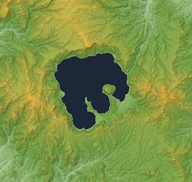
English: Lake Towada and Towada Caldera in the border between Aomori and Akita Prefectures,Honshu, Japan. This file updated by 30m Mesh.
|
| ရက်စွဲ | |
| ရင်းမြစ် |
Topographic data: NASA's SRTM-1 30m Mesh (ver.3 2014) |
| စာရေးသူ | Batholith |
| Object location | | View this and other nearby images on: OpenStreetMap |
|---|
လိုင်စင်သတ်မှတ်ခြင်း
| I, the copyright holder of this work, release this work into the public domain. This applies worldwide. In some countries this may not be legally possible; if so: အကျွန်ုပ်သည် ဤဖန်တီးမှုလက်ရာကို ဥပဒေအရလိုအပ်ခြင်းမရှိသည့် မည်သည့်အခြေအနေမျိုးတွက်မဆို၊ မည်သို့သော ရည်ရွယ်ချက်အတွက်မဆို ၎င်းကို မည်သူမဆို အသုံးပြုပိုင်ခွင့်အား ပေးအပ်သည်။ |
This image uses high-resolution digital topography data from NASA's Shuttle Radar Topography Mission (SRTM) at JPL-Caltech [1]. It is in the public domain in the United States.
|
 | |
ဖိုင်မှတ်တမ်း
ဖိုင်ကို ယင်းနေ့စွဲ အတိုင်း မြင်နိုင်ရန် နေ့စွဲ/အချိန် တစ်ခုခုပေါ်တွင် ကလစ်နှိပ်ပါ။
| နေ့စွဲ/အချိန် | နမူနာပုံငယ် | မှတ်တမ်း ဒိုင်မန်းရှင်းများ | အသုံးပြုသူ | မှတ်ချက် | |
|---|---|---|---|---|---|
| ကာလပေါ် | ၀၃:၃၅၊ ၂၈ ဖေဖော်ဝါရီ ၂၀၁၆ | | ၁၂၀၀ × ၁၁၄၀ (၈၇၀ KB) | Batholith | This file updated to 30m Mesh (SRTM-1 Ver3 2014). |
| ၁၆:၂၅၊ ၉ နိုဝင်ဘာ ၂၀၁၂ |  | ၄၀၀ × ၃၈၀ (၁၁၅ KB) | Batholith | == {{int:filedesc}} == {{Information |description= {{en|Lake Towada, Aomori Prefecture, Japan.}} {{ja|青森県の十和田湖および十和田カル�... |
ဖိုင်သုံးစွဲမှု
အောက်ပါ စာမျက်နှာ သည် ဤဖိုင်ကို အသုံးပြုထားသည်:
ဂလိုဘယ် ဖိုင်သုံးစွဲမှု
အောက်ပါ အခြားဝီကီများတွင် ဤဖိုင်ကို အသုံးပြုထားသည်-
- en.wikipedia.org တွင် အသုံးပြုမှု
- es.wikipedia.org တွင် အသုံးပြုမှု
- id.wikipedia.org တွင် အသုံးပြုမှု
- ja.wikipedia.org တွင် အသုံးပြုမှု
- simple.wikipedia.org တွင် အသုံးပြုမှု
- www.wikidata.org တွင် အသုံးပြုမှု
- zh.wikipedia.org တွင် အသုံးပြုမှု