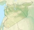
ဖိုင်:Syria physical location map.svg

Size of this PNG preview of this SVG file: ၆၈၅ × ၅၉၉ ပစ်ဇယ်. အခြား ပုံရိပ်ပြတ်သားမှု: ၂၇၄ × ၂၄၀ ပစ်ဇယ် | ၅၄၉ × ၄၈၀ ပစ်ဇယ် | ၈၇၈ × ၇၆၈ ပစ်ဇယ် | ၁၁၇၀ × ၁၀၂၄ ပစ်ဇယ် | ၂၃၄၀ × ၂၀၄၈ ပစ်ဇယ် | ၉၂၁ × ၈၀၆ ပစ်ဇယ်။
မူရင်းဖိုင် (SVG ဖိုင်, ၉၂၁ × ၈၀၆ pixels ကို အကြံပြုသည်, ဖိုင်အရွယ်အစား - ၉၇၂ KB)
ဖိုင်မှတ်တမ်း
ဖိုင်ကို ယင်းနေ့စွဲ အတိုင်း မြင်နိုင်ရန် နေ့စွဲ/အချိန် တစ်ခုခုပေါ်တွင် ကလစ်နှိပ်ပါ။
| နေ့စွဲ/အချိန် | နမူနာပုံငယ် | မှတ်တမ်း ဒိုင်မန်းရှင်းများ | အသုံးပြုသူ | မှတ်ချက် | |
|---|---|---|---|---|---|
| ကာလပေါ် | ၁၄:၀၇၊ ၁၈ နိုဝင်ဘာ ၂၀၂၂ |  | ၉၂၁ × ၈၀၆ (၉၇၂ KB) | GrandEscogriffe | more correct N/S stretching |
| ၂၀:၄၀၊ ၂၃ ဇူလိုင် ၂၀၁၂ |  | ၉၂၁ × ၇၆၁ (၇၈၈ KB) | NordNordWest | == {{int:filedesc}} == {{Information |Description={{de|Physische Positionskarte von Syrien. De-facto-Situation.}} Quadratische Plattkarte, N-S-Streckung 115 %. Geographische Begrenzung der Karte: * N: 37.6° N * S: 32.0° N * W: 34.9... |
ဖိုင်သုံးစွဲမှု
အောက်ပါ စာမျက်နှာ သည် ဤဖိုင်ကို အသုံးပြုထားသည်:
ဂလိုဘယ် ဖိုင်သုံးစွဲမှု
အောက်ပါ အခြားဝီကီများတွင် ဤဖိုင်ကို အသုံးပြုထားသည်-
- als.wikipedia.org တွင် အသုံးပြုမှု
- ar.wikipedia.org တွင် အသုံးပြုမှု
- نهر السن
- بلودان
- الزبداني
- قالب:خريطة مواقع سوريا
- زلزال حلب (1138)
- بحيرة زرزر
- بحيرة قطينة
- مضايا
- زلزال حماة 1157
- وحدة:Location map/data/Syria
- مستخدم:عبد المؤمن/مسودات/خرائط/الشام
- قائمة الصحفيين القتلى في سوريا
- وحدة:Location map/data/Syria/شرح
- الشعيطات
- الخط الزمني للحرب الأهلية السورية (سبتمبر–ديسمبر 2019)
- الخط الزمني للحرب الأهلية السورية (يناير–أبريل 2020)
- الأغاني الحورية
- رقية حسن محمد
- الانتخابات المحلية في الإدارة الذاتية لشمال وشرق سوريا 2015
- الخط الزمني للحرب الأهلية السورية (2022)
- زلزال قهرمان مرعش 2023
- زلزال حلب 1822
- زلزال سوريا 1170
- زلزال سوريا 1344
- زلزال اللاذقية 1796
- زلزال سوريا 1202
- زلزال الساحل السوري 859
- زلزال أنطاكية 526
- زلزال أميك 1872
- arz.wikipedia.org တွင် အသုံးပြုမှု
- ast.wikipedia.org တွင် အသုံးပြုမှု
- av.wikipedia.org တွင် အသုံးပြုမှု
- azb.wikipedia.org တွင် အသုံးပြုမှု
- az.wikipedia.org တွင် အသုံးပြုမှု
- ba.wikipedia.org တွင် အသုံးပြုမှု
ဤဖိုင်ကို အခြားနေရာများတွင် အသုံးပြုထားမှုများအား ကြည့်ရှုရန်။

