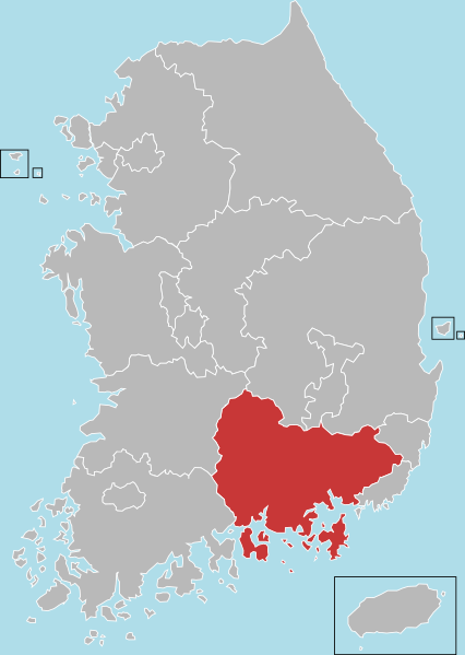
ဖိုင်:South Korea-South Gyeongsang.svg
ပုံပန်းသွင်ပြင်

Size of this PNG preview of this SVG file: ၄၂၆ × ၅၉၉ ပစ်ဇယ်. အခြား ပုံရိပ်ပြတ်သားမှု: ၁၇၀ × ၂၄၀ ပစ်ဇယ် | ၃၄၁ × ၄၈၀ ပစ်ဇယ် | ၅၄၆ × ၇၆၈ ပစ်ဇယ် | ၇၂၈ × ၁၀၂၄ ပစ်ဇယ် | ၁၄၅၆ × ၂၀၄၈ ပစ်ဇယ် | ၅၀၉ × ၇၁၆ ပစ်ဇယ်။
မူရင်းဖိုင် (SVG ဖိုင်, ၅၀၉ × ၇၁၆ pixels ကို အကြံပြုသည်, ဖိုင်အရွယ်အစား - ၅၉ KB)
ဖိုင်မှတ်တမ်း
ဖိုင်ကို ယင်းနေ့စွဲ အတိုင်း မြင်နိုင်ရန် နေ့စွဲ/အချိန် တစ်ခုခုပေါ်တွင် ကလစ်နှိပ်ပါ။
| နေ့စွဲ/အချိန် | နမူနာပုံငယ် | မှတ်တမ်း ဒိုင်မန်းရှင်းများ | အသုံးပြုသူ | မှတ်ချက် | |
|---|---|---|---|---|---|
| ကာလပေါ် | ၀၄:၃၆၊ ၄ ဇူလိုင် ၂၀၂၃ |  | ၅၀၉ × ၇၁၆ (၅၉ KB) | Nv7801 | First class administrative division change. |
| ၁၁:၀၂၊ ၇ ဖေဖော်ဝါရီ ၂၀၁၃ |  | ၅၀၉ × ၇၁၆ (၅၆ KB) | ASDFGH | == {{int:filedesc}} == {{Information |Description={{en|Locator map of South Gyeongsang}} |Source=File:Administrative divisions map of South Korea.svg (Dmthoth) |Author=Dmthoth |Date=2013-02-07 |Permission= |other_... |
ဖိုင်သုံးစွဲမှု
အောက်ပါ စာမျက်နှာ သည် ဤဖိုင်ကို အသုံးပြုထားသည်:
ဂလိုဘယ် ဖိုင်သုံးစွဲမှု
အောက်ပါ အခြားဝီကီများတွင် ဤဖိုင်ကို အသုံးပြုထားသည်-
- ar.wikipedia.org တွင် အသုံးပြုမှု
- cdo.wikipedia.org တွင် အသုံးပြုမှု
- cs.wikipedia.org တွင် အသုံးပြုမှု
- en.wikipedia.org တွင် အသုံးပြုမှု
- South Gyeongsang Province
- Jinhae District
- Changwon
- Geoje
- Gimhae
- Jinju
- Miryang
- Sacheon
- Tongyeong
- Yangsan
- Changnyeong County
- Geochang County
- Goseong County, South Gyeongsang
- Hadong County
- Haman County
- Hapcheon County
- Hamyang County
- Namhae County
- Sancheong County
- Uiryeong County
- Template:South Gyeongsang
- Uichang District
- Seongsan District
- Masanhoewon District
- Masanhappo District
- Hwawangsan
- User:Jsyjj92/sandbox
- User:Zsj.engl300/sandbox
- List of cities and counties of South Gyeongsang Province
- en.wikivoyage.org တွင် အသုံးပြုမှု
ဤဖိုင်ကို အခြားနေရာများတွင် အသုံးပြုထားမှုများအား ကြည့်ရှုရန်။

