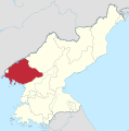
ဖိုင်:Pyonganbuk-do in North Korea 2010.svg
အခြားဘာသာစကားများဖြင့် စာမျက်နှာအကြောင်းအရာများကို ပံ့ပိုးမထားပါ။
ကိရိယာများ
ဆောင်ရွက်ချက်များ
ယေဘုယျ
အခြား ပရောဂျက်များတွင်
ပုံပန်းသွင်ပြင်

Size of this PNG preview of this SVG file: ၅၉၆ × ၆၀၀ ပစ်ဇယ်. အခြား ပုံရိပ်ပြတ်သားမှု: ၂၃၉ × ၂၄၀ ပစ်ဇယ် | ၄၇၇ × ၄၈၀ ပစ်ဇယ် | ၇၆၃ × ၇၆၈ ပစ်ဇယ် | ၁၀၁၈ × ၁၀၂၄ ပစ်ဇယ် | ၂၀၃၅ × ၂၀၄၈ ပစ်ဇယ် | ၁၆၀၆ × ၁၆၁၆ ပစ်ဇယ်။
မူရင်းဖိုင် (SVG ဖိုင်, ၁၆၀၆ × ၁၆၁၆ pixels ကို အကြံပြုသည်, ဖိုင်အရွယ်အစား - ၃၂၂ KB)
| ဤဖိုင်သည် Wikimedia Commons မှဖြစ်ပြီး အခြားပရောဂျက်များတွင် သုံးကောင်းသုံးလိမ့်မည်။ ယင်း၏ ဖိုင်အကြောင်းစာမျက်နှာ တွင် ဖော်ပြထားချက်ကို အောက်တွင် ပြထားသည်။ Commons သည် မူပိုင်ခွင့်လွတ်လပ်သော မီဒီယာဖိုင်များ သိုလှောင်ထားရာ နေရာ ဖြစ်သည်။ သင်လည်း ပါဝင်ကူညီနိုင်ပါသည်။ |
အကျဉ်းချုပ်
This map was improved or created by the Wikigraphists of the Graphic Lab (it). You can propose images to clean up, improve, create or translate as well. |
လိုင်စင်သတ်မှတ်ခြင်း
ဤဖိုင်ကို Creative Commons Attribution-Share Alike 3.0 Unported လိုင်စင်ဖြင့် သတ်မှတ်ထားသည်။
- သင်သည် လွတ်လပ်စွာ:
- မျှဝေရန် – ဖန်တီးမှုကို ကူးယူရန်၊ ဖြန့်ဖြူးရန်နှင့် ထုတ်လွှင့်ရန်
- ပြန်ရောနှောရန် – ဖန်တီးမှုကို ပြင်ဆင်ညှိနှိုင်းရန်
- အောက်ပါ အခြေအနေများတွင်:
- မှတ်ယူနိုင်ခြင်း – ပြောင်းလဲမှုများ ပြုလုပ်ခဲ့ပါက ဖန်တီးသူ သို့မဟုတ် လိုင်စင်ရှိသူမှ သတ်မှတ်သော အမျိုးအစားကို လိုက်နာရမည် (ဆိုလိုသည်မှာ သင့်အား သို့မဟုတ် သင့်ဖန်တီးမှုတွင် အသုံးပြုခြင်းအား ထောက်ခံချက်ပေးသည်ဟု မဆိုလိုပါ)။
- ထပ်တူမျှဝေ – ဤဖန်တီးမှုအား ပြင်ဆင်ခြင်း၊ ပြောင်းလဲခြင်း သို့မဟုတ် ထပ်ဆင့် ဖန်တီးခြင်း ပြုလုပ်ပါက ရရှိလာသော ဖန်တီးမှုကို ဤဖန်တီးမှုနှင့် သို့မဟုတ် ဆင်တူသော လိုင်စင်ဖြင့်သာ ဖြန့်ချိသင့်သည်။
ပုံစာများ
ဤဖိုင်၏ဆိုလိုရင်းကို စာတစ်ကြောင်းရှင်းလင်းချက်ဖြင့် ထည့်သွင်းရန်
Items portrayed in this file
depicts အင်္ဂလိပ်
copyrighted အင်္ဂလိပ်
၈ စက်တင်ဘာ 2015
ဖိုင်မှတ်တမ်း
ဖိုင်ကို ယင်းနေ့စွဲ အတိုင်း မြင်နိုင်ရန် နေ့စွဲ/အချိန် တစ်ခုခုပေါ်တွင် ကလစ်နှိပ်ပါ။
| နေ့စွဲ/အချိန် | နမူနာပုံငယ် | မှတ်တမ်း ဒိုင်မန်းရှင်းများ | အသုံးပြုသူ | မှတ်ချက် | |
|---|---|---|---|---|---|
| ကာလပေါ် | ၁၂:၀၁၊ ၂၂ စက်တင်ဘာ ၂၀၁၅ |  | ၁၆၀၆ × ၁၆၁၆ (၃၂၂ KB) | Ruthven | Nampho extension south of Taedong River was missing. |
| ၁၁:၅၉၊ ၂၂ စက်တင်ဘာ ၂၀၁၅ |  | ၁၆၀၆ × ၁၆၁၆ (၃၂၁ KB) | Ruthven | adding special administrative regions of Kaesŏng, Kŭmgangsan, and Sinŭiju | |
| ၁၀:၄၂၊ ၉ စက်တင်ဘာ ၂၀၁၅ |  | ၁၆၀၆ × ၁၆၁၆ (၃၁၅ KB) | Ruthven | User created page with UploadWizard |
ဖိုင်သုံးစွဲမှု
အောက်ပါ စာမျက်နှာ သည် ဤဖိုင်ကို အသုံးပြုထားသည်:
ဂလိုဘယ် ဖိုင်သုံးစွဲမှု
အောက်ပါ အခြားဝီကီများတွင် ဤဖိုင်ကို အသုံးပြုထားသည်-
- ar.wikipedia.org တွင် အသုံးပြုမှု
- be.wikipedia.org တွင် အသုံးပြုမှု
- bg.wikipedia.org တွင် အသုံးပြုမှု
- ca.wikipedia.org တွင် အသုံးပြုမှု
- el.wikipedia.org တွင် အသုံးပြုမှု
- eo.wikipedia.org တွင် အသုံးပြုမှု
- es.wikipedia.org တွင် အသုံးပြုမှု
- it.wikipedia.org တွင် အသုံးပြုမှု
- ja.wikipedia.org တွင် အသုံးပြုမှု
- pt.wikipedia.org တွင် အသုံးပြုမှု
- uk.wikipedia.org တွင် အသုံးပြုမှု
- www.wikidata.org တွင် အသုံးပြုမှု
မီတာဒေတာ
ဤဖိုင်တွင် သတင်းအချက်အလက် အပိုများ ပါဝင်သည်။ ဒီဂျစ်တယ် ကင်မရာ သို့ စကင်နာများက ထည့်ပေါင်းပေးလိုက်ခြင်း ဖြစ်ကောင်းဖြစ်မည်။
အကယ်၍ ဖိုင်ကို မူရင်းအခြေအနေမှ ပြုပြင်လိုက်ပါက အသေးစိတ်အချို့သည် ပြုပြင်ထားသောဖိုင်တွင် အပြည့်အစုံ ပြန်ပါလာမည်မဟုတ်။
| အကျယ် | 1606.276px |
|---|---|
| အမြင့် | 1615.731px |


