
ဖိုင်:Pakistan location map2.svg

Size of this PNG preview of this SVG file: ၇၅၀ × ၅၉၉ ပစ်ဇယ်. အခြား ပုံရိပ်ပြတ်သားမှု: ၃၀၀ × ၂၄၀ ပစ်ဇယ် | ၆၀၁ × ၄၈၀ ပစ်ဇယ် | ၉၆၁ × ၇၆၈ ပစ်ဇယ် | ၁၂၈၀ × ၁၀၂၃ ပစ်ဇယ် | ၂၅၆၀ × ၂၀၄၆ ပစ်ဇယ် | ၂၃၆၂ × ၁၈၈၈ ပစ်ဇယ်။
မူရင်းဖိုင် (SVG ဖိုင်, ၂၃၆၂ × ၁၈၈၈ pixels ကို အကြံပြုသည်, ဖိုင်အရွယ်အစား - ၁.၃၉ MB)
| ဤဖိုင်သည် Wikimedia Commons မှဖြစ်ပြီး အခြားပရောဂျက်များတွင် သုံးကောင်းသုံးလိမ့်မည်။ ယင်း၏ ဖိုင်အကြောင်းစာမျက်နှာ တွင် ဖော်ပြထားချက်ကို အောက်တွင် ပြထားသည်။ Commons သည် မူပိုင်ခွင့်လွတ်လပ်သော မီဒီယာဖိုင်များ သိုလှောင်ထားရာ နေရာ ဖြစ်သည်။ သင်လည်း ပါဝင်ကူညီနိုင်ပါသည်။ |
အကျဉ်းချုပ်
| ဖော်ပြချက် |
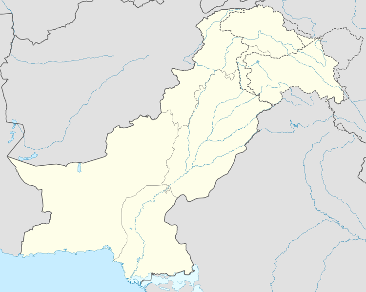
Deutsch: Positionskarte von Pakistan
Quadratische Plattkarte, N-S-Streckung 115 %. Geographische Begrenzung der Karte:
English: Location map of Pakistan
Equirectangular projection, N/S stretching 115 %. Geographic limits of the map:
|
| ရက်စွဲ | |
| ရင်းမြစ် |
own work, using
|
| စာရေးသူ | NordNordWest |
| ခွင့်ပြုချက် (ဤဖိုင်ကို ပြန်လည်အသုံးပြုခြင်း) |
ဤဖိုင်သည် Creative Commons Attribution-Share Alike 3.0 ဂျာမနီ လိုင်စင်အောက်တွင် လိုင်စင်သတ်မှတ်ထားပါသည်။
 |
| အခြား ဗားရှင်းများ |
|


|
This map has been made or improved in the German Kartenwerkstatt (Map Lab). You can propose maps to improve as well.
|
ဖိုင်မှတ်တမ်း
ဖိုင်ကို ယင်းနေ့စွဲ အတိုင်း မြင်နိုင်ရန် နေ့စွဲ/အချိန် တစ်ခုခုပေါ်တွင် ကလစ်နှိပ်ပါ။
| နေ့စွဲ/အချိန် | နမူနာပုံငယ် | မှတ်တမ်း ဒိုင်မန်းရှင်းများ | အသုံးပြုသူ | မှတ်ချက် | |
|---|---|---|---|---|---|
| ကာလပေါ် | ၀၈:၄၁၊ ၁ ဇွန် ၂၀၂၀ | | ၂၃၆၂ × ၁၈၈၈ (၁.၃၉ MB) | NordNordWest | c |
| ၁၇:၃၇၊ ၄ ဇူလိုင် ၂၀၁၅ |  | ၂၃၆၂ × ၁၈၈၈ (၁.၄၂ MB) | NordNordWest | == {{int:filedesc}} == {{Information |Description= {{de|Positionskarte von Pakistan}} Quadratische Plattkarte, N-S-Streckung 115 %. Geographische Begrenzung der Karte: * N: 37.3° N * S: 23.4° N * W: 60.5° O * O: 80.5° O {{en|Locati... |
ဖိုင်သုံးစွဲမှု
အောက်ပါ စာမျက်နှာ သည် ဤဖိုင်ကို အသုံးပြုထားသည်:
ဂလိုဘယ် ဖိုင်သုံးစွဲမှု
အောက်ပါ အခြားဝီကီများတွင် ဤဖိုင်ကို အသုံးပြုထားသည်-
- am.wikipedia.org တွင် အသုံးပြုမှု
- arz.wikipedia.org တွင် အသုံးပြုမှု
- az.wikipedia.org တွင် အသုံးပြုမှု
- ba.wikipedia.org တွင် အသုံးပြုမှု
- be-tarask.wikipedia.org တွင် အသုံးပြုမှု
- be.wikipedia.org တွင် အသုံးပြုမှု
- bn.wikipedia.org တွင် အသုံးပြုမှု
- ceb.wikipedia.org တွင် အသုံးပြုမှု
- da.wikipedia.org တွင် အသုံးပြုမှု
- el.wikipedia.org တွင် အသုံးပြုမှု
- en.wikipedia.org တွင် အသုံးပြုမှု
- eo.wikipedia.org တွင် အသုံးပြုမှု
- eu.wikipedia.org တွင် အသုံးပြုမှု
- fi.wikipedia.org တွင် အသုံးပြုမှု
- fo.wikipedia.org တွင် အသုံးပြုမှု
ဤဖိုင်ကို အခြားနေရာများတွင် အသုံးပြုထားမှုများအား ကြည့်ရှုရန်။