
ဖိုင်:Norway location map.svg

Size of this PNG preview of this SVG file: ၅၆၄ × ၅၉၉ ပစ်ဇယ်. အခြား ပုံရိပ်ပြတ်သားမှု: ၂၂၆ × ၂၄၀ ပစ်ဇယ် | ၄၅၂ × ၄၈၀ ပစ်ဇယ် | ၇၂၃ × ၇၆၈ ပစ်ဇယ် | ၉၆၄ × ၁၀၂၄ ပစ်ဇယ် | ၁၉၂၈ × ၂၀၄၈ ပစ်ဇယ် | ၂၂၁၅ × ၂၃၅၃ ပစ်ဇယ်။
မူရင်းဖိုင် (SVG ဖိုင်, ၂၂၁၅ × ၂၃၅၃ pixels ကို အကြံပြုသည်, ဖိုင်အရွယ်အစား - ၁.၃၂ MB)
| ဤဖိုင်သည် Wikimedia Commons မှဖြစ်ပြီး အခြားပရောဂျက်များတွင် သုံးကောင်းသုံးလိမ့်မည်။ ယင်း၏ ဖိုင်အကြောင်းစာမျက်နှာ တွင် ဖော်ပြထားချက်ကို အောက်တွင် ပြထားသည်။ Commons သည် မူပိုင်ခွင့်လွတ်လပ်သော မီဒီယာဖိုင်များ သိုလှောင်ထားရာ နေရာ ဖြစ်သည်။ သင်လည်း ပါဝင်ကူညီနိုင်ပါသည်။ |
အကျဉ်းချုပ်
| ဖော်ပြချက် |
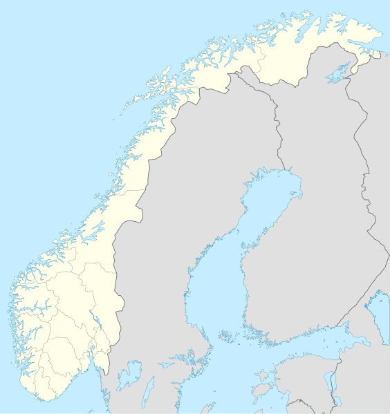
Deutsch: Positionskarte von Norwegen
Quadratische Plattkarte, N-S-Streckung 210 %. Geographische Begrenzung der Karte:
English: Location map of Norway
Equirectangular projection, N/S stretching 210 %. Geographic limits of the map:
|
| ရက်စွဲ | |
| ရင်းမြစ် |
own work, using
|
| စာရေးသူ | NordNordWest |
| အခြား ဗားရှင်းများ | Derivative works of this file: Regenbogen location map.svg |

|
This map has been made or improved in the German Kartenwerkstatt (Map Lab). You can propose maps to improve as well.
|
လိုင်စင်သတ်မှတ်ခြင်း
ကျွန်ုပ်၊ ဤလုပ်ဆောင်ချက်၏ မူပိုင်ခွင့်ပိုင်ရှင်အနေဖြင့် ဤနေရာမှ အောက်ပါလိုင်စင်များအောက်တွင် ထုတ်လွှင့်ပါသည်:

|
ဤစာတမ်းကို GNU Free Documentation License, ဗားရှင်း ၁.၂ သို့မဟုတ် Free Software Foundation မှ ဖြန့်ချီထားသော မည်သည့်ယခင်ဗားရှင်းတစ်ခုခုအောက်တွင် Invariant Sections, Front-Cover Texts နှင့် Back-Cover Texts များမပါဝင်ဘဲ ကူးယူခြင်း၊ ဖြန့်ချီခြင်း နှင့်/သို့မဟုတ် ပြင်ဆင်ပြောင်းလဲနိုင်ရန် ခွင့်ပြုသည်။ လိုင်စင်မူပွားကို GNU Free Documentation License ခေါင်းစဉ်အောက်တွင် ထည့်သွင်းထားသည်။ |
ဤဖိုင်ကို Creative Commons Attribution-Share Alike 3.0 Unported လိုင်စင်ဖြင့် သတ်မှတ်ထားသည်။
- သင်သည် လွတ်လပ်စွာ:
- မျှဝေရန် – ဖန်တီးမှုကို ကူးယူရန်၊ ဖြန့်ဖြူးရန်နှင့် ထုတ်လွှင့်ရန်
- ပြန်ရောနှောရန် – ဖန်တီးမှုကို ပြင်ဆင်ညှိနှိုင်းရန်
- အောက်ပါ အခြေအနေများတွင်:
- မှတ်ယူနိုင်ခြင်း – ပြောင်းလဲမှုများ ပြုလုပ်ခဲ့ပါက ဖန်တီးသူ သို့မဟုတ် လိုင်စင်ရှိသူမှ သတ်မှတ်သော အမျိုးအစားကို လိုက်နာရမည် (ဆိုလိုသည်မှာ သင့်အား သို့မဟုတ် သင့်ဖန်တီးမှုတွင် အသုံးပြုခြင်းအား ထောက်ခံချက်ပေးသည်ဟု မဆိုလိုပါ)။
- ထပ်တူမျှဝေ – ဤဖန်တီးမှုအား ပြင်ဆင်ခြင်း၊ ပြောင်းလဲခြင်း သို့မဟုတ် ထပ်ဆင့် ဖန်တီးခြင်း ပြုလုပ်ပါက ရရှိလာသော ဖန်တီးမှုကို ဤဖန်တီးမှုနှင့် သို့မဟုတ် ဆင်တူသော လိုင်စင်ဖြင့်သာ ဖြန့်ချိသင့်သည်။
သင်အလိုရှိရာ လိုင်စင်ကို ရွေးချယ်နိုင်ပါသည်။
ဖိုင်မှတ်တမ်း
ဖိုင်ကို ယင်းနေ့စွဲ အတိုင်း မြင်နိုင်ရန် နေ့စွဲ/အချိန် တစ်ခုခုပေါ်တွင် ကလစ်နှိပ်ပါ။
| နေ့စွဲ/အချိန် | နမူနာပုံငယ် | မှတ်တမ်း ဒိုင်မန်းရှင်းများ | အသုံးပြုသူ | မှတ်ချက် | |
|---|---|---|---|---|---|
| ကာလပေါ် | ၂၀:၅၉၊ ၃၀ ဒီဇင်ဘာ ၂၀၁၇ | | ၂၂၁၅ × ၂၃၅၃ (၁.၃၂ MB) | NordNordWest | upd |
| ၂၀:၂၆၊ ၂၅ အောက်တိုဘာ ၂၀၀၈ |  | ၂၂၁၅ × ၂၃၅၃ (၂.၁၂ MB) | NordNordWest | corrected | |
| ၀၇:၅၆၊ ၂၉ ဩဂုတ် ၂၀၀၈ |  | ၂၂၁၅ × ၂၃၅၁ (၂.၁၂ MB) | NordNordWest | ||
| ၂၀:၁၂၊ ၂၈ ဇူလိုင် ၂၀၀၈ |  | ၂၂၁၄ × ၂၃၅၁ (၁.၈၁ MB) | NordNordWest | some corrections | |
| ၁၉:၄၇၊ ၂၈ ဇူလိုင် ၂၀၀၈ |  | ၂၂၁၄ × ၂၃၅၁ (၁.၈၁ MB) | NordNordWest | {{Information |Description= {{de|Positionskarte der Norwegen}} Quadratische Plattkarte, N-S-Streckung 210 %. Geographische Begrenzung der Karte: * N: 71.5° N * S: 57.6° N * W: 4.1° O * O: 31.6° O {{en|Location map of [[:en:Norway|Norw |
ဖိုင်သုံးစွဲမှု
အောက်ပါ 7 စာမျက်နှာများ သည် ဤဖိုင်ကို အသုံးပြုထားသည်:
ဂလိုဘယ် ဖိုင်သုံးစွဲမှု
အောက်ပါ အခြားဝီကီများတွင် ဤဖိုင်ကို အသုံးပြုထားသည်-
- af.wikipedia.org တွင် အသုံးပြုမှု
- als.wikipedia.org တွင် အသုံးပြုမှု
- an.wikipedia.org တွင် အသုံးပြုမှု
- ar.wikipedia.org တွင် အသုံးပြုမှု
- ast.wikipedia.org တွင် အသုံးပြုမှု
- Estrechu de Skagerrak
- Mar del Norte
- Oslu
- Kinnarodden
- Cabu Norte
- Fiordu de Trondheim
- Fiordu de Bøk
- Fiordu de Geiranger
- Fiordu de Nærøy
- Ríu Tana
- Península Escandinava
- Bergen
- Trondheim
- Ópera d'Oslu
- Fiordu d'Oslu
- Edificiu del Storting
- Ramnefjellsfossen
- Mongefossen
- Kjelfossen
- Knivskjelodden
- Magerøyá
- Palaciu Real d'Oslu
- Catedral de Nidaros
- Bolsa d'Oslu
- Módulu:Mapa de llocalización/datos/Noruega
- Módulu:Mapa de llocalización/datos/Noruega/usu
- Haraldshaugen
- Sverd i fjell
- Aeropuertu d'Alta
- Aeropuertu d'Andøyá-Andenes
- Aeropuertu de Bardufoss
ဤဖိုင်ကို အခြားနေရာများတွင် အသုံးပြုထားမှုများအား ကြည့်ရှုရန်။