
ဖိုင်:New Zealand relief map.jpg

ဤနမူနာ၏ အရွယ်အစား - ၄၇၅ × ၅၉၉ ပစ်ဇယ်။ အခြား ပုံရိပ်ပြတ်သားမှု: ၁၉၀ × ၂၄၀ ပစ်ဇယ် | ၃၈၀ × ၄၈၀ ပစ်ဇယ် | ၆၀၉ × ၇၆၈ ပစ်ဇယ် | ၁၂၀၀ × ၁၅၁၄ ပစ်ဇယ်။
မူရင်းဖိုင် (၁၂၀၀ × ၁၅၁၄ pixels, ဖိုင်အရွယ်အစား - ၁၈၅ KB, MIME အမျိုးအစား image/jpeg)
| ဤဖိုင်သည် Wikimedia Commons မှဖြစ်ပြီး အခြားပရောဂျက်များတွင် သုံးကောင်းသုံးလိမ့်မည်။ ယင်း၏ ဖိုင်အကြောင်းစာမျက်နှာ တွင် ဖော်ပြထားချက်ကို အောက်တွင် ပြထားသည်။ Commons သည် မူပိုင်ခွင့်လွတ်လပ်သော မီဒီယာဖိုင်များ သိုလှောင်ထားရာ နေရာ ဖြစ်သည်။ သင်လည်း ပါဝင်ကူညီနိုင်ပါသည်။ |
အကျဉ်းချုပ်
| ဖော်ပြချက် |
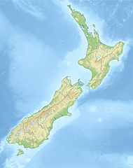
Deutsch: Positionskarte von Neuseeland
Quadratische Plattkarte, N-S-Streckung 120 %. Geographische Begrenzung der Karte: * N: 34.0° S * S: 48.3° S * W: 165.8° O * O: 179.4° O English: Location map of New Zealand
Equirectangular projection, N/S stretching 120 %. Geographic limits of the map: * N: 34.0° S * S: 48.3° S * W: 165.8° E * E: 179.4° E |
| ရက်စွဲ | (UTC) |
| ရင်းမြစ် |
|
| စာရေးသူ |
|
| အခြား ဗားရှင်းများ |
Derivative works of this file: |
| This is a retouched picture, which means that it has been digitally altered from its original version. The original can be viewed here: New Zealand location map.svg:
|
လိုင်စင်သတ်မှတ်ခြင်း
ကျွန်ုပ်၊ ဤလုပ်ဆောင်ချက်၏ မူပိုင်ခွင့်ပိုင်ရှင်အနေဖြင့် ဤနေရာမှ အောက်ပါလိုင်စင်များအောက်တွင် ထုတ်လွှင့်ပါသည်:
ဤဖိုင်ကို Creative Commons Attribution-Share Alike 3.0 Unported လိုင်စင်ဖြင့် သတ်မှတ်ထားသည်။
- သင်သည် လွတ်လပ်စွာ:
- မျှဝေရန် – ဖန်တီးမှုကို ကူးယူရန်၊ ဖြန့်ဖြူးရန်နှင့် ထုတ်လွှင့်ရန်
- ပြန်ရောနှောရန် – ဖန်တီးမှုကို ပြင်ဆင်ညှိနှိုင်းရန်
- အောက်ပါ အခြေအနေများတွင်:
- မှတ်ယူနိုင်ခြင်း – ပြောင်းလဲမှုများ ပြုလုပ်ခဲ့ပါက ဖန်တီးသူ သို့မဟုတ် လိုင်စင်ရှိသူမှ သတ်မှတ်သော အမျိုးအစားကို လိုက်နာရမည် (ဆိုလိုသည်မှာ သင့်အား သို့မဟုတ် သင့်ဖန်တီးမှုတွင် အသုံးပြုခြင်းအား ထောက်ခံချက်ပေးသည်ဟု မဆိုလိုပါ)။
- ထပ်တူမျှဝေ – ဤဖန်တီးမှုအား ပြင်ဆင်ခြင်း၊ ပြောင်းလဲခြင်း သို့မဟုတ် ထပ်ဆင့် ဖန်တီးခြင်း ပြုလုပ်ပါက ရရှိလာသော ဖန်တီးမှုကို ဤဖန်တီးမှုနှင့် သို့မဟုတ် ဆင်တူသော လိုင်စင်ဖြင့်သာ ဖြန့်ချိသင့်သည်။

|
ဤစာတမ်းကို GNU Free Documentation License, ဗားရှင်း ၁.၂ သို့မဟုတ် Free Software Foundation မှ ဖြန့်ချီထားသော မည်သည့်ယခင်ဗားရှင်းတစ်ခုခုအောက်တွင် Invariant Sections, Front-Cover Texts နှင့် Back-Cover Texts များမပါဝင်ဘဲ ကူးယူခြင်း၊ ဖြန့်ချီခြင်း နှင့်/သို့မဟုတ် ပြင်ဆင်ပြောင်းလဲနိုင်ရန် ခွင့်ပြုသည်။ လိုင်စင်မူပွားကို GNU Free Documentation License ခေါင်းစဉ်အောက်တွင် ထည့်သွင်းထားသည်။ |
သင်အလိုရှိရာ လိုင်စင်ကို ရွေးချယ်နိုင်ပါသည်။
မူရင်းတင်ထားသောမှတ်တမ်း
This image is a derivative work of the following images:
- File:New_Zealand_location_map.svg licensed with Cc-by-sa-3.0, GFDL
- 2009-08-13T17:15:46Z NordNordWest 1928x2432 (385078 Bytes) '
- 2008-09-02T20:22:10Z NordNordWest 1928x2432 (385116 Bytes) {{Information |Description= {{de|Positionskarte von [[:de:Neuseeland|Neuseeland]]}} Quadratische Plattkarte, N-S-Streckung 120 %. Geographische Begrenzung der Karte: * N: 34.0° S * S: 48.3° S * W: 165.8° O * O: 179.4° O {
Uploaded with derivativeFX
ဖိုင်မှတ်တမ်း
ဖိုင်ကို ယင်းနေ့စွဲ အတိုင်း မြင်နိုင်ရန် နေ့စွဲ/အချိန် တစ်ခုခုပေါ်တွင် ကလစ်နှိပ်ပါ။
| နေ့စွဲ/အချိန် | နမူနာပုံငယ် | မှတ်တမ်း ဒိုင်မန်းရှင်းများ | အသုံးပြုသူ | မှတ်ချက် | |
|---|---|---|---|---|---|
| ကာလပေါ် | ၁၃:၄၅၊ ၂၀ အောက်တိုဘာ ၂၀၁၀ | | ၁၂၀၀ × ၁၅၁၄ (၁၈၅ KB) | Виктор В | {{Information |Description={{de|Positionskarte von Neuseeland}} Quadratische Plattkarte, N-S-Streckung 120 %. Geographische Begrenzung der Karte: * N: 34.0° S * S: 48.3° S * W: 165.8° O * O: 179.4° O {{en|Location map of [[:en:New |
ဖိုင်သုံးစွဲမှု
အောက်ပါ စာမျက်နှာ သည် ဤဖိုင်ကို အသုံးပြုထားသည်:
ဂလိုဘယ် ဖိုင်သုံးစွဲမှု
အောက်ပါ အခြားဝီကီများတွင် ဤဖိုင်ကို အသုံးပြုထားသည်-
- als.wikipedia.org တွင် အသုံးပြုမှု
- an.wikipedia.org တွင် အသုံးပြုမှု
- Aoraki
- Tititea
- Kawarau
- Rahotu
- Glaciar Franz Josef
- Glaciar Fox
- Maungawhau
- Owairaka
- Maungakiekie
- Pico Walter (Nueva Zelanda)
- Mirror Lakes
- Crown Range
- Kā Kamu-a-Hakitekura
- Pico Cecil
- Caldera de Rotorua
- Río Kawarau
- Río Shotover
- Río Arrow
- Río Cleddau
- Río Hollyford
- Río Eglinton
- Opuke
- Te Tapu-nui
- Double Cone
- Mont Tarawera
- Mont Tongariro
- Te-taumata-o-Hakitekura
- Pico Coronet
- ar.wikipedia.org တွင် အသုံးပြုမှု
- ast.wikipedia.org တွင် အသုံးပြုမှု
- as.wikipedia.org တွင် အသုံးပြုမှု
- az.wikipedia.org တွင် အသုံးပြုမှု
- Şablon:Yer xəritəsi Yeni Zelandiya
- Taumatafakatanqihanqakoauauotamateaturipukakapikimaunqahoronukupokaifenuakitanatahu
- Celliko boğazı
- Kolvill boğazı
- Kredok boğazı
- Kuk boğazı
- Frenc-Pass boğazı
- Pitt boğazı
- Fovo boğazı
- Tamaki boğazı
- Rangitoto boğazı
- Aupouri
- Rakiura Milli Parkı
- Şimal adası (Yeni Zelandiya)
- Cənub adası (Yeni Zelandiya)
- Stüart adası
- Kraysterçdə zəlzələ (2016)
- Ranqipo
ဤဖိုင်ကို အခြားနေရာများတွင် အသုံးပြုထားမှုများအား ကြည့်ရှုရန်။