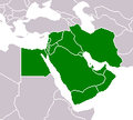
ဖိုင်:Map-Region-Middle-East.png
Map-Region-Middle-East.png (၂၀၀ × ၁၈၀ pixels, ဖိုင်အရွယ်အစား - ၅ KB, MIME အမျိုးအစား image/png)
ဖိုင်မှတ်တမ်း
ဖိုင်ကို ယင်းနေ့စွဲ အတိုင်း မြင်နိုင်ရန် နေ့စွဲ/အချိန် တစ်ခုခုပေါ်တွင် ကလစ်နှိပ်ပါ။
| နေ့စွဲ/အချိန် | နမူနာပုံငယ် | မှတ်တမ်း ဒိုင်မန်းရှင်းများ | အသုံးပြုသူ | မှတ်ချက် | |
|---|---|---|---|---|---|
| ကာလပေါ် | ၁၈:၄၀၊ ၉ ဇူလိုင် ၂၀၁၁ |  | ၂၀၀ × ၁၈၀ (၅ KB) | Hoshie | added South Sudan to the map; added Turkey as well since most maps I've seen have Turk as park of the region. |
| ၁၇:၅၈၊ ၁၉ ဩဂုတ် ၂၀၀၇ |  | ၂၀၀ × ၁၈၀ (၄ KB) | Fuzzy510 | {{Information |Description=Cropped version of Map-World-Middle-East.png |Source=Originally from [http://en.wikipedia.org en.wikipedia]; description page is/was [http://en.wikipedia.org/w/index.php?title=Image%3AMap-Region-Middle-East.png here]. |Date=2005 |
ဖိုင်သုံးစွဲမှု
အောက်ပါ စာမျက်နှာ သည် ဤဖိုင်ကို အသုံးပြုထားသည်:
ဂလိုဘယ် ဖိုင်သုံးစွဲမှု
အောက်ပါ အခြားဝီကီများတွင် ဤဖိုင်ကို အသုံးပြုထားသည်-
- ar.wikipedia.org တွင် အသုံးပြုမှု
- بوابة:مصر
- بوابة:العراق
- بوابة:العراق/بوابات شقيقة
- سلطنة العوالق العليا
- قائمة دول الشرق الأوسط حسب عدد السكان
- العربية السعيدة
- توم كلانسي هوكس 2
- قائمة بورصات منطقة غرب آسيا
- قائمة القلاع الصليبية
- بوابة:مصر/بوابات شقيقة
- الدين في الشرق الأوسط
- عيشانيون
- ماء افتراضي
- لغة كنعانية أكدية
- حمسة المناقع الأوروبية
- قالب:بذرة الشرق الأوسط
- لغات تركيا
- قرار مجلس الأمن التابع للأمم المتحدة رقم 331
- قرار مجلس الأمن التابع للأمم المتحدة رقم 416
- قرار مجلس الأمن التابع للأمم المتحدة رقم 449
- قرار مجلس الأمن التابع للأمم المتحدة رقم 456
- قرار مجلس الأمن التابع للأمم المتحدة رقم 493
- قرار مجلس الأمن التابع للأمم المتحدة رقم 519
- قائمة قبائل الكرد
- الدين في كردستان
- مؤتمر المستشرقين الدولي
- هواوي واي 9 إي
- نظام معلومات الأمم المتحدة بشأن قضية فلسطين
- شالوم أليخم
- مطرانية القدس الأسقفية
- الكنيسة الأسقفية في القدس والشرق الأوسط
- قائمة أساقفة القدس الأنجليكان
- قالب:بذرة شاعر شرق أوسطي
- شاني (مشروب)
- منظمة مكافحة التنمر والتمييز في الشرق الأوسط
- قائمة سفراء وممثلي المملكة المتحدة في الأردن
- كاتدرائية سانت فاطيما (القاهرة)
- أبرشية قبرص والخليج
- فوكس سبورتس (الشرق الأوسط)
- خورموسان
- آرتينز
- جوبكس
- قرناو
- أكاديمية قطر لعلوم الطيران
- الهيئة العامة للضرائب (قطر)
- كوجك
- نابليون: الحرب الشاملة
- سعوديون أفارقة
- خرطيط الزيتون
- دودة خضراء
ဤဖိုင်ကို အခြားနေရာများတွင် အသုံးပြုထားမှုများအား ကြည့်ရှုရန်။


