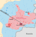
ဖိုင်:MH17 map-en.svg

Size of this PNG preview of this SVG file: ၅၁၂ × ၂၅၆ ပစ်ဇယ်. အခြား ပုံရိပ်ပြတ်သားမှု: ၃၂၀ × ၁၆၀ ပစ်ဇယ် | ၆၄၀ × ၃၂၀ ပစ်ဇယ် | ၁၀၂၄ × ၅၁၂ ပစ်ဇယ် | ၁၂၈၀ × ၆၄၀ ပစ်ဇယ် | ၂၅၆၀ × ၁၂၈၀ ပစ်ဇယ်။
မူရင်းဖိုင် (SVG ဖိုင်, ၅၁၂ × ၂၅၆ pixels ကို အကြံပြုသည်, ဖိုင်အရွယ်အစား - ၂၁၂ KB)
ဖိုင်မှတ်တမ်း
ဖိုင်ကို ယင်းနေ့စွဲ အတိုင်း မြင်နိုင်ရန် နေ့စွဲ/အချိန် တစ်ခုခုပေါ်တွင် ကလစ်နှိပ်ပါ။
| နေ့စွဲ/အချိန် | နမူနာပုံငယ် | မှတ်တမ်း ဒိုင်မန်းရှင်းများ | အသုံးပြုသူ | မှတ်ချက် | |
|---|---|---|---|---|---|
| ကာလပေါ် | ၁၆:၄၄၊ ၁၃ မတ် ၂၀၂၃ |  | ၅၁၂ × ၂၅၆ (၂၁၂ KB) | Tyrrrz | Corrected transliteration of Ukrainian capital |
| ၁၆:၁၄၊ ၁၅ စက်တင်ဘာ ၂၀၁၄ |  | ၅၁၂ × ၂၅၆ (၂၁၂ KB) | PM3 | fixed takeoff and last contact times, see [http://www.onderzoeksraad.nl/en/onderzoek/2049/investigation-crash-mh17-17-july-2014/preliminary-report#fasen] | |
| ၀၇:၃၅၊ ၁၀ စက်တင်ဘာ ၂၀၁၄ |  | ၅၁၂ × ၂၅၆ (၂၁၂ KB) | Wereldburger758 | Valid SVG now. | |
| ၁၃:၂၁၊ ၁၈ ဇူလိုင် ၂၀၁၄ |  | ၅၁၂ × ၂၅၆ (၂၃၁ KB) | Matthiasb | 1315 UTC is correct, 1415 GMT is wrong for 1415 WEST | |
| ၀၃:၅၃၊ ၁၈ ဇူလိုင် ၂၀၁၄ |  | ၅၁၂ × ၂၅၆ (၂၃၁ KB) | Maxdamantus | Original times seem to be more accurate. | |
| ၂၀:၄၀၊ ၁၇ ဇူလိုင် ၂၀၁၄ |  | ၅၁၂ × ၂၅၆ (၂၃၁ KB) | Cmglee | Fix times and font. | |
| ၂၀:၃၆၊ ၁၇ ဇူလိုင် ၂၀၁၄ |  | ၅၁၂ × ၂၅၆ (၂၃၁ KB) | Cmglee | User created page with UploadWizard |
ဖိုင်သုံးစွဲမှု
အောက်ပါ စာမျက်နှာ သည် ဤဖိုင်ကို အသုံးပြုထားသည်:
ဂလိုဘယ် ဖိုင်သုံးစွဲမှု
အောက်ပါ အခြားဝီကီများတွင် ဤဖိုင်ကို အသုံးပြုထားသည်-
- ar.wikipedia.org တွင် အသုံးပြုမှု
- bat-smg.wikipedia.org တွင် အသုံးပြုမှု
- be-tarask.wikipedia.org တွင် အသုံးပြုမှု
- be.wikipedia.org တွင် အသုံးပြုမှု
- bg.wikipedia.org တွင် အသုံးပြုမှု
- bs.wikipedia.org တွင် အသုံးပြုမှု
- ca.wikipedia.org တွင် အသုံးပြုမှု
- da.wikipedia.org တွင် အသုံးပြုမှု
- en.wikipedia.org တွင် အသုံးပြုမှု
- en.wikinews.org တွင် အသုံးပြုမှု
- eo.wikipedia.org တွင် အသုံးပြုမှု
- es.wikipedia.org တွင် အသုံးပြုမှု
- et.wikipedia.org တွင် အသုံးပြုမှု
- eu.wikipedia.org တွင် အသုံးပြုမှု
- fa.wikipedia.org တွင် အသုံးပြုမှု
- fr.wikinews.org တွင် အသုံးပြုမှု
- fy.wikipedia.org တွင် အသုံးပြုမှု
- ga.wikipedia.org တွင် အသုံးပြုမှု
- hr.wikipedia.org တွင် အသုံးပြုမှု
- id.wikipedia.org တွင် အသုံးပြုမှု
- kk.wikipedia.org တွင် အသုံးပြုမှု
- km.wikipedia.org တွင် အသုံးပြုမှု
- ko.wikipedia.org တွင် အသုံးပြုမှု
- lt.wikipedia.org တွင် အသုံးပြုမှု
- mr.wikipedia.org တွင် အသုံးပြုမှု
- ms.wikipedia.org တွင် အသုံးပြုမှု
- nl.wikinews.org တွင် အသုံးပြုမှု
- no.wikipedia.org တွင် အသုံးပြုမှု
- oc.wikipedia.org တွင် အသုံးပြုမှု
- pnb.wikipedia.org တွင် အသုံးပြုမှု
- pt.wikipedia.org တွင် အသုံးပြုမှု
- ro.wikipedia.org တွင် အသုံးပြုမှု
- sco.wikipedia.org တွင် အသုံးပြုမှု
- sh.wikipedia.org တွင် အသုံးပြုမှု
- simple.wikipedia.org တွင် အသုံးပြုမှု
- si.wikipedia.org တွင် အသုံးပြုမှု
- sk.wikipedia.org တွင် အသုံးပြုမှု
- sr.wikipedia.org တွင် အသုံးပြုမှု
- sr.wikinews.org တွင် အသုံးပြုမှု
- sv.wikipedia.org တွင် အသုံးပြုမှု
- te.wikipedia.org တွင် အသုံးပြုမှု
- th.wikipedia.org တွင် အသုံးပြုမှု
ဤဖိုင်ကို အခြားနေရာများတွင် အသုံးပြုထားမှုများအား ကြည့်ရှုရန်။


