
ဖိုင်:Libya location map.svg

Size of this PNG preview of this SVG file: ၆၂၅ × ၅၉၉ ပစ်ဇယ်. အခြား ပုံရိပ်ပြတ်သားမှု: ၂၅၀ × ၂၄၀ ပစ်ဇယ် | ၅၀၁ × ၄၈၀ ပစ်ဇယ် | ၈၀၁ × ၇၆၈ ပစ်ဇယ် | ၁၀၆၈ × ၁၀၂၄ ပစ်ဇယ် | ၂၁၃၆ × ၂၀၄၈ ပစ်ဇယ် | ၉၆၉ × ၉၂၉ ပစ်ဇယ်။
မူရင်းဖိုင် (SVG ဖိုင်, ၉၆၉ × ၉၂၉ pixels ကို အကြံပြုသည်, ဖိုင်အရွယ်အစား - ၉၀ KB)
| ဤဖိုင်သည် Wikimedia Commons မှဖြစ်ပြီး အခြားပရောဂျက်များတွင် သုံးကောင်းသုံးလိမ့်မည်။ ယင်း၏ ဖိုင်အကြောင်းစာမျက်နှာ တွင် ဖော်ပြထားချက်ကို အောက်တွင် ပြထားသည်။ Commons သည် မူပိုင်ခွင့်လွတ်လပ်သော မီဒီယာဖိုင်များ သိုလှောင်ထားရာ နေရာ ဖြစ်သည်။ သင်လည်း ပါဝင်ကူညီနိုင်ပါသည်။ |
အကျဉ်းချုပ်
| ဖော်ပြချက် |
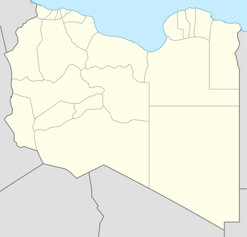
Deutsch: Positionskarte von Libyen
Quadratische Plattkarte, N-S-Streckung 110 %. Geographische Begrenzung der Karte:
English: Location map of Libya
Equirectangular projection, N/S stretching 110 %. Geographic limits of the map:
|
||
| ရက်စွဲ | |||
| ရင်းမြစ် |
ကိုယ်ပိုင်ဖန်တီးမှု (Original text: own work, using)
|
||
| စာရေးသူ | NordNordWest | ||
| အခြား ဗားရှင်းများ |
Derivative works of this file:
|
||
| SVG genesis | ဤ SVG ၏ ကုဒ်သည် ခိုင်လုံသည်။ This map was created with Adobe Illustrator.
|


လိုင်စင်သတ်မှတ်ခြင်း
NordNordWest၊ ဤလုပ်ဆောင်ချက်၏ မူပိုင်ခွင့်ပိုင်ရှင်အနေဖြင့် ဤနေရာမှ အောက်ပါလိုင်စင်များအောက်တွင် ထုတ်လွှင့်ပါသည်:

|
ဤစာတမ်းကို GNU Free Documentation License, ဗားရှင်း ၁.၂ သို့မဟုတ် Free Software Foundation မှ ဖြန့်ချီထားသော မည်သည့်ယခင်ဗားရှင်းတစ်ခုခုအောက်တွင် Invariant Sections, Front-Cover Texts နှင့် Back-Cover Texts များမပါဝင်ဘဲ ကူးယူခြင်း၊ ဖြန့်ချီခြင်း နှင့်/သို့မဟုတ် ပြင်ဆင်ပြောင်းလဲနိုင်ရန် ခွင့်ပြုသည်။ လိုင်စင်မူပွားကို GNU Free Documentation License ခေါင်းစဉ်အောက်တွင် ထည့်သွင်းထားသည်။ |
ဤဖိုင်သည် Creative Commons Attribution 3.0 Unported လိုင်စင်အောက်တွင် လိုင်စင်သတ်မှတ်ထားပါသည်။
မှတ်ယူနိုင်ခြင်း: NordNordWest
- သင်သည် လွတ်လပ်စွာ:
- မျှဝေရန် – ဖန်တီးမှုကို ကူးယူရန်၊ ဖြန့်ဖြူးရန်နှင့် ထုတ်လွှင့်ရန်
- ပြန်ရောနှောရန် – ဖန်တီးမှုကို ပြင်ဆင်ညှိနှိုင်းရန်
- အောက်ပါ အခြေအနေများတွင်:
- မှတ်ယူနိုင်ခြင်း – ပြောင်းလဲမှုများ ပြုလုပ်ခဲ့ပါက ဖန်တီးသူ သို့မဟုတ် လိုင်စင်ရှိသူမှ သတ်မှတ်သော အမျိုးအစားကို လိုက်နာရမည် (ဆိုလိုသည်မှာ သင့်အား သို့မဟုတ် သင့်ဖန်တီးမှုတွင် အသုံးပြုခြင်းအား ထောက်ခံချက်ပေးသည်ဟု မဆိုလိုပါ)။
သင်အလိုရှိရာ လိုင်စင်ကို ရွေးချယ်နိုင်ပါသည်။
ဖိုင်မှတ်တမ်း
ဖိုင်ကို ယင်းနေ့စွဲ အတိုင်း မြင်နိုင်ရန် နေ့စွဲ/အချိန် တစ်ခုခုပေါ်တွင် ကလစ်နှိပ်ပါ။
| နေ့စွဲ/အချိန် | နမူနာပုံငယ် | မှတ်တမ်း ဒိုင်မန်းရှင်းများ | အသုံးပြုသူ | မှတ်ချက် | |
|---|---|---|---|---|---|
| ကာလပေါ် | ၁၅:၅၉၊ ၁၅ ဧပြီ ၂၀၁၁ | | ၉၆၉ × ၉၂၉ (၉၀ KB) | NordNordWest | upd |
| ၁၉:၁၅၊ ၁၈ မေ ၂၀၀၉ |  | ၉၇၀ × ၉၃၁ (၁၅၀ KB) | NordNordWest | finalized | |
| ၁၆:၁၉၊ ၁၈ မေ ၂၀၀၉ |  | ၉၆၉ × ၉၃၀ (၁၂၇ KB) | NordNordWest | {{Information |Description= {{de|Positionskarte von Libyen, Vorversion}} Quadratische Plattkarte, N-S-Streckung 110 %. Geographische Begrenzung der Karte: * N: 33.4° N * S: 19.1° N * W: 9.1° O * O: 25.5° O {{en|Location map of [[:en:Lib |
ဖိုင်သုံးစွဲမှု
အောက်ပါ စာမျက်နှာ သည် ဤဖိုင်ကို အသုံးပြုထားသည်:
ဂလိုဘယ် ဖိုင်သုံးစွဲမှု
အောက်ပါ အခြားဝီကီများတွင် ဤဖိုင်ကို အသုံးပြုထားသည်-
- af.wikipedia.org တွင် အသုံးပြုမှု
- am.wikipedia.org တွင် အသုံးပြုမှု
- an.wikipedia.org တွင် အသုံးပြုမှု
- ar.wikipedia.org တွင် အသုံးပြုမှု
- كأس الأمم الإفريقية 1982
- واو الناموس
- قالب:خريطة مواقع ليبيا
- مطار بني وليد
- مطار رأس لانوف
- قاعدة الجفرة الجوية
- مطار هون
- مطار مرتوبة
- تفجير زليتن 2016
- تفجيرات الخمس 2015
- مطار تمنهنت الدولي
- مطار براك
- تفجير مسجد بيعة الرضوان 2018
- سبخة غزيل
- هجوم المفوضية الوطنية العليا للانتخابات 2018
- قالب:خريطة مفصلة للحرب الأهلية الليبية
- الغارة الجوية على مرزق 2019
- جبل هروج
- أم الأحرار
- جديد (ليبيا)
- الحجارة (ليبيا)
- ar.wikinews.org တွင် အသုံးပြုမှု
- arz.wikipedia.org တွင် အသုံးပြုမှု
- ast.wikipedia.org တွင် အသုံးပြုမှု
ဤဖိုင်ကို အခြားနေရာများတွင် အသုံးပြုထားမှုများအား ကြည့်ရှုရန်။