
ဖိုင်:Lake Chew Bahir satellite image.png
ဤနမူနာ၏ အရွယ်အစား - ၅၂၆ × ၅၉၉ ပစ်ဇယ်။ အခြား ပုံရိပ်ပြတ်သားမှု: ၂၁၁ × ၂၄၀ ပစ်ဇယ် | ၆၃၄ × ၇၂၂ ပစ်ဇယ်။
မူရင်းဖိုင် (၆၃၄ × ၇၂၂ pixels, ဖိုင်အရွယ်အစား - ၁.၀၃ MB, MIME အမျိုးအစား image/png)
| ဤဖိုင်သည် Wikimedia Commons မှဖြစ်ပြီး အခြားပရောဂျက်များတွင် သုံးကောင်းသုံးလိမ့်မည်။ ယင်း၏ ဖိုင်အကြောင်းစာမျက်နှာ တွင် ဖော်ပြထားချက်ကို အောက်တွင် ပြထားသည်။ Commons သည် မူပိုင်ခွင့်လွတ်လပ်သော မီဒီယာဖိုင်များ သိုလှောင်ထားရာ နေရာ ဖြစ်သည်။ သင်လည်း ပါဝင်ကူညီနိုင်ပါသည်။ |
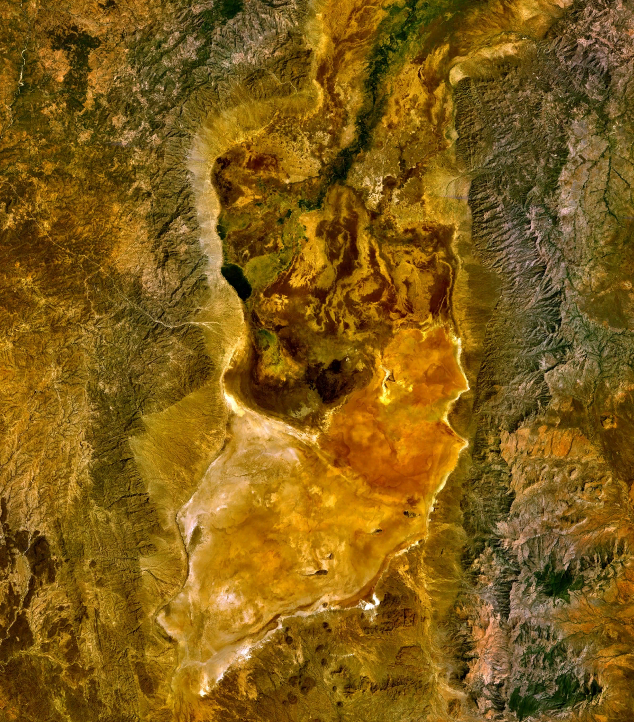
| ဖော်ပြချက် | Lake Chew Bahir (or what's left of it) as seen from space. | |||
| ရက်စွဲ | ||||
| ရင်းမြစ် | World Wind | |||
| စာရေးသူ | NASA | |||
| ခွင့်ပြုချက် (ဤဖိုင်ကို ပြန်လည်အသုံးပြုခြင်း) |
|

ဖိုင်မှတ်တမ်း
ဖိုင်ကို ယင်းနေ့စွဲ အတိုင်း မြင်နိုင်ရန် နေ့စွဲ/အချိန် တစ်ခုခုပေါ်တွင် ကလစ်နှိပ်ပါ။
| နေ့စွဲ/အချိန် | နမူနာပုံငယ် | မှတ်တမ်း ဒိုင်မန်းရှင်းများ | အသုံးပြုသူ | မှတ်ချက် | |
|---|---|---|---|---|---|
| ကာလပေါ် | ၀၈:၀၆၊ ၃၁ မတ် ၂၀၁၀ | | ၆၃၄ × ၇၂၂ (၁.၀၃ MB) | Black-Velvet | {{Information |Description=Lake Chew Bahir (or what's left of it) as seen from space. |Source=World Wind |Date=2010-03-31 |Author=NASA |Permission={{PD-WorldWind}} |other_versions= }} Category:Lakes of Ethiopia Category:Salt Lakes |
ဖိုင်သုံးစွဲမှု
အောက်ပါ စာမျက်နှာ သည် ဤဖိုင်ကို အသုံးပြုထားသည်:
ဂလိုဘယ် ဖိုင်သုံးစွဲမှု
အောက်ပါ အခြားဝီကီများတွင် ဤဖိုင်ကို အသုံးပြုထားသည်-
- de.wikipedia.org တွင် အသုံးပြုမှု
- en.wikipedia.org တွင် အသုံးပြုမှု
- es.wikipedia.org တွင် အသုံးပြုမှု
- fi.wikipedia.org တွင် အသုံးပြုမှု
- fr.wikipedia.org တွင် အသုံးပြုမှု
- hu.wikipedia.org တွင် အသုံးပြုမှု
- ru.wikipedia.org တွင် အသုံးပြုမှု
- sv.wikipedia.org တွင် အသုံးပြုမှု