မာတိကာသို့ ခုန်သွားရန်

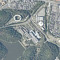
ဖိုင်:Kyoto International Conference Center 20200908.jpg

အခြားဘာသာစကားများဖြင့် စာမျက်နှာအကြောင်းအရာများကို ပံ့ပိုးမထားပါ။
This is a file from the Wikimedia Commons
ဝီကီပီးဒီးယား မှ

မူရင်းဖိုင် (၁၂၀၀ × ၁၂၀၀ pixels, ဖိုင်အရွယ်အစား - ၂၀၈ KB, MIME အမျိုးအစား image/jpeg)

အကျဉ်းချုပ်

ဖော်ပြချက်
日本語: 国土地理院空中写真CKK20202-C3-40の一部を切り取り加工したもの
ရက်စွဲ
ရင်းမြစ် 国土地理院航空写真 https://mapps.gsi.go.jp/
စာရေးသူ 国土交通省 国土地理院

လိုင်စင်သတ်မှတ်ခြင်း

Government of Japan This work is licensed under the Government of Japan Standard Terms of Use (Ver.2.0). The Terms of Use are compatible with the Creative Commons Attribution License 4.0 International. For the terms of use of this work, see this license page.

English  español  日本語  한국어  македонски  русский  português  slovenščina  svenska  Tiếng Việt  简体中文‎  繁體中文‎  +/−

w:my:Creative Commons
မှတ်ယူနိုင်ခြင်း
ဤဖိုင်သည် Creative Commons Attribution 4.0 နိုင်ငံတကာ လိုင်စင်အောက်တွင် လိုင်စင်သတ်မှတ်ထားပါသည်။
မှတ်ယူနိုင်ခြင်း: 国土地理院 (GSI)
သင်သည် လွတ်လပ်စွာ:
  • မျှဝေရန် – ဖန်တီးမှုကို ကူးယူရန်၊ ဖြန့်ဖြူးရန်နှင့် ထုတ်လွှင့်ရန်
  • ပြန်ရောနှောရန် – ဖန်တီးမှုကို ပြင်ဆင်ညှိနှိုင်းရန်
အောက်ပါ အခြေအနေများတွင်:
  • မှတ်ယူနိုင်ခြင်း – ပြောင်းလဲမှုများ ပြုလုပ်ခဲ့ပါက ဖန်တီးသူ သို့မဟုတ် လိုင်စင်ရှိသူမှ သတ်မှတ်သော အမျိုးအစားကို လိုက်နာရမည် (ဆိုလိုသည်မှာ သင့်အား သို့မဟုတ် သင့်ဖန်တီးမှုတွင် အသုံးပြုခြင်းအား ထောက်ခံချက်ပေးသည်ဟု မဆိုလိုပါ)။

ပုံစာများ

ဤဖိုင်၏ဆိုလိုရင်းကို စာတစ်ကြောင်းရှင်းလင်းချက်ဖြင့် ထည့်သွင်းရန်

Items portrayed in this file

depicts အင်္ဂလိပ်

media type အင်္ဂလိပ်

image/jpeg

ဖိုင်မှတ်တမ်း

ဖိုင်ကို ယင်းနေ့စွဲ အတိုင်း မြင်နိုင်ရန် နေ့စွဲ/အချိန် တစ်ခုခုပေါ်တွင် ကလစ်နှိပ်ပါ။

နေ့စွဲ/အချိန်နမူနာပုံငယ်မှတ်တမ်း ဒိုင်မန်းရှင်းများအသုံးပြုသူမှတ်ချက်
ကာလပေါ် ၀၃:၄၈၊ ၅ မေ ၂၀၂၂ ၀၃:၄၈၊ ၅ မေ ၂၀၂၂ ရက်က မူအတွက် နမူနာပုံငယ်၁၂၀၀ × ၁၂၀၀ (၂၀၈ KB)NarenkoUploaded a work by 国土交通省 国土地理院 from 国土地理院航空写真 https://mapps.gsi.go.jp/ with UploadWizard

အောက်ပါ စာမျက်နှာ သည် ဤဖိုင်ကို အသုံးပြုထားသည်:

ဂလိုဘယ် ဖိုင်သုံးစွဲမှု

အောက်ပါ အခြားဝီကီများတွင် ဤဖိုင်ကို အသုံးပြုထားသည်-

မီတာဒေတာ