
ဖိုင်:Japan location map.svg

Size of this PNG preview of this SVG file: ၅၈၂ × ၅၈၀ ပစ်ဇယ်. အခြား ပုံရိပ်ပြတ်သားမှု: ၂၄၁ × ၂၄၀ ပစ်ဇယ် | ၄၈၂ × ၄၈၀ ပစ်ဇယ် | ၇၇၁ × ၇၆၈ ပစ်ဇယ် | ၁၀၂၈ × ၁၀၂၄ ပစ်ဇယ် | ၂၀၅၅ × ၂၀၄၈ ပစ်ဇယ်။
မူရင်းဖိုင် (SVG ဖိုင်, ၅၈၂ × ၅၈၀ pixels ကို အကြံပြုသည်, ဖိုင်အရွယ်အစား - ၇၀၇ KB)
| ဤဖိုင်သည် Wikimedia Commons မှဖြစ်ပြီး အခြားပရောဂျက်များတွင် သုံးကောင်းသုံးလိမ့်မည်။ ယင်း၏ ဖိုင်အကြောင်းစာမျက်နှာ တွင် ဖော်ပြထားချက်ကို အောက်တွင် ပြထားသည်။ Commons သည် မူပိုင်ခွင့်လွတ်လပ်သော မီဒီယာဖိုင်များ သိုလှောင်ထားရာ နေရာ ဖြစ်သည်။ သင်လည်း ပါဝင်ကူညီနိုင်ပါသည်။ |
အကျဉ်းချုပ်
| ဖော်ပြချက် |
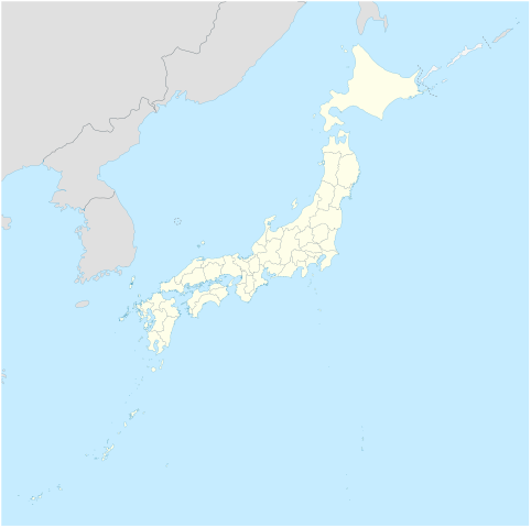
Deutsch: Postionskarte von Japan
Quadratische Plattkarte. Geographische Begrenzung der Karte:
English: Location map of Japan
Equirectangular projection. Geographic limits of the map:
|
||
| ရက်စွဲ | |||
| ရင်းမြစ် | own work, using Image:Japan_admin_levels.svg | ||
| စာရေးသူ | Maximilian Dörrbecker (Chumwa) | ||
| ခွင့်ပြုချက် (ဤဖိုင်ကို ပြန်လည်အသုံးပြုခြင်း) |
ကျွန်ုပ်၊ ဤလုပ်ဆောင်ချက်၏ မူပိုင်ခွင့်ပိုင်ရှင်အနေဖြင့် ဤနေရာမှ အောက်ပါလိုင်စင်များအောက်တွင် ထုတ်လွှင့်ပါသည်:
ဤဖိုင်ကို Creative Commons Attribution-Share Alike 3.0 Unported လိုင်စင်ဖြင့် သတ်မှတ်ထားသည်။
သင်အလိုရှိရာ လိုင်စင်ကို ရွေးချယ်နိုင်ပါသည်။ |
||
| အခြား ဗားရှင်းများ |
Derivative works of this file: National Treasures of Japan (archaeological materials).png
|


.png)

|
This map has been made or improved in the German Kartenwerkstatt (Map Lab). You can propose maps to improve as well.
|
ဖိုင်မှတ်တမ်း
ဖိုင်ကို ယင်းနေ့စွဲ အတိုင်း မြင်နိုင်ရန် နေ့စွဲ/အချိန် တစ်ခုခုပေါ်တွင် ကလစ်နှိပ်ပါ။
| နေ့စွဲ/အချိန် | နမူနာပုံငယ် | မှတ်တမ်း ဒိုင်မန်းရှင်းများ | အသုံးပြုသူ | မှတ်ချက် | |
|---|---|---|---|---|---|
| ကာလပေါ် | ၀၅:၁၈၊ ၁၄ နိုဝင်ဘာ ၂၀၂၀ | | ၅၈၂ × ၅၈၀ (၇၀၇ KB) | AichiWikiFixer | Reverted to version as of 16:25, 5 April 2020 (UTC) |
| ၀၅:၁၈၊ ၁၄ နိုဝင်ဘာ ၂၀၂၀ |  | ၄၁၃ × ၃၇၃ (၉၈၀ KB) | AichiWikiFixer | Fix borders. | |
| ၁၆:၂၅၊ ၅ ဧပြီ ၂၀၂၀ |  | ၅၈၂ × ၅၈၀ (၇၀၇ KB) | NordNordWest | Reverted to version as of 10:32, 21 February 2013 (UTC); no discussion about this change; in this set of maps disputed areas are always shown in light grey | |
| ၁၄:၂၅၊ ၅ ဧပြီ ၂၀၂၀ |  | ၅၈၂ × ၅၈၀ (၇၂၆ KB) | Туча | Итуруп и Кунашир серым цветом | |
| ၁၀:၃၂၊ ၂၁ ဖေဖော်ဝါရီ ၂၀၁၃ |  | ၅၈၂ × ၅၈၀ (၇၀၇ KB) | NordNordWest | Reverted to version as of 13:56, 30 October 2010; no need to revert, no discussion for this | |
| ၀၉:၁၇၊ ၂၁ ဖေဖော်ဝါရီ ၂၀၁၃ |  | ၅၈၂ × ၅၈၀ (၁.၂၁ MB) | Pauk | Reverted to version as of 01:23, 17 September 2010 | |
| ၁၃:၅၆၊ ၃၀ အောက်တိုဘာ ၂၀၁၀ |  | ၅၈၂ × ၅၈၀ (၇၀၇ KB) | NordNordWest | Liancourt Rocks boundary | |
| ၀၁:၂၃၊ ၁၇ စက်တင်ဘာ ၂၀၁၀ |  | ၅၈၂ × ၅၈၀ (၁.၂၁ MB) | Dinamik | medium color for disputed territories | |
| ၁၁:၄၀၊ ၂၁ မတ် ၂၀၁၀ |  | ၅၈၂ × ၅၈၀ (၁.၁၈ MB) | Chumwa | Präfekturgrenzen bereinigt | |
| ၀၉:၅၅၊ ၂၀ မတ် ၂၀၁၀ |  | ၅၈၂ × ၅၈၀ (၁.၃၇ MB) | Chumwa | einige Inseln ergänzt und diverse Lagekorrekturen durchgeführt |
ဖိုင်သုံးစွဲမှု
အောက်ပါ စာမျက်နှာ သည် ဤဖိုင်ကို အသုံးပြုထားသည်:
ဂလိုဘယ် ဖိုင်သုံးစွဲမှု
အောက်ပါ အခြားဝီကီများတွင် ဤဖိုင်ကို အသုံးပြုထားသည်-
- ba.wikipedia.org တွင် အသုံးပြုမှု
- bcl.wikipedia.org တွင် အသုံးပြုမှု
- bg.wikinews.org တွင် အသုံးပြုမှု
- crh.wikipedia.org တွင် အသုံးပြုမှု
- da.wikipedia.org တွင် အသုံးပြုမှု
- de.wikipedia.org တွင် အသုံးပြုမှု
- en.wikipedia.org တွင် အသုံးပြုမှု
- Iwo Jima
- Cities designated by government ordinance of Japan
- Ogasawara, Tokyo
- Chichijima
- Hahajima
- Senhata, Akita
- Hiranai
- Hachijō-jima
- Yonaguni Monument
- North Iwo Jima
- South Iwo Jima
- Fukutoku-Okanoba
- Nishinoshima (Ogasawara)
- 2013–14 FIS Ski Jumping World Cup
- Wikipedia talk:WikiProject Geographical coordinates/Archive 29
- 2020 Summer Olympics torch relay
- Module:Location map/data/Japan complete
- Module:Location map/data/Japan complete/doc
- 2015 Ogasawara earthquake
- Chibusa Dam
- Nakōdo-jima
- Naval Base Iwo Jima
- User:Turbo Slayer 2021
- User:Mr J 2023
- 1931 Empress of Canada stabbings
- List of mass stabbing incidents (before 2010)
- eo.wikipedia.org တွင် အသုံးပြုမှု
ဤဖိုင်ကို အခြားနေရာများတွင် အသုံးပြုထားမှုများအား ကြည့်ရှုရန်။