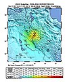
ဖိုင်:Iran-Iraq border earthquake ShakeMap.jpg

ဤနမူနာ၏ အရွယ်အစား - ၄၇၃ × ၅၉၉ ပစ်ဇယ်။ အခြား ပုံရိပ်ပြတ်သားမှု: ၁၈၉ × ၂၄၀ ပစ်ဇယ် | ၃၇၉ × ၄၈၀ ပစ်ဇယ် | ၇၈၇ × ၉၉၇ ပစ်ဇယ်။
မူရင်းဖိုင် (၇၈၇ × ၉၉၇ pixels, ဖိုင်အရွယ်အစား - ၄၂၂ KB, MIME အမျိုးအစား image/jpeg)
ဖိုင်မှတ်တမ်း
ဖိုင်ကို ယင်းနေ့စွဲ အတိုင်း မြင်နိုင်ရန် နေ့စွဲ/အချိန် တစ်ခုခုပေါ်တွင် ကလစ်နှိပ်ပါ။
| နေ့စွဲ/အချိန် | နမူနာပုံငယ် | မှတ်တမ်း ဒိုင်မန်းရှင်းများ | အသုံးပြုသူ | မှတ်ချက် | |
|---|---|---|---|---|---|
| ကာလပေါ် | ၀၈:၁၉၊ ၁၆ စက်တင်ဘာ ၂၀၂၀ |  | ၇၈၇ × ၉၉၇ (၄၂၂ KB) | IllCom | updated version by USGS |
| ၁၇:၁၉၊ ၁၄ နိုဝင်ဘာ ၂၀၁၇ |  | ၅၂၅ × ၆၆၉ (၁၃၁ KB) | أبو آسر | ShakeMap updated by USGS | |
| ၁၀:၄၀၊ ၁၃ နိုဝင်ဘာ ၂၀၁၇ |  | ၆၁၂ × ၇၁၉ (၁၄၄ KB) | أبو آسر | update | |
| ၂၀:၂၀၊ ၁၂ နိုဝင်ဘာ ၂၀၁၇ |  | ၆၁၂ × ၇၁၉ (၁၄၇ KB) | أبو آسر | User created page with UploadWizard |
ဖိုင်သုံးစွဲမှု
ဤဖိုင်ကို အသုံးပြုထားသော စာမျက်နှာများမရှိပါ။
ဂလိုဘယ် ဖိုင်သုံးစွဲမှု
အောက်ပါ အခြားဝီကီများတွင် ဤဖိုင်ကို အသုံးပြုထားသည်-
- ar.wikipedia.org တွင် အသုံးပြုမှု
- azb.wikipedia.org တွင် အသုံးပြုမှု
- bn.wikipedia.org တွင် အသုံးပြုမှု
- cs.wikipedia.org တွင် အသုံးပြုမှု
- de.wikipedia.org တွင် အသုံးပြုမှု
- fa.wikipedia.org တွင် အသုံးပြုမှု
- fr.wikipedia.org တွင် အသုံးပြုမှု
- hi.wikipedia.org တွင် အသုံးပြုမှု
- hy.wikipedia.org တွင် အသုံးပြုမှု
- ja.wikipedia.org တွင် အသုံးပြုမှု
- pt.wikipedia.org တွင် အသုံးပြုမှု
- ru.wikinews.org တွင် အသုံးပြုမှု
- sv.wikipedia.org တွင် အသုံးပြုမှု
- zh.wikipedia.org တွင် အသုံးပြုမှု


