
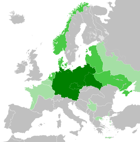
ဖိုင်:Greater German Reich (1942).svg

Size of this PNG preview of this SVG file: ၄၅၀ × ၄၅၆ ပစ်ဇယ်. အခြား ပုံရိပ်ပြတ်သားမှု: ၂၃၇ × ၂၄၀ ပစ်ဇယ် | ၄၇၄ × ၄၈၀ ပစ်ဇယ် | ၇၅၈ × ၇၆၈ ပစ်ဇယ် | ၁၀၁၁ × ၁၀၂၄ ပစ်ဇယ် | ၂၀၂၁ × ၂၀၄၈ ပစ်ဇယ်။
မူရင်းဖိုင် (SVG ဖိုင်, ၄၅၀ × ၄၅၆ pixels ကို အကြံပြုသည်, ဖိုင်အရွယ်အစား - ၅၉၄ KB)
| ဤဖိုင်သည် Wikimedia Commons မှဖြစ်ပြီး အခြားပရောဂျက်များတွင် သုံးကောင်းသုံးလိမ့်မည်။ ယင်း၏ ဖိုင်အကြောင်းစာမျက်နှာ တွင် ဖော်ပြထားချက်ကို အောက်တွင် ပြထားသည်။ Commons သည် မူပိုင်ခွင့်လွတ်လပ်သော မီဒီယာဖိုင်များ သိုလှောင်ထားရာ နေရာ ဖြစ်သည်။ သင်လည်း ပါဝင်ကူညီနိုင်ပါသည်။ |


.svg)
.svg)
.svg)
.svg)
.svg)


.svg)
.svg)
.svg)


.png)
.png)


.svg)


.svg)

.svg)


.svg)
.svg)
.svg)
.svg)


.svg)
.png)


.svg)


.svg)
.svg)


.svg)


.svg)


.svg)
.svg)
.svg)
.svg)
.svg)
.svg)
.svg)
.svg)
_cropped.svg)
.svg)
.svg)
.svg)
.svg)
.svg)
.svg)
.svg)
.svg)
.svg)
.svg)
.svg)
.svg)
.svg)
.svg)
.svg)
.svg)
.svg)
.svg)
.svg)
.svg)
.svg)
.svg)
.svg)
.svg)
.svg)
.svg)
.svg)
.svg)
.svg)
.svg)
.svg)
.svg)
.svg)
.svg)
.svg)
.svg)
.svg)
.svg)
.svg)
.svg)
.svg)
.svg)
.svg)
.svg)
.svg)
ဖိုင်မှတ်တမ်း
ဖိုင်ကို ယင်းနေ့စွဲ အတိုင်း မြင်နိုင်ရန် နေ့စွဲ/အချိန် တစ်ခုခုပေါ်တွင် ကလစ်နှိပ်ပါ။
.svg&dir=prev)
.svg&offset=20180422235102)
.svg&offset=&limit=20)
.svg&offset=&limit=50)
.svg&offset=&limit=100)
.svg&offset=&limit=250)
.svg&offset=&limit=500)
| နေ့စွဲ/အချိန် | နမူနာပုံငယ် | မှတ်တမ်း ဒိုင်မန်းရှင်းများ | အသုံးပြုသူ | မှတ်ချက် | |
|---|---|---|---|---|---|
| ကာလပေါ် | ၂၀:၄၈၊ ၂၀ မတ် ၂၀၂၃ | | ၄၅၀ × ၄၅၆ (၅၉၄ KB) | Qbox673 | Reverted to version as of 07:51, 23 August 2020 (UTC) Please establish consensus on the talk page before changing. |
| ၁၉:၁၆၊ ၁၉ မတ် ၂၀၂၃ |  | ၄၅၀ × ၄၅၆ (၁.၅၁ MB) | Daniilnihuya | Reverted to version as of 18:47, 22 August 2020 (UTC) | |
| ၀၇:၅၁၊ ၂၃ ဩဂုတ် ၂၀၂၀ |  | ၄၅၀ × ၄၅၆ (၅၉၄ KB) | BOS2077 | Reverted to version as of 13:23, 28 July 2020 (UTC) | |
| ၁၈:၄၇၊ ၂၂ ဩဂုတ် ၂၀၂၀ |  | ၄၅၀ × ၄၅၆ (၁.၅၁ MB) | Terryfirut | Reverted to version as of 17:17, 5 July 2020 (UTC) | |
| ၁၃:၂၃၊ ၂၈ ဇူလိုင် ၂၀၂၀ |  | ၄၅၀ × ၄၅၆ (၅၉၄ KB) | Staberinde | Reverted to version as of 01:04, 24 April 2018 (UTC) restore old version, puppet states are not the same thing as occupied territory | |
| ၀၄:၁၂၊ ၇ ဇူလိုင် ၂၀၂၀ |  | ၄၅၀ × ၄၅၆ (၁.၀၄ MB) | Croatianpotato | Reverted to version as of 22:35, 4 July 2020 (UTC) | |
| ၁၇:၁၇၊ ၅ ဇူလိုင် ၂၀၂၀ |  | ၄၅၀ × ၄၅၆ (၁.၅၁ MB) | Hell - lllio | Winter Offensive Occupied Territory | |
| ၂၂:၃၅၊ ၄ ဇူလိုင် ၂၀၂၀ |  | ၄၅၀ × ၄၅၆ (၁.၀၄ MB) | Hell - lllio | Vichy France (and its colonies) and Slovakia we're German Puppet States, so it should be Included in the Civilian Controlled Occupied Territories (Puppets) | |
| ၀၁:၀၄၊ ၂၄ ဧပြီ ၂၀၁၈ |  | ၄၅၀ × ၄၅၆ (၅၉၄ KB) | TRAJAN 117 | +++ | |
| ၂၃:၅၁၊ ၂၂ ဧပြီ ၂၀၁၈ |  | ၄၅၀ × ၄၅၆ (၅၉၄ KB) | TRAJAN 117 | +++ |
ဖိုင်သုံးစွဲမှု
အောက်ပါ စာမျက်နှာ သည် ဤဖိုင်ကို အသုံးပြုထားသည်:
ဂလိုဘယ် ဖိုင်သုံးစွဲမှု
အောက်ပါ အခြားဝီကီများတွင် ဤဖိုင်ကို အသုံးပြုထားသည်-
- ar.wikipedia.org တွင် အသုံးပြုမှု
- av.wikipedia.org တွင် အသုံးပြုမှု
- az.wikipedia.org တွင် အသုံးပြုမှု
- bbc.wikipedia.org တွင် အသုံးပြုမှု
- bg.wikipedia.org တွင် အသုံးပြုမှု
- cs.wikipedia.org တွင် အသုံးပြုမှု
- el.wikipedia.org တွင် အသုံးပြုမှု
- en.wikipedia.org တွင် အသုံးပြုမှု
- es.wikipedia.org တွင် အသုံးပြုမှု
- fr.wikipedia.org တွင် အသုံးပြုမှု
- gn.wikipedia.org တွင် အသုံးပြုမှု
- he.wikipedia.org တွင် အသုံးပြုမှု
- hr.wikipedia.org တွင် အသုံးပြုမှု
- hu.wikipedia.org တွင် အသုံးပြုမှု
- id.wikipedia.org တွင် အသုံးပြုမှု
- Jerman Nazi
- Daftar imperium terbesar
- Anschluss
- Wikipedia:Artikel pilihan/Jadwal/Usulan/2020
- Wikipedia:Artikel pilihan/Jadwal/Usulan/2020/Periode 3
- Wikipedia:Artikel pilihan/Jadwal/Usulan/2020/Periode 8
- Wikipedia:Artikel pilihan/Daftar artikel pilihan 2020
- Wikipedia:Artikel Pilihan/32 2020
- Wikipedia:Arsip halaman utama/2020/08/03
- Wikipedia:Arsip halaman utama/2020/08/04
- Wikipedia:Arsip halaman utama/2020/08/05
- Wikipedia:Arsip halaman utama/2020/08/06
- Wikipedia:Arsip halaman utama/2020/08/07
- Wikipedia:Arsip halaman utama/2020/08/08
- Wikipedia:Arsip halaman utama/2020/08/09
- Wikipedia:Artikel pilihan/Daftar artikel pilihan 2023
- Wikipedia:Artikel pilihan/Jadwal/Usulan/2023
ဤဖိုင်ကို အခြားနေရာများတွင် အသုံးပြုထားမှုများအား ကြည့်ရှုရန်။
.svg)
.svg)