
ဖိုင်:Estonia municipalities.png

ဤနမူနာ၏ အရွယ်အစား - ၈၀၀ × ၅၁၃ ပစ်ဇယ်။ အခြား ပုံရိပ်ပြတ်သားမှု: ၃၂၀ × ၂၀၅ ပစ်ဇယ် | ၆၄၀ × ၄၁၁ ပစ်ဇယ် | ၁၀၂၄ × ၆၅၇ ပစ်ဇယ် | ၁၂၈၀ × ၈၂၁ ပစ်ဇယ် | ၁၆၀၁ × ၁၀၂၇ ပစ်ဇယ်။
မူရင်းဖိုင် (၁၆၀၁ × ၁၀၂၇ pixels, ဖိုင်အရွယ်အစား - ၈၂ KB, MIME အမျိုးအစား image/png)
| ဤဖိုင်သည် Wikimedia Commons မှဖြစ်ပြီး အခြားပရောဂျက်များတွင် သုံးကောင်းသုံးလိမ့်မည်။ ယင်း၏ ဖိုင်အကြောင်းစာမျက်နှာ တွင် ဖော်ပြထားချက်ကို အောက်တွင် ပြထားသည်။ Commons သည် မူပိုင်ခွင့်လွတ်လပ်သော မီဒီယာဖိုင်များ သိုလှောင်ထားရာ နေရာ ဖြစ်သည်။ သင်လည်း ပါဝင်ကူညီနိုင်ပါသည်။ |
အကျဉ်းချုပ်
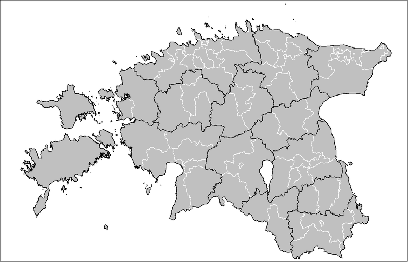
| ဖော်ပြချက် | Map of the municipalities of Estonia after the 2017 municipal reform. Created by Rarelibra 15:43, 20 December 2006 (UTC) for public domain use, using MapInfo Professional v8.5 and various mapping resources. |
| ရက်စွဲ | ၂၀ ဒီဇင်ဘာ ၂၀၀၆ (original upload date) |
| ရင်းမြစ် | No machine-readable source provided. Own work assumed (based on copyright claims). |
| စာရေးသူ | No machine-readable author provided. Rarelibra assumed (based on copyright claims). |

|
This image could be re-created using vector graphics as an SVG file. This has several advantages; see Commons:Media for cleanup for more information. If an SVG form of this image is available, please upload it and afterwards replace this template with
{{vector version available|new image name}}.
It is recommended to name the SVG file “Estonia municipalities.svg”—then the template Vector version available (or Vva) does not need the new image name parameter. |
လိုင်စင်သတ်မှတ်ခြင်း
| I, the copyright holder of this work, release this work into the public domain. This applies worldwide. In some countries this may not be legally possible; if so: အကျွန်ုပ်သည် ဤဖန်တီးမှုလက်ရာကို ဥပဒေအရလိုအပ်ခြင်းမရှိသည့် မည်သည့်အခြေအနေမျိုးတွက်မဆို၊ မည်သို့သော ရည်ရွယ်ချက်အတွက်မဆို ၎င်းကို မည်သူမဆို အသုံးပြုပိုင်ခွင့်အား ပေးအပ်သည်။ |
ဖိုင်မှတ်တမ်း
ဖိုင်ကို ယင်းနေ့စွဲ အတိုင်း မြင်နိုင်ရန် နေ့စွဲ/အချိန် တစ်ခုခုပေါ်တွင် ကလစ်နှိပ်ပါ။
| နေ့စွဲ/အချိန် | နမူနာပုံငယ် | မှတ်တမ်း ဒိုင်မန်းရှင်းများ | အသုံးပြုသူ | မှတ်ချက် | |
|---|---|---|---|---|---|
| ကာလပေါ် | ၁၉:၅၀၊ ၈ ဧပြီ ၂၀၁၉ | | ၁၆၀၁ × ၁၀၂၇ (၈၂ KB) | H2ppyme | Fixed Kohila Parish |
| ၁၄:၅၁၊ ၈ ဒီဇင်ဘာ ၂၀၁၇ |  | ၁၆၀၁ × ၁၀၂၇ (၇၂ KB) | RoMex | Updated according to the 2017 municipal reform. | |
| ၀၇:၃၃၊ ၁၀ မတ် ၂၀၁၇ |  | ၁၆၀၁ × ၁၀၂၇ (၁၀၂ KB) | H2ppyme | Corrected borders of Põlva and Rakvere parishes and Võhma Town. | |
| ၀၁:၄၄၊ ၄ ဇန်နဝါရီ ၂၀၁၅ |  | ၁၆၀၁ × ၁၀၂၇ (၁၂၂ KB) | Flying Saucer | updated Lääne-Saare Parish | |
| ၂၃:၃၅၊ ၂၅ အောက်တိုဘာ ၂၀၁၃ |  | ၁၆၀၁ × ၁၀၂၇ (၁၂၂ KB) | Flying Saucer | October 2013 updates | |
| ၁၂:၃၀၊ ၂ စက်တင်ဘာ ၂၀၁၀ |  | ၁၆၀၁ × ၁၀၂၇ (၁၁၀ KB) | H2ppyme | Kaisma Parish merged with Vändra Parish | |
| ၁၃:၄၀၊ ၂၄ မတ် ၂၀၀၈ |  | ၁၆၀၁ × ၁၀၂၇ (၇၆ KB) | Rarelibra | updated map style | |
| ၁၇:၃၉၊ ၈ ဇန်နဝါရီ ၂၀၀၇ |  | ၁၂၈၁ × ၈၇၈ (၅၆ KB) | Rarelibra | Updated map of the municipalities of Estonia (due to 2006 updates). | |
| ၁၅:၄၃၊ ၂၀ ဒီဇင်ဘာ ၂၀၀၆ |  | ၁၂၈၁ × ၈၇၈ (၄၁ KB) | Rarelibra | Map of the municipalities of Estonia. Created by ~~~~ for public domain use, using MapInfo Professional v8.5 and various mapping resources. |
ဖိုင်သုံးစွဲမှု
အောက်ပါ စာမျက်နှာ သည် ဤဖိုင်ကို အသုံးပြုထားသည်:
ဂလိုဘယ် ဖိုင်သုံးစွဲမှု
အောက်ပါ အခြားဝီကီများတွင် ဤဖိုင်ကို အသုံးပြုထားသည်-
- ar.wikipedia.org တွင် အသုံးပြုမှု
- arz.wikipedia.org တွင် အသုံးပြုမှု
- ba.wikipedia.org တွင် အသုံးပြုမှု
- bn.wikipedia.org တွင် အသုံးပြုမှု
- bs.wikipedia.org တွင် အသုံးပြုမှု
- ca.wikipedia.org တွင် အသုံးပြုမှု
- ceb.wikipedia.org တွင် အသုံးပြုမှု
- cs.wikipedia.org တွင် အသုံးပြုမှု
- da.wikipedia.org တွင် အသုံးပြုမှု
- de.wikipedia.org တွင် အသုံးပြုမှု
- el.wikipedia.org တွင် အသုံးပြုမှု
- en.wikipedia.org တွင် အသုံးပြုမှု
- et.wikipedia.org တွင် အသုံးပြုမှု
- Eesti
- Eesti külade loend
- Arutelu:Eesti
- Eesti haldusüksuste lippude loend
- Eesti haldusjaotus
- URBACT
- Eesti regionaalpoliitika
- Eesti omavalitsuste haldusreform
- Eesti haldusüksuste vappide loend
- Vikipeedia arutelu:Vikiprojekt KOV 2017
- Kasutaja:Telempe/Mall:KOV2017
- Mall:Eesti maakondade lippude kaart
- Mall:Eesti maakondade vappide kaart
- fa.wikipedia.org တွင် အသုံးပြုမှု
- fiu-vro.wikipedia.org တွင် အသုံးပြုမှု
- fi.wikipedia.org တွင် အသုံးပြုမှု
- fr.wikipedia.org တွင် အသုံးပြုမှု
- hu.wikipedia.org တွင် အသုံးပြုမှု
- it.wikipedia.org တွင် အသုံးပြုမှု
- ja.wikipedia.org တွင် အသုံးပြုမှု
- ka.wikipedia.org တွင် အသုံးပြုမှု
- la.wikipedia.org တွင် အသုံးပြုမှု
- mk.wikipedia.org တွင် အသုံးပြုမှု
- nl.wikipedia.org တွင် အသုံးပြုမှု
- nn.wikipedia.org တွင် အသုံးပြုမှု
- no.wikipedia.org တွင် အသုံးပြုမှု
- pl.wikipedia.org တွင် အသုံးပြုမှု
ဤဖိုင်ကို အခြားနေရာများတွင် အသုံးပြုထားမှုများအား ကြည့်ရှုရန်။