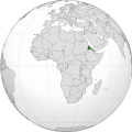
ဖိုင်:Eritrea (Africa orthographic projection).svg

Size of this PNG preview of this SVG file: ၅၅၀ × ၅၅၀ ပစ်ဇယ်. အခြား ပုံရိပ်ပြတ်သားမှု: ၂၄၀ × ၂၄၀ ပစ်ဇယ် | ၄၈၀ × ၄၈၀ ပစ်ဇယ် | ၇၆၈ × ၇၆၈ ပစ်ဇယ် | ၁၀၂၄ × ၁၀၂၄ ပစ်ဇယ် | ၂၀၄၈ × ၂၀၄၈ ပစ်ဇယ်။
မူရင်းဖိုင် (SVG ဖိုင်, ၅၅၀ × ၅၅၀ pixels ကို အကြံပြုသည်, ဖိုင်အရွယ်အစား - ၁၄၁ KB)
ဖိုင်မှတ်တမ်း
ဖိုင်ကို ယင်းနေ့စွဲ အတိုင်း မြင်နိုင်ရန် နေ့စွဲ/အချိန် တစ်ခုခုပေါ်တွင် ကလစ်နှိပ်ပါ။
| နေ့စွဲ/အချိန် | နမူနာပုံငယ် | မှတ်တမ်း ဒိုင်မန်းရှင်းများ | အသုံးပြုသူ | မှတ်ချက် | |
|---|---|---|---|---|---|
| ကာလပေါ် | ၀၈:၅၅၊ ၉ ဧပြီ ၂၀၁၈ |  | ၅၅၀ × ၅၅၀ (၁၄၁ KB) | Nikki070 | Reverted to version as of 20:28, 16 December 2012 (UTC); unification |
| ၁၉:၃၇၊ ၁၇ မတ် ၂၀၁၇ |  | ၅၅၀ × ၅၅၀ (၁၈၅ KB) | Esmu Igors | Colors from the locator map of France don't seem to have enough contrast; I therefore made Africa on the map darker. | |
| ၁၉:၃၄၊ ၁၇ မတ် ၂၀၁၇ |  | ၅၅၀ × ၅၅၀ (၁၈၅ KB) | Esmu Igors | Description, at least on the en.wikipedia.org article "Eritrea" has description about Africa dark grey and the rest of the world gray. I didn't see any of this, so changed the colours as were in an analogous map for France. | |
| ၀၈:၃၇၊ ၁၅ မေ ၂၀၁၆ |  | ၅၅၀ × ၅၅၀ (၁၈၆ KB) | Richard0048 | Reverted to version as of 20:52, 14 May 2016 (UTC) | |
| ၀၈:၁၅၊ ၁၅ မေ ၂၀၁၆ |  | ၅၅၀ × ၅၅၀ (၁၈၆ KB) | Richard0048 | Col | |
| ၂၀:၅၂၊ ၁၄ မေ ၂၀၁၆ |  | ၅၅၀ × ၅၅၀ (၁၈၆ KB) | Richard0048 | clearer borders | |
| ၂၀:၄၉၊ ၁၄ မေ ၂၀၁၆ |  | ၅၅၀ × ၅၅၀ (၁၈၆ KB) | Richard0048 | Reverted to version as of 16:51, 13 December 2012 (UTC) | |
| ၂၀:၂၈၊ ၁၆ ဒီဇင်ဘာ ၂၀၁၂ |  | ၅၅၀ × ၅၅၀ (၁၄၁ KB) | Sémhur | Light grey version ; prominent Congo river removed | |
| ၁၆:၅၁၊ ၁၃ ဒီဇင်ဘာ ၂၀၁၂ |  | ၅၅၀ × ၅၅၀ (၁၈၆ KB) | Chipmunkdavis | Version with colours that greatly contrast, with South Sudan border and other fixes | |
| ၀၉:၃၄၊ ၁၃ ဒီဇင်ဘာ ၂၀၁၂ |  | ၅၅၀ × ၅၅၀ (၁၄၂ KB) | Sémhur | That's your pov, not mine, but please do not destroy informations! (south sudan border and few corrections) |
ဖိုင်သုံးစွဲမှု
အောက်ပါ စာမျက်နှာ သည် ဤဖိုင်ကို အသုံးပြုထားသည်:
ဂလိုဘယ် ဖိုင်သုံးစွဲမှု
အောက်ပါ အခြားဝီကီများတွင် ဤဖိုင်ကို အသုံးပြုထားသည်-
- ami.wikipedia.org တွင် အသုံးပြုမှု
- ar.wikipedia.org တွင် အသုံးပြုမှု
- arz.wikipedia.org တွင် အသုံးပြုမှု
- avk.wikipedia.org တွင် အသုံးပြုမှု
- azb.wikipedia.org တွင် အသုံးပြုမှု
- az.wiktionary.org တွင် အသုံးပြုမှု
- be-tarask.wikipedia.org တွင် အသုံးပြုမှု
- bg.wikipedia.org တွင် အသုံးပြုမှု
- bh.wikipedia.org တွင် အသုံးပြုမှု
- bi.wikipedia.org တွင် အသုံးပြုမှု
- ca.wikipedia.org တွင် အသုံးပြုမှု
- ceb.wikipedia.org တွင် အသုံးပြုမှု
- ckb.wikipedia.org တွင် အသုံးပြုမှု
- cs.wikipedia.org တွင် အသုံးပြုမှု
- cu.wikipedia.org တွင် အသုံးပြုမှု
- da.wikipedia.org တွင် အသုံးပြုမှု
- de.wikivoyage.org တွင် အသုံးပြုမှု
- din.wikipedia.org တွင် အသုံးပြုမှု
- dv.wikipedia.org တွင် အသုံးပြုမှု
- el.wikipedia.org တွင် အသုံးပြုမှု
- en.wikipedia.org တွင် အသုံးပြုမှု
- en.wikinews.org တွင် အသုံးပြုမှု
- en.wikivoyage.org တွင် အသုံးပြုမှု
- eo.wikipedia.org တွင် အသုံးပြုမှု
- es.wikipedia.org တွင် အသုံးပြုမှု
- eu.wikipedia.org တွင် အသုံးပြုမှု
- fa.wikipedia.org တွင် အသုံးပြုမှု
- ff.wikipedia.org တွင် အသုံးပြုမှု
- fi.wikipedia.org တွင် အသုံးပြုမှု
- fr.wikipedia.org တွင် အသုံးပြုမှု
- fr.wikinews.org တွင် အသုံးပြုမှု
- gl.wikipedia.org တွင် အသုံးပြုမှု
- ha.wikipedia.org တွင် အသုံးပြုမှု
- he.wikipedia.org တွင် အသုံးပြုမှု
- hr.wikipedia.org တွင် အသုံးပြုမှု
ဤဖိုင်ကို အခြားနေရာများတွင် အသုံးပြုထားမှုများအား ကြည့်ရှုရန်။
