
ဖိုင်:ES-Mesoamérica.png

ဤနမူနာ၏ အရွယ်အစား - ၈၀၀ × ၅၈၈ ပစ်ဇယ်။ အခြား ပုံရိပ်ပြတ်သားမှု: ၃၂၀ × ၂၃၅ ပစ်ဇယ် | ၆၄၀ × ၄၇၀ ပစ်ဇယ် | ၁၀၂၄ × ၇၅၂ ပစ်ဇယ် | ၁၀၇၄ × ၇၈၉ ပစ်ဇယ်။
မူရင်းဖိုင် (၁၀၇၄ × ၇၈၉ pixels, ဖိုင်အရွယ်အစား - ၁၀၀၂ KB, MIME အမျိုးအစား image/png)
| ဤဖိုင်သည် Wikimedia Commons မှဖြစ်ပြီး အခြားပရောဂျက်များတွင် သုံးကောင်းသုံးလိမ့်မည်။ ယင်း၏ ဖိုင်အကြောင်းစာမျက်နှာ တွင် ဖော်ပြထားချက်ကို အောက်တွင် ပြထားသည်။ Commons သည် မူပိုင်ခွင့်လွတ်လပ်သော မီဒီယာဖိုင်များ သိုလှောင်ထားရာ နေရာ ဖြစ်သည်။ သင်လည်း ပါဝင်ကူညီနိုင်ပါသည်။ |

|
File:Mesoamerica topographic map-blank.svg is a vector version of this file. It should be used in place of this PNG file when not inferior. (reason: Vector map & Cozumel included)
File:ES-Mesoamérica.png → File:Mesoamerica topographic map-blank.svg
For more information, see Help:SVG. |
 |
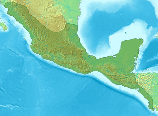
| ဖော်ပြချက် | Map of Meso-america |
| ရက်စွဲ | (UTC) |
| ရင်းမြစ် | |
| စာရေးသူ |
|
| အခြား ဗားရှင်းများ | Derivative works of this file: Ubicación Quelepa.png |
| This is a retouched picture, which means that it has been digitally altered from its original version. Modifications: Sin subdivisiones. The original can be viewed here: Mesoamérica.png:
|

|
ဤစာတမ်းကို GNU Free Documentation License, ဗားရှင်း ၁.၂ သို့မဟုတ် Free Software Foundation မှ ဖြန့်ချီထားသော မည်သည့်ယခင်ဗားရှင်းတစ်ခုခုအောက်တွင် Invariant Sections, Front-Cover Texts နှင့် Back-Cover Texts များမပါဝင်ဘဲ ကူးယူခြင်း၊ ဖြန့်ချီခြင်း နှင့်/သို့မဟုတ် ပြင်ဆင်ပြောင်းလဲနိုင်ရန် ခွင့်ပြုသည်။ လိုင်စင်မူပွားကို GNU Free Documentation License ခေါင်းစဉ်အောက်တွင် ထည့်သွင်းထားသည်။ |
| ဤဖိုင်ကို Creative Commons Attribution-Share Alike 3.0 Unported လိုင်စင်ဖြင့် သတ်မှတ်ထားသည်။ | ||
| ||
| This licensing tag was added to this file as part of the GFDL licensing update. |
မူရင်းတင်ထားသောမှတ်တမ်း
This image is a derivative work of the following images:
- File:Mesoamérica.png licensed with GFDL
- 2007-02-15T02:17:04Z Juan Miguel 1074x789 (1223954 Bytes) == Sumario == {{es|Mapa de las áreas culturales de Mesoamérica}} Mapa en el que se indican las áreas culturales de Mesoamérica. Fue elaborado por [[User:Yavidaxiu|Yavidaxiu]] a partir de los mapas Imagen:Topographic30deg
- 2006-04-04T04:43:00Z Yavidaxiu 1074x789 (1223954 Bytes) Mapa en el que se indican las áreas culturales de Mesoamérica. Fue elaborado por [[User:Yavidaxiu|Yavidaxiu]] a partir de los mapas Imagen:Topographic30deg N0W90.png y Imagen:Topographic30deg N0W60.png, que obran en el arch
Uploaded with derivativeFX
ဖိုင်မှတ်တမ်း
ဖိုင်ကို ယင်းနေ့စွဲ အတိုင်း မြင်နိုင်ရန် နေ့စွဲ/အချိန် တစ်ခုခုပေါ်တွင် ကလစ်နှိပ်ပါ။
| နေ့စွဲ/အချိန် | နမူနာပုံငယ် | မှတ်တမ်း ဒိုင်မန်းရှင်းများ | အသုံးပြုသူ | မှတ်ချက် | |
|---|---|---|---|---|---|
| ကာလပေါ် | ၂၂:၀၃၊ ၁၃ မတ် ၂၀၀၉ | | ၁၀၇၄ × ၇၈၉ (၁၀၀၂ KB) | DavoO | {{Information |Description=Map of Meso-america |Source=*File:Mesoamérica.png |Date=2009-03-13 22:00 (UTC) |Author=*File:Mesoamérica.png: '''Yavidaxiu''' *derivative work: ~~~ |Permission=see below |other_versions= }} {{RetouchedPicture|Sin |
ဖိုင်သုံးစွဲမှု
အောက်ပါ စာမျက်နှာ သည် ဤဖိုင်ကို အသုံးပြုထားသည်:
ဂလိုဘယ် ဖိုင်သုံးစွဲမှု
အောက်ပါ အခြားဝီကီများတွင် ဤဖိုင်ကို အသုံးပြုထားသည်-
- es.wikipedia.org တွင် အသုံးပြုမှု
- fi.wikibooks.org တွင် အသုံးပြုမှု
- hi.wikipedia.org တွင် အသုံးပြုမှု
- id.wikipedia.org တွင် အသုံးပြုမှု
- ko.wikipedia.org တွင် အသုံးပြုမှု
- ml.wikipedia.org တွင် အသုံးပြုမှု
- simple.wikipedia.org တွင် အသုံးပြုမှု
- ta.wikipedia.org တွင် အသုံးပြုမှု
- th.wikipedia.org တွင် အသုံးပြုမှု
- tl.wikipedia.org တွင် အသုံးပြုမှု
- tr.wikipedia.org တွင် အသုံးပြုမှု
- uk.wikipedia.org တွင် အသုံးပြုမှု
- vi.wikipedia.org တွင် အသုံးပြုမှု
ဤဖိုင်ကို အခြားနေရာများတွင် အသုံးပြုထားမှုများအား ကြည့်ရှုရန်။