
ဖိုင်:DarienCTUSCoastAndGeodeticSurvey1965Marker11042007.jpg

ဤနမူနာ၏ အရွယ်အစား - ၆၈၇ × ၆၀၀ ပစ်ဇယ်။ အခြား ပုံရိပ်ပြတ်သားမှု: ၂၇၅ × ၂၄၀ ပစ်ဇယ် | ၅၅၀ × ၄၈၀ ပစ်ဇယ် | ၈၈၀ × ၇၆၈ ပစ်ဇယ် | ၁၁၇၃ × ၁၀၂၄ ပစ်ဇယ် | ၁၂၉၀ × ၁၁၂၆ ပစ်ဇယ်။
မူရင်းဖိုင် (၁၂၉၀ × ၁၁၂၆ pixels, ဖိုင်အရွယ်အစား - ၆၀၆ KB, MIME အမျိုးအစား image/jpeg)
| ဤဖိုင်သည် Wikimedia Commons မှဖြစ်ပြီး အခြားပရောဂျက်များတွင် သုံးကောင်းသုံးလိမ့်မည်။ ယင်း၏ ဖိုင်အကြောင်းစာမျက်နှာ တွင် ဖော်ပြထားချက်ကို အောက်တွင် ပြထားသည်။ Commons သည် မူပိုင်ခွင့်လွတ်လပ်သော မီဒီယာဖိုင်များ သိုလှောင်ထားရာ နေရာ ဖြစ်သည်။ သင်လည်း ပါဝင်ကူညီနိုင်ပါသည်။ |
အကျဉ်းချုပ်
| ဖော်ပြချက် |
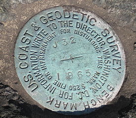
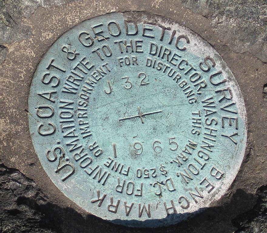
English: Marker, United States Coast and Geodetic Survey marker embedded in a large rock in front of the Noroton Volunteer Fire Department, Darien, Connecticut. |
| ရက်စွဲ | ၅ နိုဝင်ဘာ ၂၀၀၇ (original upload date) |
| ရင်းမြစ် | Transferred from en.wikipedia to Commons by Oxyman using CommonsHelper. |
| စာရေးသူ | The original uploader was Noroton at အင်္ဂလိပ် ဝီကီပီးဒီးယား. |
| Camera location | | View this and other nearby images on: OpenStreetMap |
|---|
လိုင်စင်သတ်မှတ်ခြင်း
| This work has been released into the public domain by its author, Noroton at အင်္ဂလိပ် ဝီကီပီးဒီးယား. This applies worldwide. In some countries this may not be legally possible; if so: Noroton grants anyone the right to use this work for any purpose, without any conditions, unless such conditions are required by law. |
မူရင်းတင်ထားသောမှတ်တမ်း
ဖော်ပြချက် မူရင်းစာမျက်နှာမှာ here ဖြစ်သည်။ အောက်ပါအသုံးပြုသူ အမည်များအားလုံးသည် en.wikipedia ကို ရည်ညွှန်းသည်။
- 2007-11-05 02:12 Noroton 1290×1126× (620467 bytes) Marker, [[U.S. National Geodetic Survey]] marker embedded in a large rock in front of the Noroton Fire Department, [[Darien, Connecticut]]
ဖိုင်မှတ်တမ်း
ဖိုင်ကို ယင်းနေ့စွဲ အတိုင်း မြင်နိုင်ရန် နေ့စွဲ/အချိန် တစ်ခုခုပေါ်တွင် ကလစ်နှိပ်ပါ။
| နေ့စွဲ/အချိန် | နမူနာပုံငယ် | မှတ်တမ်း ဒိုင်မန်းရှင်းများ | အသုံးပြုသူ | မှတ်ချက် | |
|---|---|---|---|---|---|
| ကာလပေါ် | ၂၁:၅၉၊ ၁၃ ဇွန် ၂၀၀၉ | | ၁၂၉၀ × ၁၁၂၆ (၆၀၆ KB) | File Upload Bot (Magnus Manske) | {{BotMoveToCommons|en.wikipedia|year={{subst:CURRENTYEAR}}|month={{subst:CURRENTMONTHNAME}}|day={{subst:CURRENTDAY}}}} {{Information |Description={{en|Marker, en:U.S. National Geodetic Survey marker embedded in a large rock in front of the Noroton |
ဖိုင်သုံးစွဲမှု
အောက်ပါ စာမျက်နှာ သည် ဤဖိုင်ကို အသုံးပြုထားသည်:
ဂလိုဘယ် ဖိုင်သုံးစွဲမှု
အောက်ပါ အခြားဝီကီများတွင် ဤဖိုင်ကို အသုံးပြုထားသည်-
- en.wikipedia.org တွင် အသုံးပြုမှု
- fa.wikipedia.org တွင် အသုံးပြုမှု
- fr.wikipedia.org တွင် အသုံးပြုမှု
- it.wikipedia.org တွင် အသုံးပြုမှု
- nn.wikipedia.org တွင် အသုံးပြုမှု
- pt.wikipedia.org တွင် အသုံးပြုမှု
- simple.wikipedia.org တွင် အသုံးပြုမှု
- ta.wikipedia.org တွင် အသုံးပြုမှု
- tl.wikipedia.org တွင် အသုံးပြုမှု
- uk.wikipedia.org တွင် အသုံးပြုမှု
- www.wikidata.org တွင် အသုံးပြုမှု