
ဖိုင်:China edcp location map.svg

Size of this PNG preview of this SVG file: ၅၁၂ × ၄၀၈ ပစ်ဇယ်. အခြား ပုံရိပ်ပြတ်သားမှု: ၃၀၁ × ၂၄၀ ပစ်ဇယ် | ၆၀၂ × ၄၈၀ ပစ်ဇယ် | ၉၆၄ × ၇၆၈ ပစ်ဇယ် | ၁၂၈၀ × ၁၀၂၀ ပစ်ဇယ် | ၂၅၆၀ × ၂၀၄၀ ပစ်ဇယ်။
မူရင်းဖိုင် (SVG ဖိုင်, ၅၁၂ × ၄၀၈ pixels ကို အကြံပြုသည်, ဖိုင်အရွယ်အစား - ၂.၅၆ MB)
| ဤဖိုင်သည် Wikimedia Commons မှဖြစ်ပြီး အခြားပရောဂျက်များတွင် သုံးကောင်းသုံးလိမ့်မည်။ ယင်း၏ ဖိုင်အကြောင်းစာမျက်နှာ တွင် ဖော်ပြထားချက်ကို အောက်တွင် ပြထားသည်။ Commons သည် မူပိုင်ခွင့်လွတ်လပ်သော မီဒီယာဖိုင်များ သိုလှောင်ထားရာ နေရာ ဖြစ်သည်။ သင်လည်း ပါဝင်ကူညီနိုင်ပါသည်။ |
အကျဉ်းချုပ်
| ဖော်ပြချက် |
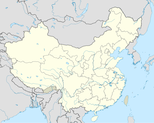
English: Location map of China.
EquiDistantConicProjection : Central parallel :
Central meridian :
Standard parallels:
Latitudes on the central meridian :
|
| ရက်စွဲ | |
| ရင်းမြစ် | ကိုယ်ပိုင်ဖန်တီးမှု |
| စာရေးသူ | Uwe Dedering |
| အခြား ဗားရှင်းများ |
Derivative works of this file:
|
| SVG genesis | This W3C-invalid map was created with Adobe Illustrator, and with Inkscape. |

လိုင်စင်သတ်မှတ်ခြင်း
ကျွန်ုပ်၊ ဤလုပ်ဆောင်ချက်၏ မူပိုင်ခွင့်ပိုင်ရှင်အနေဖြင့် ဤနေရာမှ အောက်ပါလိုင်စင်များအောက်တွင် ထုတ်လွှင့်ပါသည်:
ဤဖိုင်ကို Creative Commons Attribution-Share Alike 3.0 Unported လိုင်စင်ဖြင့် သတ်မှတ်ထားသည်။
- သင်သည် လွတ်လပ်စွာ:
- မျှဝေရန် – ဖန်တီးမှုကို ကူးယူရန်၊ ဖြန့်ဖြူးရန်နှင့် ထုတ်လွှင့်ရန်
- ပြန်ရောနှောရန် – ဖန်တီးမှုကို ပြင်ဆင်ညှိနှိုင်းရန်
- အောက်ပါ အခြေအနေများတွင်:
- မှတ်ယူနိုင်ခြင်း – ပြောင်းလဲမှုများ ပြုလုပ်ခဲ့ပါက ဖန်တီးသူ သို့မဟုတ် လိုင်စင်ရှိသူမှ သတ်မှတ်သော အမျိုးအစားကို လိုက်နာရမည် (ဆိုလိုသည်မှာ သင့်အား သို့မဟုတ် သင့်ဖန်တီးမှုတွင် အသုံးပြုခြင်းအား ထောက်ခံချက်ပေးသည်ဟု မဆိုလိုပါ)။
- ထပ်တူမျှဝေ – ဤဖန်တီးမှုအား ပြင်ဆင်ခြင်း၊ ပြောင်းလဲခြင်း သို့မဟုတ် ထပ်ဆင့် ဖန်တီးခြင်း ပြုလုပ်ပါက ရရှိလာသော ဖန်တီးမှုကို ဤဖန်တီးမှုနှင့် သို့မဟုတ် ဆင်တူသော လိုင်စင်ဖြင့်သာ ဖြန့်ချိသင့်သည်။

|
ဤစာတမ်းကို GNU Free Documentation License, ဗားရှင်း ၁.၂ သို့မဟုတ် Free Software Foundation မှ ဖြန့်ချီထားသော မည်သည့်ယခင်ဗားရှင်းတစ်ခုခုအောက်တွင် Invariant Sections, Front-Cover Texts နှင့် Back-Cover Texts များမပါဝင်ဘဲ ကူးယူခြင်း၊ ဖြန့်ချီခြင်း နှင့်/သို့မဟုတ် ပြင်ဆင်ပြောင်းလဲနိုင်ရန် ခွင့်ပြုသည်။ လိုင်စင်မူပွားကို GNU Free Documentation License ခေါင်းစဉ်အောက်တွင် ထည့်သွင်းထားသည်။ |
သင်အလိုရှိရာ လိုင်စင်ကို ရွေးချယ်နိုင်ပါသည်။
ဖိုင်မှတ်တမ်း
ဖိုင်ကို ယင်းနေ့စွဲ အတိုင်း မြင်နိုင်ရန် နေ့စွဲ/အချိန် တစ်ခုခုပေါ်တွင် ကလစ်နှိပ်ပါ။
| နေ့စွဲ/အချိန် | နမူနာပုံငယ် | မှတ်တမ်း ဒိုင်မန်းရှင်းများ | အသုံးပြုသူ | မှတ်ချက် | |
|---|---|---|---|---|---|
| ကာလပေါ် | ၀၄:၁၀၊ ၁၃ ဒီဇင်ဘာ ၂၀၂၁ | | ၅၁၂ × ၄၀၈ (၂.၅၆ MB) | Maanshen | Update borders and land reclamation. |
| ၀၂:၄၄၊ ၃၁ အောက်တိုဘာ ၂၀၂၁ |  | ၅၁၂ × ၄၀၈ (၂.၅၄ MB) | Not logging in | Fix colored path shown as land in XInjiang and Gansu. | |
| ၀၂:၄၁၊ ၃၁ အောက်တိုဘာ ၂၀၂၁ |  | ၅၁၂ × ၄၀၈ (၂.၅၄ MB) | Not logging in | FIx | |
| ၀၂:၃၅၊ ၃၁ အောက်တိုဘာ ၂၀၂၁ |  | ၅၁၂ × ၄၀၈ (၂.၅၄ MB) | Not logging in | Corrected borders for Xinjiang, Qinghai, and Gansu provincial borders per request, see NordNordWest's talk page | |
| ၁၂:၃၂၊ ၂၉ မတ် ၂၀၂၁ |  | ၅၁၂ × ၄၀၈ (၂.၃၆ MB) | 瑞丽江的河水 | Reverted to version as of 09:13, 22 February 2021 (UTC), disputed area, special color | |
| ၀၇:၄၀၊ ၂၉ မတ် ၂၀၂၁ |  | ၁၁၈၁ × ၉၄၀ (၄.၀၇ MB) | Turbo Slayer 2021 | Reverted to version as of 02:23, 28 March 2021 (UTC)Firstly, Taiwan is not a part of China cause the Government of Taiwan is Republic of China. Southern Tibet is a part of India not China. That's all | |
| ၁၄:၀၈၊ ၂၈ မတ် ၂၀၂၁ |  | ၅၁၂ × ၄၀၈ (၂.၃၆ MB) | 瑞丽江的河水 | Reverted to version as of 09:13, 22 February 2021 (UTC) | |
| ၀၂:၂၃၊ ၂၈ မတ် ၂၀၂၁ |  | ၁၁၈၁ × ၉၄၀ (၄.၀၇ MB) | Turbo Slayer 2021 | Reverted to version as of 20:14, 31 August 2011 (UTC) | |
| ၀၉:၁၃၊ ၂၂ ဖေဖော်ဝါရီ ၂၀၂၁ |  | ၅၁၂ × ၄၀၈ (၂.၃၆ MB) | DokiDonkey | Fix | |
| ၀၉:၂၃၊ ၁၉ ဖေဖော်ဝါရီ ၂၀၂၁ |  | ၅၁၂ × ၄၀၈ (၂.၃၄ MB) | DokiDonkey | Change Trans-Karakoram Tract |
ဖိုင်သုံးစွဲမှု
အောက်ပါ 19 စာမျက်နှာများ သည် ဤဖိုင်ကို အသုံးပြုထားသည်:
- Donglin Temple (Jiangxi)
- Fayu Temple
- Guangxiao Temple (Guangzhou)
- Qixia Temple
- ကတော့ကျောင်းတော်
- ကော်ချင်းဘုရားကျောင်း
- ကျန်းကျားကျဲသဘာဝဥယျာဉ်
- တုံးကွမ်
- ဒဖိုကျောင်းတော် (ကွမ်ကျိုး)
- ဒဖိုကျောင်းတော် (ချောင်ယဲ့)
- နန်းဟွာဘုရားကျောင်း
- ပေကျင်း မြို့တော် အပြည်ပြည်ဆိုင်ရာ လေဆိပ်
- ဖုန့်ဟွမ်ရှေးဟောင်းမြို့
- ရှန်ဟိုင်း ဖူတုန်း အပြည်ပြည်ဆိုင်ရာ လေဆိပ်
- ရှန်ဟိုင်း ဟုန်ချောင် အပြည်ပြည်ဆိုင်ရာ လေဆိပ်
- ရှိန်းကျိန့်မြို့
- လင်ချန်း
- ၂၀၁၀ အာရှ အားကစားပြိုင်ပွဲ
- တမ်းပလိတ်:Location map China
ဂလိုဘယ် ဖိုင်သုံးစွဲမှု
အောက်ပါ အခြားဝီကီများတွင် ဤဖိုင်ကို အသုံးပြုထားသည်-
- ace.wikipedia.org တွင် အသုံးပြုမှု
- af.wikipedia.org တွင် အသုံးပြုမှု
- Nanjing
- Groot Muur van China
- Sjabloon:Liggingkaart Volksrepubliek China
- Shangqiu
- Dongguan
- Wenzhou
- Zibo
- Suzhou, Jiangsu
- Kaifeng
- Qingdao
- Xiamen
- Shantou
- Wuxi
- Quanzhou
- Shijiazhuang
- Changsha
- Hefei
- Kunming
- Tangshan
- Ningbo
- Fuzhou
- Changzhou
- Taizhou, Zhejiang
- Ürümqi
- Guiyang
- Xuzhou
- Nanchang
- Lanzhou
- Anshan
- Yangzhou
- Nantong
- Hohhot
- Jilin (stad)
- Huainan
- Linyi
- Xiangtan
- Huizhou
- Baotou
- Nanyang
- Baoding
- Liuzhou
- Tai'an
- Fuyang
- Jiangmen
- Yinchuan
- Weifang
- Zhuhai
- Huangshi
ဤဖိုင်ကို အခြားနေရာများတွင် အသုံးပြုထားမှုများအား ကြည့်ရှုရန်။