
ဖိုင်:China Hong Kong location map.svg

Size of this PNG preview of this SVG file: ၇၆၆ × ၆၀၀ ပစ်ဇယ်. အခြား ပုံရိပ်ပြတ်သားမှု: ၃၀၇ × ၂၄၀ ပစ်ဇယ် | ၆၁၃ × ၄၈၀ ပစ်ဇယ် | ၉၈၁ × ၇၆၈ ပစ်ဇယ် | ၁၂၈၀ × ၁၀၀၂ ပစ်ဇယ် | ၂၅၆၀ × ၂၀၀၄ ပစ်ဇယ် | ၁၂၉၈ × ၁၀၁၆ ပစ်ဇယ်။
မူရင်းဖိုင် (SVG ဖိုင်, ၁၂၉၈ × ၁၀၁၆ pixels ကို အကြံပြုသည်, ဖိုင်အရွယ်အစား - ၂၄၄ KB)
| ဤဖိုင်သည် Wikimedia Commons မှဖြစ်ပြီး အခြားပရောဂျက်များတွင် သုံးကောင်းသုံးလိမ့်မည်။ ယင်း၏ ဖိုင်အကြောင်းစာမျက်နှာ တွင် ဖော်ပြထားချက်ကို အောက်တွင် ပြထားသည်။ Commons သည် မူပိုင်ခွင့်လွတ်လပ်သော မီဒီယာဖိုင်များ သိုလှောင်ထားရာ နေရာ ဖြစ်သည်။ သင်လည်း ပါဝင်ကူညီနိုင်ပါသည်။ |
အကျဉ်းချုပ်
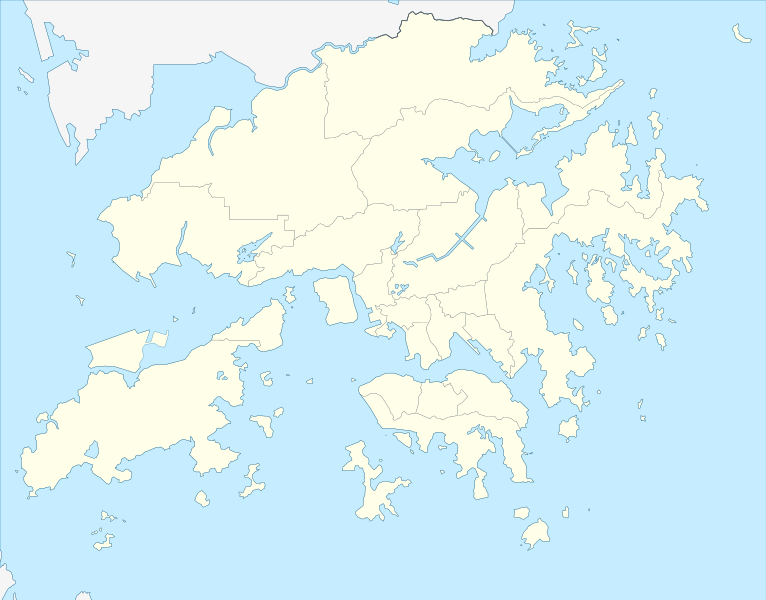
| ဖော်ပြချက် |
Deutsch: Postionskarte von Hong Kong
Quadratische Plattkarte. Geographische Begrenzung der Karte:
English: Location map of Hong Kong
Equirectangular projection. Geographic limits of the map:
|
||
| ရက်စွဲ | |||
| ရင်းမြစ် | own work, using this file by Moddlyg | ||
| စာရေးသူ | Maximilian Dörrbecker (Chumwa) | ||
| ခွင့်ပြုချက် (ဤဖိုင်ကို ပြန်လည်အသုံးပြုခြင်း) |
ကျွန်ုပ်၊ ဤလုပ်ဆောင်ချက်၏ မူပိုင်ခွင့်ပိုင်ရှင်အနေဖြင့် ဤနေရာမှ အောက်ပါလိုင်စင်များအောက်တွင် ထုတ်လွှင့်ပါသည်:
ဤဖိုင်ကို Creative Commons Attribution-Share Alike 3.0 Unported လိုင်စင်ဖြင့် သတ်မှတ်ထားသည်။
သင်အလိုရှိရာ လိုင်စင်ကို ရွေးချယ်နိုင်ပါသည်။ |


|
This map has been made or improved in the German Kartenwerkstatt (Map Lab). You can propose maps to improve as well.
|
ဖိုင်မှတ်တမ်း
ဖိုင်ကို ယင်းနေ့စွဲ အတိုင်း မြင်နိုင်ရန် နေ့စွဲ/အချိန် တစ်ခုခုပေါ်တွင် ကလစ်နှိပ်ပါ။
| နေ့စွဲ/အချိန် | နမူနာပုံငယ် | မှတ်တမ်း ဒိုင်မန်းရှင်းများ | အသုံးပြုသူ | မှတ်ချက် | |
|---|---|---|---|---|---|
| ကာလပေါ် | ၀၄:၂၅၊ ၁၃ ဧပြီ ၂၀၂၄ | | ၁၂၉၈ × ၁၀၁၆ (၂၄၄ KB) | TanoDano | Added HZMB HK Port Artificial Island |
| ၂၃:၅၆၊ ၁၃ ဒီဇင်ဘာ ၂၀၂၂ |  | ၁၂၉၈ × ၁၀၁၆ (၂၄၅ KB) | Turbo Slayer 2021 | Reverted to version as of 02:34, 15 March 2022 (UTC) | |
| ၀၂:၃၅၊ ၁၅ မတ် ၂၀၂၂ |  | ၁၂၉၈ × ၁၀၁၆ (၂၄၄ KB) | Turbo Slayer 2021 | Reverted to version as of 15:10, 16 May 2021 (UTC) | |
| ၀၂:၃၄၊ ၁၅ မတ် ၂၀၂၂ |  | ၁၂၉၈ × ၁၀၁၆ (၂၄၅ KB) | Turbo Slayer 2021 | Reverted to version as of 07:02, 4 May 2021 (UTC) | |
| ၁၅:၁၀၊ ၁၆ မေ ၂၀၂၁ |  | ၁၂၉၈ × ၁၀၁၆ (၂၄၄ KB) | 瑞丽江的河水 | Reverted to version as of 16:40, 12 September 2018 (UTC) | |
| ၀၇:၀၂၊ ၄ မေ ၂၀၂၁ |  | ၁၂၉၈ × ၁၀၁၆ (၂၄၅ KB) | Turbo Slayer 2021 | Reverted to version as of 05:09, 29 March 2021 (UTC) | |
| ၁၂:၃၇၊ ၂၉ မတ် ၂၀၂၁ |  | ၁၂၉၈ × ၁၀၁၆ (၂၄၄ KB) | 瑞丽江的河水 | Reverted to version as of 16:40, 12 September 2018 (UTC), new coastline after the Hong Kong Zhuhai Macau Bridge Islands built, it is correct, please check with satellite imagery | |
| ၀၅:၀၉၊ ၂၉ မတ် ၂၀၂၁ |  | ၁၂၉၈ × ၁၀၁၆ (၂၄၅ KB) | Turbo Slayer 2021 | This is a actual map of Hong Kong due to the Hong Kong Zhuhai Macau Bridge Islands is not that size, Don't worry It will upload a new map until the third runway is finished, Please, wiki is a equal place that Mainland Chinese users are not allowed in this edit, because the firewall. if I found it, I will report to the wiki centre. Thank you. P.S. I am a Hong Konger | |
| ၁၄:၁၃၊ ၂၈ မတ် ၂၀၂၁ |  | ၁၂၉၈ × ၁၀၁၆ (၂၄၄ KB) | 瑞丽江的河水 | Reverted to version as of 16:40, 12 September 2018 (UTC) | |
| ၁၂:၅၆၊ ၂၅ မတ် ၂၀၂၁ |  | ၁၂၉၈ × ၁၀၁၆ (၂၄၅ KB) | Turbo Slayer 2021 | Reverted to version as of 09:39, 11 September 2011 (UTC) |
ဖိုင်သုံးစွဲမှု
အောက်ပါ 2 စာမျက်နှာများ သည် ဤဖိုင်ကို အသုံးပြုထားသည်:
ဂလိုဘယ် ဖိုင်သုံးစွဲမှု
အောက်ပါ အခြားဝီကီများတွင် ဤဖိုင်ကို အသုံးပြုထားသည်-
- af.wikipedia.org တွင် အသုံးပြုမှု
- an.wikipedia.org တွင် အသုံးပြုမှု
- ar.wikipedia.org တွင် အသုံးပြုမှု
- ast.wikipedia.org တွင် အသုံးပြုမှု
- azb.wikipedia.org တွင် အသုံးပြုမှု
- az.wikipedia.org တွင် အသုံးပြုမှု
- ba.wikipedia.org တွင် အသုံးပြုမှု
- bcl.wikipedia.org တွင် အသုံးပြုမှု
- bg.wikipedia.org တွင် အသုံးပြုမှု
- bn.wikipedia.org တွင် အသုံးပြုမှု
- ceb.wikipedia.org တွင် အသုံးပြုမှု
ဤဖိုင်ကို အခြားနေရာများတွင် အသုံးပြုထားမှုများအား ကြည့်ရှုရန်။