
ဖိုင်:Bahrain adm location map.svg

Size of this PNG preview of this SVG file: ၄၁၃ × ၅၉၉ ပစ်ဇယ်. အခြား ပုံရိပ်ပြတ်သားမှု: ၁၆၅ × ၂၄၀ ပစ်ဇယ် | ၃၃၁ × ၄၈၀ ပစ်ဇယ် | ၅၂၉ × ၇၆၈ ပစ်ဇယ် | ၇၀၆ × ၁၀၂၄ ပစ်ဇယ် | ၁၄၁၁ × ၂၀၄၈ ပစ်ဇယ် | ၁၂၄၆ × ၁၈၀၈ ပစ်ဇယ်။
မူရင်းဖိုင် (SVG ဖိုင်, ၁၂၄၆ × ၁၈၀၈ pixels ကို အကြံပြုသည်, ဖိုင်အရွယ်အစား - ၃၂၆ KB)
| ဤဖိုင်သည် Wikimedia Commons မှဖြစ်ပြီး အခြားပရောဂျက်များတွင် သုံးကောင်းသုံးလိမ့်မည်။ ယင်း၏ ဖိုင်အကြောင်းစာမျက်နှာ တွင် ဖော်ပြထားချက်ကို အောက်တွင် ပြထားသည်။ Commons သည် မူပိုင်ခွင့်လွတ်လပ်သော မီဒီယာဖိုင်များ သိုလှောင်ထားရာ နေရာ ဖြစ်သည်။ သင်လည်း ပါဝင်ကူညီနိုင်ပါသည်။ |
အကျဉ်းချုပ်
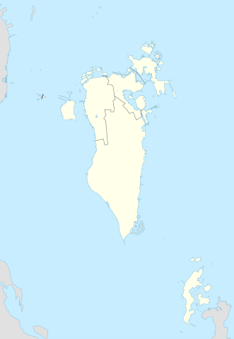
| ဖော်ပြချက် |
Deutsch: Positionskarte von Bahrain
English: Location map of Bahrain
|
||||||||||||
| ရက်စွဲ | |||||||||||||
| ရင်းမြစ် |
Own work using: |
||||||||||||
| စာရေးသူ | NordNordWest and OpenStreetMap contributors | ||||||||||||
| SVG genesis | ဤ SVG ၏ ကုဒ်သည် ခိုင်လုံသည်။ This map was created with Adobe Illustrator.
|
||||||||||||

လိုင်စင်သတ်မှတ်ခြင်း
ဤဖိုင်သည် Creative Commons Attribution-Share Alike 2.0 Generic လိုင်စင်အောက်တွင် လိုင်စင်သတ်မှတ်ထားပါသည်။
- သင်သည် လွတ်လပ်စွာ:
- မျှဝေရန် – ဖန်တီးမှုကို ကူးယူရန်၊ ဖြန့်ဖြူးရန်နှင့် ထုတ်လွှင့်ရန်
- ပြန်ရောနှောရန် – ဖန်တီးမှုကို ပြင်ဆင်ညှိနှိုင်းရန်
- အောက်ပါ အခြေအနေများတွင်:
- မှတ်ယူနိုင်ခြင်း – ပြောင်းလဲမှုများ ပြုလုပ်ခဲ့ပါက ဖန်တီးသူ သို့မဟုတ် လိုင်စင်ရှိသူမှ သတ်မှတ်သော အမျိုးအစားကို လိုက်နာရမည် (ဆိုလိုသည်မှာ သင့်အား သို့မဟုတ် သင့်ဖန်တီးမှုတွင် အသုံးပြုခြင်းအား ထောက်ခံချက်ပေးသည်ဟု မဆိုလိုပါ)။
- ထပ်တူမျှဝေ – ဤဖန်တီးမှုအား ပြင်ဆင်ခြင်း၊ ပြောင်းလဲခြင်း သို့မဟုတ် ထပ်ဆင့် ဖန်တီးခြင်း ပြုလုပ်ပါက ရရှိလာသော ဖန်တီးမှုကို ဤဖန်တီးမှုနှင့် သို့မဟုတ် ဆင်တူသော လိုင်စင်ဖြင့်သာ ဖြန့်ချိသင့်သည်။
ဖိုင်မှတ်တမ်း
ဖိုင်ကို ယင်းနေ့စွဲ အတိုင်း မြင်နိုင်ရန် နေ့စွဲ/အချိန် တစ်ခုခုပေါ်တွင် ကလစ်နှိပ်ပါ။
| နေ့စွဲ/အချိန် | နမူနာပုံငယ် | မှတ်တမ်း ဒိုင်မန်းရှင်းများ | အသုံးပြုသူ | မှတ်ချက် | |
|---|---|---|---|---|---|
| ကာလပေါ် | ၂၃:၀၈၊ ၂၀ ဖေဖော်ဝါရီ ၂၀၁၅ | | ၁၂၄၆ × ၁၈၀၈ (၃၂၆ KB) | NordNordWest | upd |
| ၁၄:၃၇၊ ၁၃ နိုဝင်ဘာ ၂၀၁၄ |  | ၁၂၄၆ × ၁၆၀၇ (၁၃၄ KB) | NordNordWest | == {{int:filedesc}} == {{Information |Description= {{de|1=Positionskarte von Bahrain}} {{en|1=Location map of Bahrain}} {{Location map series N |stretching= |top=26.6 |bottom=16.5 |left=51.8 |right=60.1 }} |Source={{Own using}} * [http:www.openstreetma... |
ဖိုင်သုံးစွဲမှု
အောက်ပါ စာမျက်နှာ သည် ဤဖိုင်ကို အသုံးပြုထားသည်:
ဂလိုဘယ် ဖိုင်သုံးစွဲမှု
အောက်ပါ အခြားဝီကီများတွင် ဤဖိုင်ကို အသုံးပြုထားသည်-
- an.wikipedia.org တွင် အသုံးပြုမှု
- ar.wikipedia.org တွင် အသုံးပြုမှု
- كأس الخليج العربي 1
- جدة (جزيرة)
- جزيرة النبيه صالح
- بلاد القديم
- قالب:خريطة مواقع البحرين
- الدوري البحريني الممتاز 2010–11
- جزيرة أم النعسان
- الدوري البحريني الممتاز 2009–10
- الدوري البحريني الممتاز 2011–12
- الدوري البحريني الممتاز 2012–13
- الدوري البحريني الممتاز 2013–14
- جزيرة البحرين
- جزيرة أم الصبان
- جسر الملك حمد
- الدوري البحريني الممتاز 2015–16
- الدوري البحريني الممتاز 2016–17
- تفجير قرية الدراز 2017
- جزيرة الدار
- الدوري البحريني الممتاز 2021-22
- الدوري البحريني الممتاز 2020-21
- الدوري البحريني الممتاز 2022-23
- الدوري البحريني الممتاز 2023-24
- ast.wikipedia.org တွင် အသုံးပြုမှု
- azb.wikipedia.org တွင် အသုံးပြုမှု
- az.wikipedia.org တွင် အသုံးပြုမှု
ဤဖိုင်ကို အခြားနေရာများတွင် အသုံးပြုထားမှုများအား ကြည့်ရှုရန်။