
ဖိုင်:Antarctica blank.svg

Size of this PNG preview of this SVG file: ၆၀၀ × ၆၀၀ ပစ်ဇယ်. အခြား ပုံရိပ်ပြတ်သားမှု: ၂၄၀ × ၂၄၀ ပစ်ဇယ် | ၄၈၀ × ၄၈၀ ပစ်ဇယ် | ၇၆၈ × ၇၆၈ ပစ်ဇယ် | ၁၀၂၄ × ၁၀၂၄ ပစ်ဇယ် | ၂၀၄၈ × ၂၀၄၈ ပစ်ဇယ် | ၈၀၄ × ၈၀၄ ပစ်ဇယ်။
မူရင်းဖိုင် (SVG ဖိုင်, ၈၀၄ × ၈၀၄ pixels ကို အကြံပြုသည်, ဖိုင်အရွယ်အစား - ၃၉ KB)
| ဤဖိုင်သည် Wikimedia Commons မှဖြစ်ပြီး အခြားပရောဂျက်များတွင် သုံးကောင်းသုံးလိမ့်မည်။ ယင်း၏ ဖိုင်အကြောင်းစာမျက်နှာ တွင် ဖော်ပြထားချက်ကို အောက်တွင် ပြထားသည်။ Commons သည် မူပိုင်ခွင့်လွတ်လပ်သော မီဒီယာဖိုင်များ သိုလှောင်ထားရာ နေရာ ဖြစ်သည်။ သင်လည်း ပါဝင်ကူညီနိုင်ပါသည်။ |
အကျဉ်းချုပ်
This W3C-unspecified vector image was created with Inkscape .
| ဖော်ပြချက် |
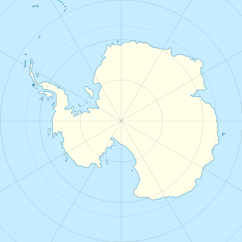
English: Blank map of Antarctica.
Français : Carte nue de l'Antarctique. La latitude au centre de chaque bord est -60. Donc le pôle est centré. |
| ရက်စွဲ | |
| ရင်းမြစ် | Image:Antarctica_research_station.gif + Image:Blank suedpolarregion.png |
| စာရေးသူ | STyx |
| အခြား ဗားရှင်းများ | Map with territorial claims marked out, Antarctica blank 2.svg |
လိုင်စင်သတ်မှတ်ခြင်း
ကျွန်ုပ်၊ ဤလုပ်ဆောင်ချက်၏ မူပိုင်ခွင့်ပိုင်ရှင်အနေဖြင့် ဤနေရာမှ အောက်ပါလိုင်စင်များအောက်တွင် ထုတ်လွှင့်ပါသည်:

|
ဤစာတမ်းကို GNU Free Documentation License, ဗားရှင်း ၁.၂ သို့မဟုတ် Free Software Foundation မှ ဖြန့်ချီထားသော မည်သည့်ယခင်ဗားရှင်းတစ်ခုခုအောက်တွင် Invariant Sections, Front-Cover Texts နှင့် Back-Cover Texts များမပါဝင်ဘဲ ကူးယူခြင်း၊ ဖြန့်ချီခြင်း နှင့်/သို့မဟုတ် ပြင်ဆင်ပြောင်းလဲနိုင်ရန် ခွင့်ပြုသည်။ လိုင်စင်မူပွားကို GNU Free Documentation License ခေါင်းစဉ်အောက်တွင် ထည့်သွင်းထားသည်။ |
ဤဖိုင်သည် Creative Commons Attribution 3.0 Unported လိုင်စင်အောက်တွင် လိုင်စင်သတ်မှတ်ထားပါသည်။
- သင်သည် လွတ်လပ်စွာ:
- မျှဝေရန် – ဖန်တီးမှုကို ကူးယူရန်၊ ဖြန့်ဖြူးရန်နှင့် ထုတ်လွှင့်ရန်
- ပြန်ရောနှောရန် – ဖန်တီးမှုကို ပြင်ဆင်ညှိနှိုင်းရန်
- အောက်ပါ အခြေအနေများတွင်:
- မှတ်ယူနိုင်ခြင်း – ပြောင်းလဲမှုများ ပြုလုပ်ခဲ့ပါက ဖန်တီးသူ သို့မဟုတ် လိုင်စင်ရှိသူမှ သတ်မှတ်သော အမျိုးအစားကို လိုက်နာရမည် (ဆိုလိုသည်မှာ သင့်အား သို့မဟုတ် သင့်ဖန်တီးမှုတွင် အသုံးပြုခြင်းအား ထောက်ခံချက်ပေးသည်ဟု မဆိုလိုပါ)။
သင်အလိုရှိရာ လိုင်စင်ကို ရွေးချယ်နိုင်ပါသည်။
ဖိုင်မှတ်တမ်း
ဖိုင်ကို ယင်းနေ့စွဲ အတိုင်း မြင်နိုင်ရန် နေ့စွဲ/အချိန် တစ်ခုခုပေါ်တွင် ကလစ်နှိပ်ပါ။
| နေ့စွဲ/အချိန် | နမူနာပုံငယ် | မှတ်တမ်း ဒိုင်မန်းရှင်းများ | အသုံးပြုသူ | မှတ်ချက် | |
|---|---|---|---|---|---|
| ကာလပေါ် | ၁၁:၄၅၊ ၂၁ ဒီဇင်ဘာ ၂၀၀၉ | | ၈၀၄ × ၈၀၄ (၃၉ KB) | Botev | Reverted to version as of 07:30, 14 October 2009 - we are using this image as a location map on pl wiki, don't simply change it like that. Upload a new image if you want. |
| ၁၅:၅၉၊ ၁၇ ဒီဇင်ဘာ ၂၀၀၉ |  | ၁၁၃၉ × ၁၂၆၂ (၄၃ KB) | NuclearVacuum | minor | |
| ၁၅:၅၇၊ ၁၇ ဒီဇင်ဘာ ၂၀၀၉ |  | ၁၁၃၉ × ၁၂၆၂ (၄၃ KB) | NuclearVacuum | made image larger to show the rest of the image | |
| ၀၇:၃၀၊ ၁၄ အောက်တိုဘာ ၂၀၀၉ |  | ၈၀၄ × ၈၀၄ (၃၉ KB) | Entlinkt | Just slightly changed colours to those given at File:Maps_template-fr.svg | |
| ၀၁:၄၃၊ ၁၁ မတ် ၂၀၀၈ |  | ၈၀၄ × ၈၀၄ (၃၉ KB) | STyx | ||
| ၀၀:၄၃၊ ၁၁ မတ် ၂၀၀၈ |  | ၈၀၄ × ၈၀၄ (၃၀ KB) | STyx | == Summary == {{Created with Inkscape}} {{Information |Description= *{{en}} Blank map of Antarctica. *{{fr}} Carte nue de l'Antarctique. La latitude au centre de chaque bord est -60. Donc le pôle est centré. |Source=[[:Image:Antarctica_research_station. |
ဖိုင်သုံးစွဲမှု
ဤဖိုင်ကို အသုံးပြုထားသော စာမျက်နှာများမရှိပါ။
ဂလိုဘယ် ဖိုင်သုံးစွဲမှု
အောက်ပါ အခြားဝီကီများတွင် ဤဖိုင်ကို အသုံးပြုထားသည်-
- de.wikipedia.org တွင် အသုံးပြုမှု
- en.wikipedia.org တွင် အသုံးပြုမှု
- es.wikipedia.org တွင် အသုံးပြုမှု
- fr.wikipedia.org တွင် အသုံးပြုမှု
- hy.wikipedia.org တွင် အသုံးပြုမှု
- zh.wikipedia.org တွင် အသုံးပြုမှု