
ဖိုင်:LocationAmericas.png

ဤနမူနာ၏ အရွယ်အစား - ၈၀၀ × ၄၀၇ ပစ်ဇယ်။ အခြား ပုံရိပ်ပြတ်သားမှု: ၃၂၀ × ၁၆၃ ပစ်ဇယ် | ၆၄၀ × ၃၂၆ ပစ်ဇယ် | ၁၀၂၄ × ၅၂၁ ပစ်ဇယ် | ၁၂၈၀ × ၆၅၁ ပစ်ဇယ် | ၂၇၅၉ × ၁၄၀၄ ပစ်ဇယ်။
မူရင်းဖိုင် (၂၇၅၉ × ၁၄၀၄ pixels, ဖိုင်အရွယ်အစား - ၉၉ KB, MIME အမျိုးအစား image/png)
| ဤဖိုင်သည် Wikimedia Commons မှဖြစ်ပြီး အခြားပရောဂျက်များတွင် သုံးကောင်းသုံးလိမ့်မည်။ ယင်း၏ ဖိုင်အကြောင်းစာမျက်နှာ တွင် ဖော်ပြထားချက်ကို အောက်တွင် ပြထားသည်။ Commons သည် မူပိုင်ခွင့်လွတ်လပ်သော မီဒီယာဖိုင်များ သိုလှောင်ထားရာ နေရာ ဖြစ်သည်။ သင်လည်း ပါဝင်ကူညီနိုင်ပါသည်။ |

|
File:Location of America.svg is a vector version of this file. It should be used in place of this PNG file when not inferior.
File:LocationAmericas.png → File:Location of America.svg
For more information, see Help:SVG. |
 |
အကျဉ်းချုပ်
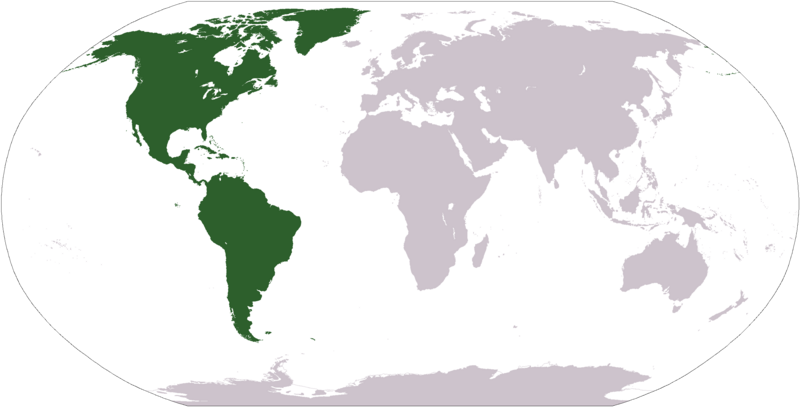
Deutsch: Weltkarte mit Fokus auf Amerika
English: World map depicting America
Esperanto: Mondmapo bildiganta Amerikon
Español: Ubicación de América
map adapted from PDF world map at CIA World Fact Book
လိုင်စင်သတ်မှတ်ခြင်း
This image is in the public domain because it contains materials that originally came from the United States Central Intelligence Agency's World Factbook.
|
 |
ဖိုင်မှတ်တမ်း
ဖိုင်ကို ယင်းနေ့စွဲ အတိုင်း မြင်နိုင်ရန် နေ့စွဲ/အချိန် တစ်ခုခုပေါ်တွင် ကလစ်နှိပ်ပါ။
| နေ့စွဲ/အချိန် | နမူနာပုံငယ် | မှတ်တမ်း ဒိုင်မန်းရှင်းများ | အသုံးပြုသူ | မှတ်ချက် | |
|---|---|---|---|---|---|
| ကာလပေါ် | ၁၂:၃၁၊ ၁၉ ဇန်နဝါရီ ၂၀၀၈ | | ၂၇၅၉ × ၁၄၀၄ (၉၉ KB) | F l a n k e r | Transparency |
| ၁၉:၁၁၊ ၁၂ အောက်တိုဘာ ၂၀၀၅ |  | ၂၇၅၉ × ၁၄၀၄ (၅၅ KB) | E Pluribus Anthony~commonswiki | World map: Americas (location) | |
| ၁၅:၀၆၊ ၂၉ ဧပြီ ၂၀၀၅ |  | ၁၃၇၇ × ၆၉၉ (၁၆ KB) | Ghalas | Extracted from CIA World Factbook PDF world map, then rasterized and colored. {{PD-USGov-CIA-WF}} |
ဖိုင်သုံးစွဲမှု
ဤဖိုင်ကို အသုံးပြုထားသော စာမျက်နှာများမရှိပါ။
ဂလိုဘယ် ဖိုင်သုံးစွဲမှု
အောက်ပါ အခြားဝီကီများတွင် ဤဖိုင်ကို အသုံးပြုထားသည်-
- als.wikipedia.org တွင် အသုံးပြုမှု
- ar.wikipedia.org တွင် အသုံးပြုမှု
- البحر الأبيض المتوسط
- آسيا
- أوروبا
- قارة
- المحيط الهندي
- المحيط الهادئ
- القارة القطبية الجنوبية
- أوقيانوسيا
- حضارة المايا
- أمريكا الشمالية
- أمريكا الجنوبية
- أوروبا الشرقية
- القطب الشمالي
- أوروبا الوسطى
- أوروبا الشمالية
- القوقاز
- شمال إفريقيا
- بحر
- تاريخ أمريكا الشمالية
- المنطقة القطبية الجنوبية
- المحيط المتجمد الشمالي
- القرن الإفريقي
- غرب آسيا
- آسيا الوسطى
- جنوب آسيا
- شرق آسيا
- جنوب شرق آسيا
- المحيط الجنوبي
- الكاريبي
- أمريكا الوسطى
- جزر الأنتيل
- أوروبا الغربية
- شرق إفريقيا
- ميلانيزيا
- بولنيزيا
- ميكرونيسيا
- بوابة:آسيا
- بوابة:أوروبا
- بوابة:الأمريكيتان
- أمريكا اللاتينية
- غرب إفريقيا
- العالم الجديد
- الشرق الأدنى
- الشعوب الأصلية في الأمريكتين
- القطب الجنوبي
- محيط (جغرافيا)
- الأمريكتان
- شبه القارة الهندية
- الاستعمار الأوروبي للأمريكيتين
ဤဖိုင်ကို အခြားနေရာများတွင် အသုံးပြုထားမှုများအား ကြည့်ရှုရန်။